Brommat geodata
Brommat (Occitanie) is a populated place; located in France in Europe/Paris (GMT+2) time zone. With population of 814 people, there are 10439 cities with bigger population in this country. Compared to other cities in France, 81.2% of cities are located further ↑North; 53.2% of cities are located further ←West and 95.9% of cities have lower elevation than Brommat. Note1
Administrative division(s):
- Level 1: Occitanie
- Level 2: Département de l'Aveyron
- Level 3: Arrondissement de Rodez
- Level 4: Brommat


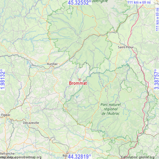
Brommat GPS coordinates[2]
44° 49' 44.436" North, 2° 41' 4.02" East
| Map corner | latitude | longitude |
|---|---|---|
| Upper-left | 45.32552°, | 1.98132° |
| Center: | 44.82901°, | 2.68445° |
| Lower-right: | 44.32819°, | 3.38757° |
| Map W x H: | 110.9×110.9 km | = 68.9×68.9mi |
| max Lat: | 51.07786° ⇑81.2% North |
| Brommat: | 44.82901° |
| min Lat: | ⇓18.8% South 41.3874° |
| min Long | Brommat | max Long |
| -5.08615° | 2.68445° | 9.52242° |
| W 53.2%⇐ | ⇒46.8% E |
Elevation
Elevation of Brommat is 641 m = 2103 ft, and this is 447.3 m = 1468 ft above average elevation for this country.
| Max E: |
2333 m = 7654 ft | 4.1% |
| Brommat | 641 m 2103 ft | |
| Avg. | 193.7 m = 635 ft | |
Min E: |
-1 m = -3 ft | 95.9% |
See also: France elevation on elevation.city.
Geographical zone
Brommat is located in North temperate zone (between Tropic of Cancer and the Arctic Circle). Distance of this Northern Tropic circle is 2378.6 km =1478 mi to South.| Distance of | km | miles | from Brommat |
|---|---|---|---|
| North Pole | 5022.5 | 3120.8 | to North |
| Arctic Circle | 2416.7 | 1501.7 | to North |
| Tropic Cancer | 2378.6 | 1478 | to South |
| Equator | 4984.5 | 3097.2 | to South |


Nearby cities:
15 places around Brommat: (largest is in red/bold)
• Arpajon-sur-Cère
19.8 km =12.3 mi,  294°
294°
• Giou-de-Mamou
17.6 km =10.9 mi,  310°
310°
• Lacroix-Barrez
6.6 km =4.1 mi,  214°
214°
• Lafeuillade-en-Vézie
18.2 km =11.3 mi,  255°
255°
• Laguiole
20.5 km =12.7 mi,  141°
141°
• Montsalvy
19.9 km =12.4 mi,  226°
226°
• Mur-de-Barrez
2.5 km =1.6 mi, 311°
• Pierrefort
15.9 km =9.9 mi,  49°
49°
• Polminhac
16 km =9.9 mi,  328°
328°
• Prunet
17.5 km =10.9 mi,  266°
266°
• Saint-Amans-des-Cots
15.9 km =9.9 mi,  186°
186°
• Sainte-Geneviève-sur-Argence
6.6 km =4.1 mi,  116°
116°
• Taussac
3.3 km =2.1 mi, 269°
• Thiézac
20.7 km =12.9 mi,  355°
355°
• Vic-sur-Cère
17.4 km =10.8 mi,  344°
344°
Sources, notices
• [Note1] Compared only with cities in France existing in our database
• [Src1] Map data: © OpenStreetMap contributors (CC-BY-SA)
• [Src2] Other city data from geonames.org with taken over terms of usage.
• [Src3] Geographical zone / Annual Mean Temperature by Robert A. Rohde @ Wikipedia
