Sainte-Geneviève-sur-Argence geodata
Sainte-Geneviève-sur-Argence (Occitanie) is a populated place; located in France in Europe/Paris (GMT+2) time zone. With population of 1,018 people, there are 8707 cities with bigger population in this country. Compared to other cities in France, 81.4% of cities are located further ↑North; 54.3% of cities are located further ←West and 97.9% of cities have lower elevation than Sainte-Geneviève-sur-Argence. Note1
Administrative division(s):
- Level 1: Occitanie
- Level 2: Département de l'Aveyron
- Level 3: Arrondissement de Rodez
- Level 4: Argences en Aubrac
Current local time in Sainte-Geneviève-sur-Argence:
11:32 AM, SaturdayDifference from your time zone: hours


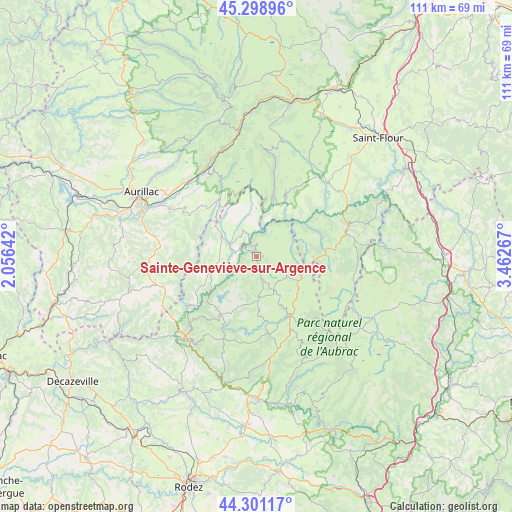
Sainte-Geneviève-sur-Argence GPS coordinates[2]
44° 48' 7.992" North, 2° 45' 34.344" East
| Map corner | latitude | longitude |
|---|---|---|
| Upper-left | 45.29896°, | 2.05642° |
| Center: | 44.80222°, | 2.75954° |
| Lower-right: | 44.30117°, | 3.46267° |
| Map W x H: | 110.9×110.9 km | = 68.9×68.9mi |
| max Lat: | 51.07786° ⇑81.4% North |
| Sainte-Geneviève-sur-Argence: | 44.80222° |
| min Lat: | ⇓18.6% South 41.3874° |
| min Long | Sainte-Geneviè | max Long |
| -5.08615° | 2.75954° | 9.52242° |
| W 54.3%⇐ | ⇒45.7% E |
Elevation
Elevation of Sainte-Geneviève-sur-Argence is 805 m = 2641 ft, and this is 611.3 m = 2006 ft above average elevation for this country.
| Max E: |
2333 m = 7654 ft | 2.1% |
| Sainte-Geneviève-sur-Argence | 805 m 2641 ft | |
| Avg. | 193.7 m = 635 ft | |
Min E: |
-1 m = -3 ft | 97.9% |
See also: France elevation on elevation.city.
Geographical zone
Sainte-Geneviève-sur-Argence is located in North temperate zone (between Tropic of Cancer and the Arctic Circle). Distance of this Northern Tropic circle is 2375.6 km =1476.1 mi to South.| Distance of | km | miles | from Sainte-Geneviève-sur-Argence |
|---|---|---|---|
| North Pole | 5025.5 | 3122.7 | to North |
| Arctic Circle | 2419.6 | 1503.5 | to North |
| Tropic Cancer | 2375.6 | 1476.1 | to South |
| Equator | 4981.5 | 3095.4 | to South |


Nearby cities:
15 places around Sainte-Geneviève-sur-Argence: (largest is in red/bold)
• Brommat
6.6 km =4.1 mi,  296°
296°
• Chaudes-Aigues
20.1 km =12.5 mi,  73°
73°
• Lacroix-Barrez
9.9 km =6.2 mi,  255°
255°
• Laguiole
14.8 km =9.2 mi,  152°
152°
• Le Nayrac
22.3 km =13.9 mi,  199°
199°
• Montpeyroux
18.5 km =11.5 mi,  164°
164°
• Montsalvy
23 km =14.3 mi,  242°
242°
• Mur-de-Barrez
9 km =5.6 mi, 300°
• Neuvéglise
22.5 km =14 mi,  51°
51°
• Pierrefort
14.7 km =9.1 mi,  24°
24°
• Polminhac
22 km =13.7 mi,  319°
319°
• Saint-Amans-des-Cots
15 km =9.3 mi,  210°
210°
• Saint-Urcize
22.6 km =14 mi,  121°
121°
• Taussac
9.7 km =6 mi,  287°
287°
• Vic-sur-Cère
22.4 km =13.9 mi,  331°
331°
Sources, notices
• [Note1] Compared only with cities in France existing in our database
• [Src1] Map data: © OpenStreetMap contributors (CC-BY-SA)
• [Src2] Other city data from geonames.org with taken over terms of usage.
• [Src3] Geographical zone / Annual Mean Temperature by Robert A. Rohde @ Wikipedia
