Péronne geodata
Péronne (Hauts-de-France) is a seat of a third-order administrative division; located in France in Europe/Paris (GMT+2) time zone. With population of 9,011 people, there are 1071 cities with bigger population in this country. Compared to other cities in France, 93.2% of cities are located further ↓South; 56.9% of cities are located further ←West and 81.5% of cities have higher elevation than Péronne. Note1
Administrative division(s):
- Level 1: Hauts-de-France
- Level 2: Somme
- Level 3: Arrondissement de Péronne
- Level 4: Péronne


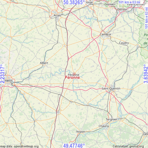
Péronne GPS coordinates[2]
49° 55' 55.848" North, 2° 56' 10.68" East
| Map corner | latitude | longitude |
|---|---|---|
| Upper-left | 50.38265°, | 2.23317° |
| Center: | 49.93218°, | 2.9363° |
| Lower-right: | 49.47746°, | 3.63942° |
| Map W x H: | 100.6×100.6 km | = 62.5×62.5mi |
| max Lat: | 51.07786° ⇑6.8% North |
| Péronne: | 49.93218° |
| min Lat: | ⇓93.2% South 41.3874° |
| min Long | Péronne | max Long |
| -5.08615° | 2.9363° | 9.52242° |
| W 56.9%⇐ | ⇒43.1% E |
Elevation
Elevation of Péronne is 51 m = 167 ft, and this is 142.7 m = 468 ft below average elevation for this country.
| Max E: |
2333 m = 7654 ft | 81.5% |
| Avg. | 193.7 m = 635 ft | |
| Péronne | 51 m = 167 ft | |
Min E: |
-1 m = -3 ft | 18.5% |
See also: France elevation on elevation.city.
Geographical zone
Péronne is located in North temperate zone (between Tropic of Cancer and the Arctic Circle). Distance of this North polar circle is 1849.2 km =1149 mi to North.| Distance of | km | miles | from Péronne |
|---|---|---|---|
| North Pole | 4455.1 | 2768.3 | to North |
| Arctic Circle | 1849.2 | 1149 | to North |
| Tropic Cancer | 2946 | 1830.6 | to South |
| Equator | 5551.9 | 3449.8 | to South |


Nearby cities:
15 places around Péronne: (largest is in red/bold)
• Athies
9.3 km =5.8 mi,  159°
159°
• Becquincourt
9 km =5.6 mi,  254°
254°
• Bray-sur-Somme
15.6 km =9.7 mi,  273°
273°
• Cartigny
5.9 km =3.7 mi,  112°
112°
• Cléry-sur-Somme
4.5 km =2.8 mi,  308°
308°
• Combles
9.9 km =6.2 mi,  330°
330°
• Doingt
2.6 km =1.6 mi,  118°
118°
• Estrées-Mons
7.9 km =4.9 mi,  139°
139°
• Heudicourt
14.4 km =8.9 mi,  45°
45°
• Matigny
16 km =9.9 mi, 161°
• Moislains
6.5 km =4 mi,  17°
17°
• Monchy-Lagache
11.9 km =7.4 mi, 139°
• Roisel
11.8 km =7.3 mi,  81°
81°
• Villers-Faucon
12.9 km =8 mi,  66°
66°
• Épehy
16 km =9.9 mi,  61°
61°
Sources, notices
• [Note1] Compared only with cities in France existing in our database
• [Src1] Map data: © OpenStreetMap contributors (CC-BY-SA)
• [Src2] Other city data from geonames.org with taken over terms of usage.
• [Src3] Geographical zone / Annual Mean Temperature by Robert A. Rohde @ Wikipedia
