Villers-Faucon geodata
Villers-Faucon (Hauts-de-France) is a populated place; located in France in Europe/Paris (GMT+2) time zone. With population of 642 people, there are 12644 cities with bigger population in this country. Compared to other cities in France, 93.4% of cities are located further ↓South; 59.3% of cities are located further ←West and 59.7% of cities have higher elevation than Villers-Faucon. Note1
Administrative division(s):
- Level 1: Hauts-de-France
- Level 2: Somme
- Level 3: Arrondissement de Péronne
- Level 4: Villers-Faucon


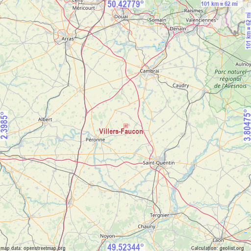
Villers-Faucon GPS coordinates[2]
49° 58' 39.864" North, 3° 6' 5.832" East
| Map corner | latitude | longitude |
|---|---|---|
| Upper-left | 50.42779°, | 2.3985° |
| Center: | 49.97774°, | 3.10162° |
| Lower-right: | 49.52344°, | 3.80475° |
| Map W x H: | 100.6×100.6 km | = 62.5×62.5mi |
| max Lat: | 51.07786° ⇑6.6% North |
| Villers-Faucon: | 49.97774° |
| min Lat: | ⇓93.4% South 41.3874° |
| min Long | Villers-Faucon | max Long |
| -5.08615° | 3.10162° | 9.52242° |
| W 59.3%⇐ | ⇒40.7% E |
Elevation
Elevation of Villers-Faucon is 103 m = 338 ft, and this is 90.7 m = 298 ft below average elevation for this country.
| Max E: |
2333 m = 7654 ft | 59.7% |
| Avg. | 193.7 m = 635 ft | |
| Villers-Faucon | 103 m = 338 ft | |
Min E: |
-1 m = -3 ft | 40.3% |
See also: France elevation on elevation.city.
Geographical zone
Villers-Faucon is located in North temperate zone (between Tropic of Cancer and the Arctic Circle). Distance of this North polar circle is 1844.2 km =1145.9 mi to North.| Distance of | km | miles | from Villers-Faucon |
|---|---|---|---|
| North Pole | 4450.1 | 2765.2 | to North |
| Arctic Circle | 1844.2 | 1145.9 | to North |
| Tropic Cancer | 2951.1 | 1833.7 | to South |
| Equator | 5557 | 3453 | to South |


Nearby cities:
15 places around Villers-Faucon: (largest is in red/bold)
• Bellicourt
9.7 km =6 mi,  100°
100°
• Cartigny
9.7 km =6 mi,  221°
221°
• Doingt
11.5 km =7.1 mi,  236°
236°
• Gouy
11.3 km =7 mi,  76°
76°
• Gouzeaucourt
8.8 km =5.5 mi,  10°
10°
• Hargicourt
5.8 km =3.6 mi,  108°
108°
• Heudicourt
5.1 km =3.2 mi,  343°
343°
• Honnecourt-sur-Escaut
9.4 km =5.8 mi,  48°
48°
• Metz-en-Couture
10.2 km =6.3 mi, 344°
• Moislains
9.9 km =6.2 mi,  276°
276°
• Nauroy
11.3 km =7 mi, 103°
• Roisel
3.3 km =2.1 mi,  182°
182°
• Ronssoy
4.2 km =2.6 mi, 82°
• Villers-Guislain
8 km =5 mi,  28°
28°
• Épehy
3.4 km =2.1 mi,  42°
42°
Sources, notices
• [Note1] Compared only with cities in France existing in our database
• [Src1] Map data: © OpenStreetMap contributors (CC-BY-SA)
• [Src2] Other city data from geonames.org with taken over terms of usage.
• [Src3] Geographical zone / Annual Mean Temperature by Robert A. Rohde @ Wikipedia
