Pernes-les-Fontaines geodata
Pernes-les-Fontaines (Provence-Alpes-Côte d'Azur) is a populated place; located in France in Europe/Paris (GMT+2) time zone. With population of 10,868 people, there are 882 cities with bigger population in this country. Compared to other cities in France, 87.1% of cities are located further ↑North; 78.3% of cities are located further ←West and 60% of cities have higher elevation than Pernes-les-Fontaines. Note1
Administrative division(s):
- Level 1: Provence-Alpes-Côte d'Azur
- Level 2: Département du Vaucluse
- Level 3: Arrondissement de Carpentras
- Level 4: Pernes-les-Fontaines
Current local time in Pernes-les-Fontaines:
06:02 AM, WednesdayDifference from your time zone: hours


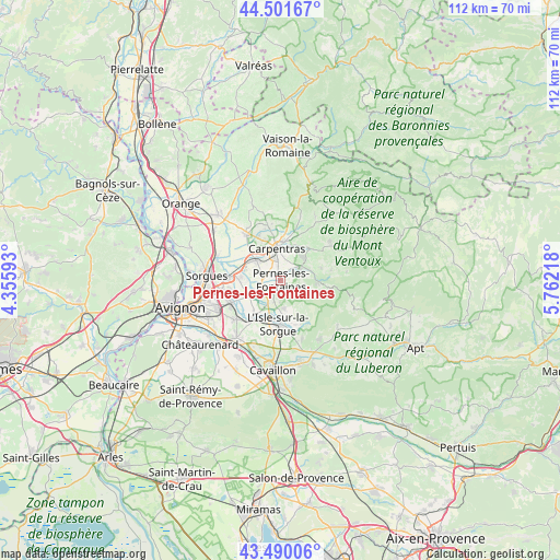
Pernes-les-Fontaines GPS coordinates[2]
43° 59' 52.872" North, 5° 3' 32.616" East
| Map corner | latitude | longitude |
|---|---|---|
| Upper-left | 44.50167°, | 4.35593° |
| Center: | 43.99802°, | 5.05906° |
| Lower-right: | 43.49006°, | 5.76218° |
| Map W x H: | 112.5×112.5 km | = 69.9×69.9mi |
| max Lat: | 51.07786° ⇑87.1% North |
| Pernes-les-Fontaines: | 43.99802° |
| min Lat: | ⇓12.9% South 41.3874° |
| min Long | Pernes-les-Font | max Long |
| -5.08615° | 5.05906° | 9.52242° |
| W 78.3%⇐ | ⇒21.7% E |
Elevation
Elevation of Pernes-les-Fontaines is 102 m = 335 ft, and this is 91.7 m = 301 ft below average elevation for this country.
| Max E: |
2333 m = 7654 ft | 60% |
| Avg. | 193.7 m = 635 ft | |
| Pernes-les-Fontaines | 102 m = 335 ft | |
Min E: |
-1 m = -3 ft | 40% |
See also: France elevation on elevation.city.
Geographical zone
Pernes-les-Fontaines is located in North temperate zone (between Tropic of Cancer and the Arctic Circle). Distance of this Northern Tropic circle is 2286.2 km =1420.6 mi to South.| Distance of | km | miles | from Pernes-les-Fontaines |
|---|---|---|---|
| North Pole | 5114.9 | 3178.3 | to North |
| Arctic Circle | 2509.1 | 1559.1 | to North |
| Tropic Cancer | 2286.2 | 1420.6 | to South |
| Equator | 4892.1 | 3039.8 | to South |


Nearby cities:
15 places around Pernes-les-Fontaines: (largest is in red/bold)
• Althen-des-Paluds
8.1 km =5 mi,  274°
274°
• Carpentras
6.4 km =4 mi,  352°
352°
• Entraigues-sur-la-Sorgue
10.6 km =6.6 mi, 273°
• Fontaine-de-Vaucluse
10 km =6.2 mi,  147°
147°
• Jonquerettes
11.6 km =7.2 mi,  240°
240°
• Le Thor
9.2 km =5.7 mi,  213°
213°
• Loriol-du-Comtat
9.9 km =6.2 mi,  331°
331°
• L’Isle-sur-la-Sorgue
8.7 km =5.4 mi,  184°
184°
• Malemort-du-Comtat
8.4 km =5.2 mi,  72°
72°
• Mazan
8.5 km =5.3 mi,  39°
39°
• Monteux
6.6 km =4.1 mi,  310°
310°
• Saint-Didier
4.2 km =2.6 mi,  80°
80°
• Saumane-de-Vaucluse
7.8 km =4.8 mi, 151°
• Velleron
5.1 km =3.2 mi, 207°
• Venasque
7 km =4.3 mi,  91°
91°
Sources, notices
• [Note1] Compared only with cities in France existing in our database
• [Src1] Map data: © OpenStreetMap contributors (CC-BY-SA)
• [Src2] Other city data from geonames.org with taken over terms of usage.
• [Src3] Geographical zone / Annual Mean Temperature by Robert A. Rohde @ Wikipedia
