Peisey-Nancroix geodata
Peisey-Nancroix (Auvergne-Rhône-Alpes) is a populated place; located in France in Europe/Paris (GMT+2) time zone. With population of 663 people, there are 12328 cities with bigger population in this country. Compared to other cities in France, 73.5% of cities are located further ↑North; 93.4% of cities are located further ←West and 99.8% of cities have lower elevation than Peisey-Nancroix. Note1
Administrative division(s):
- Level 1: Auvergne-Rhône-Alpes
- Level 2: Savoie
- Level 3: Albertville
- Level 4: Peisey-Nancroix


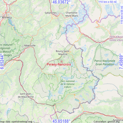
Peisey-Nancroix GPS coordinates[2]
45° 32' 47.256" North, 6° 45' 20.016" East
| Map corner | latitude | longitude |
|---|---|---|
| Upper-left | 46.03672°, | 6.05244° |
| Center: | 45.54646°, | 6.75556° |
| Lower-right: | 45.05188°, | 7.45869° |
| Map W x H: | 109.5×109.5 km | = 68×68mi |
| max Lat: | 51.07786° ⇑73.5% North |
| Peisey-Nancroix: | 45.54646° |
| min Lat: | ⇓26.5% South 41.3874° |
| min Long | Peisey-Nancroix | max Long |
| -5.08615° | 6.75556° | 9.52242° |
| W 93.4%⇐ | ⇒6.6% E |
Elevation
Elevation of Peisey-Nancroix is 1301 m = 4268 ft, and this is 1107.3 m = 3633 ft above average elevation for this country.
| Max E: |
2333 m = 7654 ft | 0.2% |
| Peisey-Nancroix | 1301 m 4268 ft | |
| Avg. | 193.7 m = 635 ft | |
Min E: |
-1 m = -3 ft | 99.8% |
See also: France elevation on elevation.city.
Geographical zone
Peisey-Nancroix is located in North temperate zone (between Tropic of Cancer and the Arctic Circle). Distance of this North polar circle is 2336.9 km =1452.1 mi to North.| Distance of | km | miles | from Peisey-Nancroix |
|---|---|---|---|
| North Pole | 4942.8 | 3071.3 | to North |
| Arctic Circle | 2336.9 | 1452.1 | to North |
| Tropic Cancer | 2458.4 | 1527.6 | to South |
| Equator | 5064.3 | 3146.8 | to South |


Nearby cities:
15 places around Peisey-Nancroix: (largest is in red/bold)
• Aime
8.2 km =5.1 mi,  277°
277°
• Belle-Plagne
5.6 km =3.5 mi,  222°
222°
• Bellentre
4.1 km =2.5 mi,  308°
308°
• Bourg-Saint-Maurice
7.6 km =4.7 mi,  7°
7°
• Bozel
14.2 km =8.8 mi, 215°
• Brides-les-Bains
17.9 km =11.1 mi,  234°
234°
• Champagny-en-Vanoise
11.3 km =7 mi,  205°
205°
• Courchevel
17.3 km =10.7 mi, 212°
• Landry
3.1 km =1.9 mi,  336°
336°
• Montvalezan
10.1 km =6.3 mi,  44°
44°
• Mâcot-la-Plagne
6.9 km =4.3 mi,  273°
273°
• Saint-Bon-Tarentaise
15.6 km =9.7 mi, 216°
• Sainte-Foy-Tarentaise
11.1 km =6.9 mi,  64°
64°
• Séez
9.3 km =5.8 mi,  22°
22°
• Tignes
14.3 km =8.9 mi,  113°
113°
Sources, notices
• [Note1] Compared only with cities in France existing in our database
• [Src1] Map data: © OpenStreetMap contributors (CC-BY-SA)
• [Src2] Other city data from geonames.org with taken over terms of usage.
• [Src3] Geographical zone / Annual Mean Temperature by Robert A. Rohde @ Wikipedia
