Montvalezan geodata
Montvalezan (Auvergne-Rhône-Alpes) is a populated place; located in France in Europe/Paris (GMT+2) time zone. With population of 627 people, there are 12867 cities with bigger population in this country. Compared to other cities in France, 72.4% of cities are located further ↑North; 93.9% of cities are located further ←West and 99.5% of cities have lower elevation than Montvalezan. Note1
Administrative division(s):
- Level 1: Auvergne-Rhône-Alpes
- Level 2: Savoie
- Level 3: Albertville
- Level 4: Montvalezan


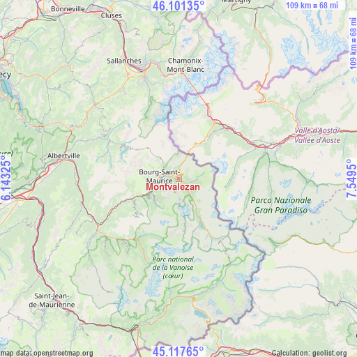
Montvalezan GPS coordinates[2]
45° 36' 41.976" North, 6° 50' 46.932" East
| Map corner | latitude | longitude |
|---|---|---|
| Upper-left | 46.10135°, | 6.14325° |
| Center: | 45.61166°, | 6.84637° |
| Lower-right: | 45.11765°, | 7.5495° |
| Map W x H: | 109.4×109.4 km | = 68×68mi |
| max Lat: | 51.07786° ⇑72.4% North |
| Montvalezan: | 45.61166° |
| min Lat: | ⇓27.6% South 41.3874° |
| min Long | Montvalezan | max Long |
| -5.08615° | 6.84637° | 9.52242° |
| W 93.9%⇐ | ⇒6.1% E |
Elevation
Elevation of Montvalezan is 1148 m = 3766 ft, and this is 954.3 m = 3131 ft above average elevation for this country.
| Max E: |
2333 m = 7654 ft | 0.5% |
| Montvalezan | 1148 m 3766 ft | |
| Avg. | 193.7 m = 635 ft | |
Min E: |
-1 m = -3 ft | 99.5% |
See also: France elevation on elevation.city.
Geographical zone
Montvalezan is located in North temperate zone (between Tropic of Cancer and the Arctic Circle). Distance of this North polar circle is 2329.6 km =1447.5 mi to North.| Distance of | km | miles | from Montvalezan |
|---|---|---|---|
| North Pole | 4935.5 | 3066.8 | to North |
| Arctic Circle | 2329.6 | 1447.5 | to North |
| Tropic Cancer | 2465.6 | 1532.1 | to South |
| Equator | 5071.5 | 3151.3 | to South |


Nearby cities:
15 places around Montvalezan: (largest is in red/bold)
• Aime
16.5 km =10.3 mi,  247°
247°
• Beaufort
24.4 km =15.2 mi,  299°
299°
• Belle-Plagne
15.7 km =9.8 mi,  223°
223°
• Bellentre
11.3 km =7 mi, 245°
• Bourg-Saint-Maurice
6.1 km =3.8 mi,  273°
273°
• Bozel
24.3 km =15.1 mi, 219°
• Champagny-en-Vanoise
21.2 km =13.2 mi,  214°
214°
• Landry
9.4 km =5.8 mi,  242°
242°
• Les Contamines-Montjoie
25.1 km =15.6 mi,  338°
338°
• Mâcot-la-Plagne
15.6 km =9.7 mi, 243°
• Peisey-Nancroix
10.1 km =6.3 mi, 224°
• Sainte-Foy-Tarentaise
3.9 km =2.4 mi,  129°
129°
• Séez
3.7 km =2.3 mi,  290°
290°
• Tignes
14.2 km =8.8 mi,  154°
154°
• Val-d’Isère
20.4 km =12.7 mi, 150°
Sources, notices
• [Note1] Compared only with cities in France existing in our database
• [Src1] Map data: © OpenStreetMap contributors (CC-BY-SA)
• [Src2] Other city data from geonames.org with taken over terms of usage.
• [Src3] Geographical zone / Annual Mean Temperature by Robert A. Rohde @ Wikipedia
