Tignes geodata
Tignes (Auvergne-Rhône-Alpes) is a populated place; located in France in Europe/Paris (GMT+2) time zone. With population of 2,385 people, there are 4056 cities with bigger population in this country. Compared to other cities in France, 74.2% of cities are located further ↑North; 94.4% of cities are located further ←West and 100% of cities have lower elevation than Tignes. Note1
Administrative division(s):
- Level 1: Auvergne-Rhône-Alpes
- Level 2: Savoie
- Level 3: Albertville
- Level 4: Tignes


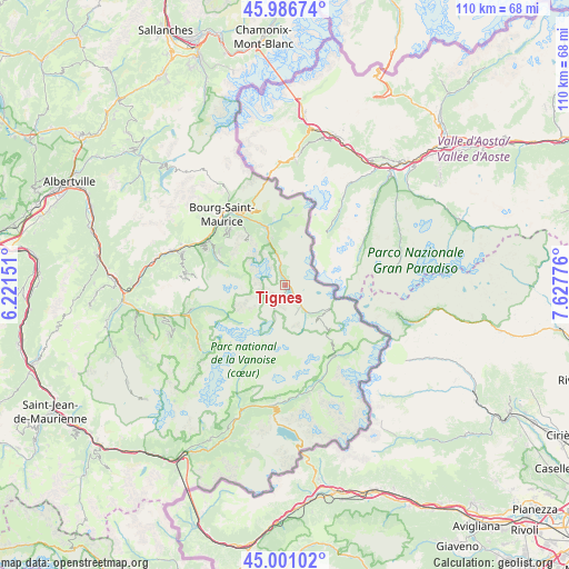
Tignes GPS coordinates[2]
45° 29' 45.744" North, 6° 55' 28.668" East
| Map corner | latitude | longitude |
|---|---|---|
| Upper-left | 45.98674°, | 6.22151° |
| Center: | 45.49604°, | 6.92463° |
| Lower-right: | 45.00102°, | 7.62776° |
| Map W x H: | 109.6×109.6 km | = 68.1×68.1mi |
| max Lat: | 51.07786° ⇑74.2% North |
| Tignes: | 45.49604° |
| min Lat: | ⇓25.8% South 41.3874° |
| min Long | Tignes | max Long |
| -5.08615° | 6.92463° | 9.52242° |
| W 94.4%⇐ | ⇒5.6% E |
Elevation
Elevation of Tignes is 1802 m = 5912 ft, and this is 1608.3 m = 5277 ft above average elevation for this country.
| Max E: |
2333 m = 7654 ft | 0% |
| Tignes | 1802 m 5912 ft | |
| Avg. | 193.7 m = 635 ft | |
Min E: |
-1 m = -3 ft | 100% |
See also: France elevation on elevation.city.
Geographical zone
Tignes is located in North temperate zone (between Tropic of Cancer and the Arctic Circle). Distance of this North polar circle is 2342.5 km =1455.6 mi to North.| Distance of | km | miles | from Tignes |
|---|---|---|---|
| North Pole | 4948.4 | 3074.8 | to North |
| Arctic Circle | 2342.5 | 1455.6 | to North |
| Tropic Cancer | 2452.8 | 1524.1 | to South |
| Equator | 5058.7 | 3143.3 | to South |


Nearby cities:
15 places around Tignes: (largest is in red/bold)
• Aime
22.4 km =13.9 mi,  287°
287°
• Belle-Plagne
17 km =10.6 mi,  274°
274°
• Bellentre
18.3 km =11.4 mi,  296°
296°
• Bourg-Saint-Maurice
17.9 km =11.1 mi,  317°
317°
• Bozel
22.3 km =13.9 mi,  254°
254°
• Champagny-en-Vanoise
18.6 km =11.6 mi,  255°
255°
• Landry
16.7 km =10.4 mi, 300°
• Montvalezan
14.2 km =8.8 mi,  334°
334°
• Mâcot-la-Plagne
21 km =13 mi, 286°
• Peisey-Nancroix
14.3 km =8.9 mi, 293°
• Pralognan-la-Vanoise
20.4 km =12.7 mi,  232°
232°
• Saint-Bon-Tarentaise
23.5 km =14.6 mi, 252°
• Sainte-Foy-Tarentaise
10.8 km =6.7 mi,  343°
343°
• Séez
17.1 km =10.6 mi, 325°
• Val-d’Isère
6.3 km =3.9 mi,  141°
141°
Sources, notices
• [Note1] Compared only with cities in France existing in our database
• [Src1] Map data: © OpenStreetMap contributors (CC-BY-SA)
• [Src2] Other city data from geonames.org with taken over terms of usage.
• [Src3] Geographical zone / Annual Mean Temperature by Robert A. Rohde @ Wikipedia
