Noyers geodata
Noyers (Bourgogne-Franche-Comté) is a populated place; located in France in Europe/Paris (GMT+2) time zone. With population of 829 people, there are 10301 cities with bigger population in this country. Compared to other cities in France, 54.1% of cities are located further ↓South; 67.7% of cities are located further ←West and 61% of cities have lower elevation than Noyers. Note1
Administrative division(s):
- Level 1: Bourgogne-Franche-Comté
- Level 2: Département de l'Yonne
- Level 3: Avallon
- Level 4: Noyers


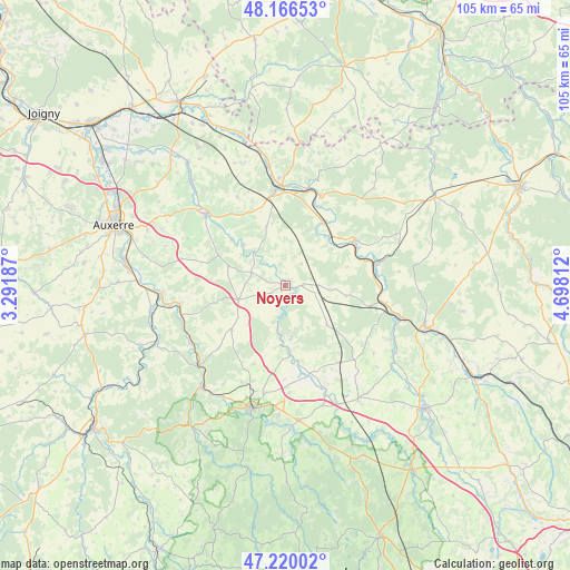
Noyers GPS coordinates[2]
47° 41' 43.512" North, 3° 59' 41.964" East
| Map corner | latitude | longitude |
|---|---|---|
| Upper-left | 48.16653°, | 3.29187° |
| Center: | 47.69542°, | 3.99499° |
| Lower-right: | 47.22002°, | 4.69812° |
| Map W x H: | 105.2×105.2 km | = 65.4×65.4mi |
| max Lat: | 51.07786° ⇑45.9% North |
| Noyers: | 47.69542° |
| min Lat: | ⇓54.1% South 41.3874° |
| min Long | Noyers | max Long |
| -5.08615° | 3.99499° | 9.52242° |
| W 67.7%⇐ | ⇒32.3% E |
Elevation
Elevation of Noyers is 175 m = 574 ft, and this is 18.7 m = 61 ft below average elevation for this country.
| Max E: |
2333 m = 7654 ft | 39% |
| Avg. | 193.7 m = 635 ft | |
| Noyers | 175 m = 574 ft | |
Min E: |
-1 m = -3 ft | 61% |
See also: France elevation on elevation.city.
Geographical zone
Noyers is located in North temperate zone (between Tropic of Cancer and the Arctic Circle). Distance of this North polar circle is 2097.9 km =1303.6 mi to North.| Distance of | km | miles | from Noyers |
|---|---|---|---|
| North Pole | 4703.8 | 2922.8 | to North |
| Arctic Circle | 2097.9 | 1303.6 | to North |
| Tropic Cancer | 2697.3 | 1676 | to South |
| Equator | 5303.2 | 3295.3 | to South |


Nearby cities:
15 places around Noyers: (largest is in red/bold)
• Ancy-le-Franc
15.5 km =9.6 mi,  54°
54°
• Avallon
23.7 km =14.7 mi,  195°
195°
• Chablis
19.7 km =12.2 mi,  311°
311°
• Cravant
22.8 km =14.2 mi,  266°
266°
• Joux-la-Ville
12.8 km =8 mi,  230°
230°
• Lézinnes
13.6 km =8.5 mi,  30°
30°
• Mailly-la-Ville
25.7 km =16 mi,  245°
245°
• Ravières
18 km =11.2 mi,  75°
75°
• Saint-Rémy
23.6 km =14.7 mi,  105°
105°
• Sauvigny-le-Bois
20.6 km =12.8 mi,  191°
191°
• Tanlay
17.9 km =11.1 mi,  22°
22°
• Tonnerre
18 km =11.2 mi,  354°
354°
• Vermenton
19.8 km =12.3 mi,  260°
260°
• Épineuil
19.7 km =12.2 mi,  356°
356°
• Époisses
24.9 km =15.5 mi,  147°
147°
Sources, notices
• [Note1] Compared only with cities in France existing in our database
• [Src1] Map data: © OpenStreetMap contributors (CC-BY-SA)
• [Src2] Other city data from geonames.org with taken over terms of usage.
• [Src3] Geographical zone / Annual Mean Temperature by Robert A. Rohde @ Wikipedia
