Lézinnes geodata
Lézinnes (Bourgogne-Franche-Comté) is a populated place; located in France in Europe/Paris (GMT+2) time zone. With population of 819 people, there are 10400 cities with bigger population in this country. Compared to other cities in France, 55.7% of cities are located further ↓South; 68.7% of cities are located further ←West and 60.3% of cities have lower elevation than Lézinnes. Note1
Administrative division(s):
- Level 1: Bourgogne-Franche-Comté
- Level 2: Département de l'Yonne
- Level 3: Avallon
- Level 4: Lézinnes


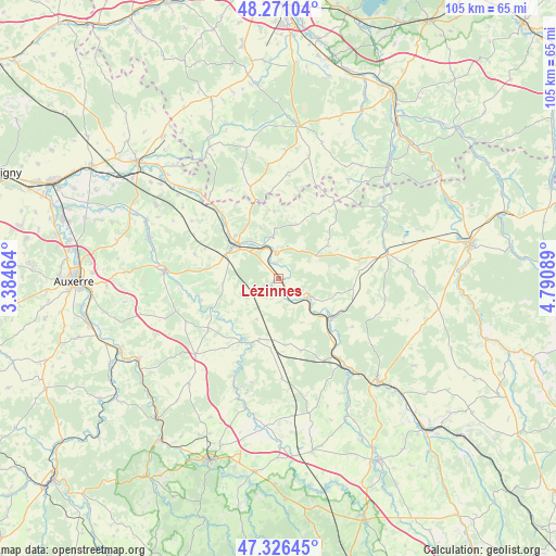
Lézinnes GPS coordinates[2]
47° 48' 3.204" North, 4° 5' 15.936" East
| Map corner | latitude | longitude |
|---|---|---|
| Upper-left | 48.27104°, | 3.38464° |
| Center: | 47.80089°, | 4.08776° |
| Lower-right: | 47.32645°, | 4.79089° |
| Map W x H: | 105×105 km | = 65.2×65.2mi |
| max Lat: | 51.07786° ⇑44.3% North |
| Lézinnes: | 47.80089° |
| min Lat: | ⇓55.7% South 41.3874° |
| min Long | Lézinnes | max Long |
| -5.08615° | 4.08776° | 9.52242° |
| W 68.7%⇐ | ⇒31.3% E |
Elevation
Elevation of Lézinnes is 171 m = 561 ft, and this is 22.7 m = 74 ft below average elevation for this country.
| Max E: |
2333 m = 7654 ft | 39.7% |
| Avg. | 193.7 m = 635 ft | |
| Lézinnes | 171 m = 561 ft | |
Min E: |
-1 m = -3 ft | 60.3% |
See also: France elevation on elevation.city.
Geographical zone
Lézinnes is located in North temperate zone (between Tropic of Cancer and the Arctic Circle). Distance of this North polar circle is 2086.2 km =1296.3 mi to North.| Distance of | km | miles | from Lézinnes |
|---|---|---|---|
| North Pole | 4692.1 | 2915.5 | to North |
| Arctic Circle | 2086.2 | 1296.3 | to North |
| Tropic Cancer | 2709 | 1683.3 | to South |
| Equator | 5315 | 3302.6 | to South |


Nearby cities:
15 places around Lézinnes: (largest is in red/bold)
• Ancy-le-Franc
6.3 km =3.9 mi,  116°
116°
• Chablis
21.7 km =13.5 mi,  273°
273°
• Chessy-les-Prés
27.9 km =17.3 mi,  332°
332°
• Flogny-la-Chapelle
23.4 km =14.5 mi,  315°
315°
• Joux-la-Ville
26.1 km =16.2 mi,  220°
220°
• Laignes
21.2 km =13.2 mi,  77°
77°
• Ligny-le-Châtel
27 km =16.8 mi,  294°
294°
• Maligny
25.3 km =15.7 mi, 287°
• Montbard
27.2 km =16.9 mi,  136°
136°
• Noyers
13.6 km =8.5 mi,  210°
210°
• Ravières
12.8 km =8 mi,  125°
125°
• Saint-Rémy
24 km =14.9 mi, 139°
• Tanlay
4.9 km =3 mi,  357°
357°
• Tonnerre
10.5 km =6.5 mi,  305°
305°
• Épineuil
11.3 km =7 mi, 314°
Sources, notices
• [Note1] Compared only with cities in France existing in our database
• [Src1] Map data: © OpenStreetMap contributors (CC-BY-SA)
• [Src2] Other city data from geonames.org with taken over terms of usage.
• [Src3] Geographical zone / Annual Mean Temperature by Robert A. Rohde @ Wikipedia
