Tanlay geodata
Tanlay (Bourgogne-Franche-Comté) is a populated place; located in France in Europe/Paris (GMT+2) time zone. With population of 1,143 people, there are 7868 cities with bigger population in this country. Compared to other cities in France, 56.5% of cities are located further ↓South; 68.7% of cities are located further ←West and 57.4% of cities have lower elevation than Tanlay. Note1
Administrative division(s):
- Level 1: Bourgogne-Franche-Comté
- Level 2: Département de l'Yonne
- Level 3: Avallon
- Level 4: Tanlay


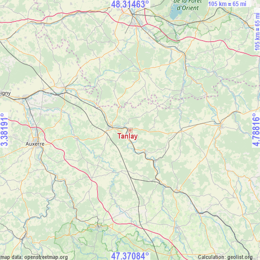
Tanlay GPS coordinates[2]
47° 50' 41.568" North, 4° 5' 6.144" East
| Map corner | latitude | longitude |
|---|---|---|
| Upper-left | 48.31463°, | 3.38191° |
| Center: | 47.84488°, | 4.08504° |
| Lower-right: | 47.37084°, | 4.78816° |
| Map W x H: | 104.9×104.9 km | = 65.2×65.2mi |
| max Lat: | 51.07786° ⇑43.5% North |
| Tanlay: | 47.84488° |
| min Lat: | ⇓56.5% South 41.3874° |
| min Long | Tanlay | max Long |
| -5.08615° | 4.08504° | 9.52242° |
| W 68.7%⇐ | ⇒31.3% E |
Elevation
Elevation of Tanlay is 159 m = 522 ft, and this is 34.7 m = 114 ft below average elevation for this country.
| Max E: |
2333 m = 7654 ft | 42.6% |
| Avg. | 193.7 m = 635 ft | |
| Tanlay | 159 m = 522 ft | |
Min E: |
-1 m = -3 ft | 57.4% |
See also: France elevation on elevation.city.
Geographical zone
Tanlay is located in North temperate zone (between Tropic of Cancer and the Arctic Circle). Distance of this North polar circle is 2081.3 km =1293.3 mi to North.| Distance of | km | miles | from Tanlay |
|---|---|---|---|
| North Pole | 4687.2 | 2912.5 | to North |
| Arctic Circle | 2081.3 | 1293.3 | to North |
| Tropic Cancer | 2713.9 | 1686.3 | to South |
| Equator | 5319.9 | 3305.6 | to South |


Nearby cities:
15 places around Tanlay: (largest is in red/bold)
• Ancy-le-Franc
9.7 km =6 mi,  142°
142°
• Chablis
21.7 km =13.5 mi,  260°
260°
• Chaource
24.1 km =15 mi,  9°
9°
• Chessy-les-Prés
23.6 km =14.7 mi,  327°
327°
• Ervy-le-Châtel
25.4 km =15.8 mi, 329°
• Flogny-la-Chapelle
20 km =12.4 mi,  305°
305°
• Laignes
20.9 km =13 mi,  90°
90°
• Les Riceys
26.9 km =16.7 mi,  52°
52°
• Ligny-le-Châtel
25.2 km =15.7 mi,  284°
284°
• Lézinnes
4.9 km =3 mi,  177°
177°
• Maligny
24.1 km =15 mi, 276°
• Noyers
17.9 km =11.1 mi,  202°
202°
• Ravières
16.2 km =10.1 mi, 138°
• Tonnerre
8.4 km =5.2 mi, 278°
• Épineuil
8.5 km =5.3 mi,  290°
290°
Sources, notices
• [Note1] Compared only with cities in France existing in our database
• [Src1] Map data: © OpenStreetMap contributors (CC-BY-SA)
• [Src2] Other city data from geonames.org with taken over terms of usage.
• [Src3] Geographical zone / Annual Mean Temperature by Robert A. Rohde @ Wikipedia
