Noyant geodata
Noyant (Pays de la Loire) is a populated place; located in France in Europe/Paris (GMT+2) time zone. With population of 1,975 people, there are 4840 cities with bigger population in this country. Compared to other cities in France, 51.4% of cities are located further ↓South; 77% of cities are located further →East and 67.4% of cities have higher elevation than Noyant. Note1
Administrative division(s):
- Level 1: Pays de la Loire
- Level 2: Département de Maine-et-Loire
- Level 3: Arrondissement de Saumur
- Level 4: Noyant-Villages


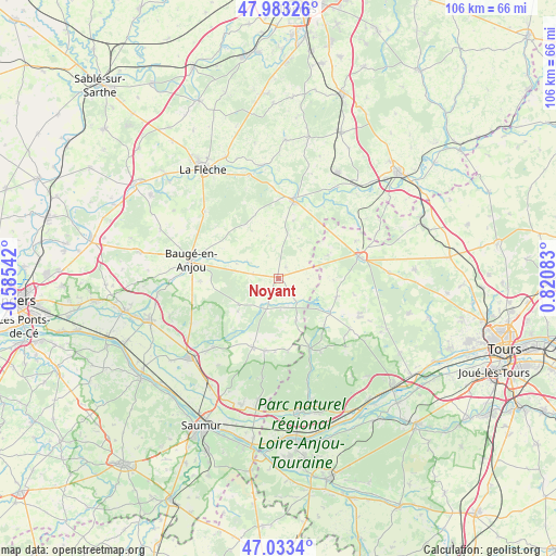
Noyant GPS coordinates[2]
47° 30' 37.728" North, 0° 7' 3.756" East
| Map corner | latitude | longitude |
|---|---|---|
| Upper-left | 47.98326°, | -0.58542° |
| Center: | 47.51048°, | 0.11771° |
| Lower-right: | 47.0334°, | 0.82083° |
| Map W x H: | 105.6×105.6 km | = 65.6×65.6mi |
| max Lat: | 51.07786° ⇑48.6% North |
| Noyant: | 47.51048° |
| min Lat: | ⇓51.4% South 41.3874° |
| min Long | Noyant | max Long |
| -5.08615° | 0.11771° | 9.52242° |
| W 23%⇐ | ⇒77% E |
Elevation
Elevation of Noyant is 84 m = 276 ft, and this is 109.7 m = 360 ft below average elevation for this country.
| Max E: |
2333 m = 7654 ft | 67.4% |
| Avg. | 193.7 m = 635 ft | |
| Noyant | 84 m = 276 ft | |
Min E: |
-1 m = -3 ft | 32.6% |
See also: France elevation on elevation.city.
Geographical zone
Noyant is located in North temperate zone (between Tropic of Cancer and the Arctic Circle). Distance of this North polar circle is 2118.5 km =1316.4 mi to North.| Distance of | km | miles | from Noyant |
|---|---|---|---|
| North Pole | 4724.4 | 2935.6 | to North |
| Arctic Circle | 2118.5 | 1316.4 | to North |
| Tropic Cancer | 2676.8 | 1663.3 | to South |
| Equator | 5282.7 | 3282.5 | to South |


Nearby cities:
15 places around Noyant: (largest is in red/bold)
• Baugé-en-Anjou
17.3 km =10.7 mi,  282°
282°
• Bocé
15 km =9.3 mi,  268°
268°
• Channay-sur-Lathan
11.5 km =7.1 mi,  107°
107°
• Château-la-Vallière
16 km =9.9 mi,  75°
75°
• Couesmes
17.8 km =11.1 mi,  70°
70°
• Dissé-sous-le-Lude
11.4 km =7.1 mi,  14°
14°
• Hommes
16.4 km =10.2 mi,  125°
125°
• Le Lude
15.4 km =9.6 mi, 10°
• Mouliherne
9 km =5.6 mi,  237°
237°
• Parçay-les-Pins
8.9 km =5.5 mi,  157°
157°
• Saint-Philbert-du-Peuple
17.8 km =11.1 mi,  222°
222°
• Savigné-sur-Lathan
16.9 km =10.5 mi,  115°
115°
• Vernantes
13.9 km =8.6 mi,  200°
200°
• Vernoil-le-Fourrier
14.4 km =8.9 mi,  190°
190°
• Villiers-au-Bouin
16.3 km =10.1 mi,  64°
64°
Sources, notices
• [Note1] Compared only with cities in France existing in our database
• [Src1] Map data: © OpenStreetMap contributors (CC-BY-SA)
• [Src2] Other city data from geonames.org with taken over terms of usage.
• [Src3] Geographical zone / Annual Mean Temperature by Robert A. Rohde @ Wikipedia
