Mouliherne geodata
Mouliherne (Pays de la Loire) is a populated place; located in France in Europe/Paris (GMT+2) time zone. With population of 879 people, there are 9827 cities with bigger population in this country. Compared to other cities in France, 50.7% of cities are located further ↓South; 78% of cities are located further →East and 75.8% of cities have higher elevation than Mouliherne. Note1
Administrative division(s):
- Level 1: Pays de la Loire
- Level 2: Département de Maine-et-Loire
- Level 3: Arrondissement de Saumur
- Level 4: Mouliherne


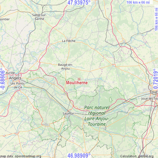
Mouliherne GPS coordinates[2]
47° 27' 59.652" North, 0° 1' 1.452" East
| Map corner | latitude | longitude |
|---|---|---|
| Upper-left | 47.93975°, | -0.68606° |
| Center: | 47.46657°, | 0.01707° |
| Lower-right: | 46.98909°, | 0.72019° |
| Map W x H: | 105.7×105.7 km | = 65.7×65.7mi |
| max Lat: | 51.07786° ⇑49.3% North |
| Mouliherne: | 47.46657° |
| min Lat: | ⇓50.7% South 41.3874° |
| min Long | Mouliherne | max Long |
| -5.08615° | 0.01707° | 9.52242° |
| W 22%⇐ | ⇒78% E |
Elevation
Elevation of Mouliherne is 65 m = 213 ft, and this is 128.7 m = 422 ft below average elevation for this country.
| Max E: |
2333 m = 7654 ft | 75.8% |
| Avg. | 193.7 m = 635 ft | |
| Mouliherne | 65 m = 213 ft | |
Min E: |
-1 m = -3 ft | 24.2% |
See also: France elevation on elevation.city.
Geographical zone
Mouliherne is located in North temperate zone (between Tropic of Cancer and the Arctic Circle). Distance of this North polar circle is 2123.4 km =1319.4 mi to North.| Distance of | km | miles | from Mouliherne |
|---|---|---|---|
| North Pole | 4729.3 | 2938.6 | to North |
| Arctic Circle | 2123.4 | 1319.4 | to North |
| Tropic Cancer | 2671.9 | 1660.2 | to South |
| Equator | 5277.8 | 3279.5 | to South |


Nearby cities:
15 places around Mouliherne: (largest is in red/bold)
• Baugé-en-Anjou
12.7 km =7.9 mi,  313°
313°
• Beaufort-en-Vallée
18 km =11.2 mi,  260°
260°
• Blou
12.4 km =7.7 mi,  199°
199°
• Bocé
8.7 km =5.4 mi,  300°
300°
• Brion
13.3 km =8.3 mi, 257°
• Fontaine-Guérin
15.6 km =9.7 mi,  278°
278°
• Jumelles
9.7 km =6 mi,  248°
248°
• Le Vieil-Baugé
12.5 km =7.8 mi, 305°
• Neuillé
14.5 km =9 mi, 195°
• Noyant
9 km =5.6 mi,  57°
57°
• Parçay-les-Pins
11.5 km =7.1 mi,  106°
106°
• Saint-Philbert-du-Peuple
9.4 km =5.8 mi,  209°
209°
• Vernantes
8.6 km =5.3 mi,  161°
161°
• Vernoil-le-Fourrier
10.5 km =6.5 mi,  151°
151°
• Vivy
16.5 km =10.3 mi, 199°
Sources, notices
• [Note1] Compared only with cities in France existing in our database
• [Src1] Map data: © OpenStreetMap contributors (CC-BY-SA)
• [Src2] Other city data from geonames.org with taken over terms of usage.
• [Src3] Geographical zone / Annual Mean Temperature by Robert A. Rohde @ Wikipedia
