Hommes geodata
Hommes (Centre) is a populated place; located in France in Europe/Paris (GMT+2) time zone. With population of 730 people, there are 11410 cities with bigger population in this country. Compared to other cities in France, 50.2% of cities are located further ↓South; 75.4% of cities are located further →East and 66% of cities have higher elevation than Hommes. Note1
Administrative division(s):
- Level 1: Centre
- Level 2: Département d'Indre-et-Loire
- Level 3: Arrondissement de Chinon
- Level 4: Hommes


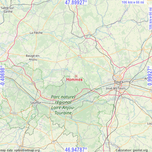
Hommes GPS coordinates[2]
47° 25' 32.592" North, 0° 17' 46.104" East
| Map corner | latitude | longitude |
|---|---|---|
| Upper-left | 47.89927°, | -0.40698° |
| Center: | 47.42572°, | 0.29614° |
| Lower-right: | 46.94787°, | 0.99927° |
| Map W x H: | 105.8×105.8 km | = 65.7×65.7mi |
| max Lat: | 51.07786° ⇑49.8% North |
| Hommes: | 47.42572° |
| min Lat: | ⇓50.2% South 41.3874° |
| min Long | Hommes | max Long |
| -5.08615° | 0.29614° | 9.52242° |
| W 24.6%⇐ | ⇒75.4% E |
Elevation
Elevation of Hommes is 87 m = 285 ft, and this is 106.7 m = 350 ft below average elevation for this country.
| Max E: |
2333 m = 7654 ft | 66% |
| Avg. | 193.7 m = 635 ft | |
| Hommes | 87 m = 285 ft | |
Min E: |
-1 m = -3 ft | 34% |
See also: France elevation on elevation.city.
Geographical zone
Hommes is located in North temperate zone (between Tropic of Cancer and the Arctic Circle). Distance of this North polar circle is 2127.9 km =1322.2 mi to North.| Distance of | km | miles | from Hommes |
|---|---|---|---|
| North Pole | 4733.8 | 2941.4 | to North |
| Arctic Circle | 2127.9 | 1322.2 | to North |
| Tropic Cancer | 2667.3 | 1657.4 | to South |
| Equator | 5273.2 | 3276.6 | to South |


Nearby cities:
15 places around Hommes: (largest is in red/bold)
• Ambillou
11.7 km =7.3 mi,  76°
76°
• Bréhémont
15.3 km =9.5 mi,  161°
161°
• Channay-sur-Lathan
6.4 km =4 mi,  337°
337°
• Château-la-Vallière
13.6 km =8.5 mi,  9°
9°
• Cinq-Mars-la-Pile
15.1 km =9.4 mi,  125°
125°
• Cléré-les-Pins
7 km =4.3 mi,  90°
90°
• La Chapelle-aux-Naux
15.5 km =9.6 mi,  140°
140°
• Langeais
13.6 km =8.5 mi, 144°
• Mazières-de-Touraine
10.8 km =6.7 mi,  115°
115°
• Parçay-les-Pins
10.1 km =6.3 mi,  276°
276°
• Pernay
15.5 km =9.6 mi, 82°
• Saint-Michel-sur-Loire
13.7 km =8.5 mi, 163°
• Saint-Patrice
15.7 km =9.8 mi,  180°
180°
• Savigné-sur-Lathan
2.8 km =1.7 mi,  41°
41°
• Souvigné
13.1 km =8.1 mi, 35°
Sources, notices
• [Note1] Compared only with cities in France existing in our database
• [Src1] Map data: © OpenStreetMap contributors (CC-BY-SA)
• [Src2] Other city data from geonames.org with taken over terms of usage.
• [Src3] Geographical zone / Annual Mean Temperature by Robert A. Rohde @ Wikipedia
