Retonfey geodata
Retonfey (Grand Est) is a populated place; located in France in Europe/Paris (GMT+2) time zone. With population of 1,404 people, there are 6592 cities with bigger population in this country. Compared to other cities in France, 83% of cities are located further ↓South; 90.2% of cities are located further ←West and 76.4% of cities have lower elevation than Retonfey. Note1
Administrative division(s):
- Level 1: Grand Est
- Level 2: Moselle
- Level 3: Arrondissement de Metz
- Level 4: Retonfey


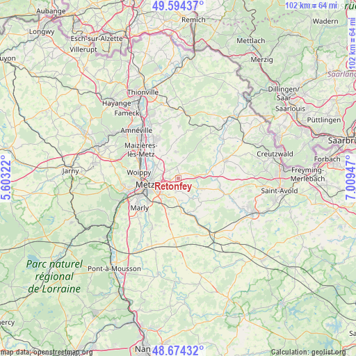
Retonfey GPS coordinates[2]
49° 8' 11.328" North, 6° 18' 22.824" East
| Map corner | latitude | longitude |
|---|---|---|
| Upper-left | 49.59437°, | 5.60322° |
| Center: | 49.13648°, | 6.30634° |
| Lower-right: | 48.67432°, | 7.00947° |
| Map W x H: | 102.3×102.3 km | = 63.6×63.6mi |
| max Lat: | 51.07786° ⇑17% North |
| Retonfey: | 49.13648° |
| min Lat: | ⇓83% South 41.3874° |
| min Long | Retonfey | max Long |
| -5.08615° | 6.30634° | 9.52242° |
| W 90.2%⇐ | ⇒9.8% E |
Elevation
Elevation of Retonfey is 259 m = 850 ft, and this is 65.3 m = 214 ft above average elevation for this country.
| Max E: |
2333 m = 7654 ft | 23.6% |
| Retonfey | 259 m 850 ft | |
| Avg. | 193.7 m = 635 ft | |
Min E: |
-1 m = -3 ft | 76.4% |
See also: France elevation on elevation.city.
Geographical zone
Retonfey is located in North temperate zone (between Tropic of Cancer and the Arctic Circle). Distance of this North polar circle is 1937.7 km =1204 mi to North.| Distance of | km | miles | from Retonfey |
|---|---|---|---|
| North Pole | 4543.6 | 2823.3 | to North |
| Arctic Circle | 1937.7 | 1204 | to North |
| Tropic Cancer | 2857.5 | 1775.6 | to South |
| Equator | 5463.5 | 3394.9 | to South |


Nearby cities:
15 places around Retonfey: (largest is in red/bold)
• Ars-Laquenexy
5.4 km =3.4 mi,  209°
209°
• Charly-Oradour
6.5 km =4 mi,  310°
310°
• Courcelles-Chaussy
7.6 km =4.7 mi,  113°
113°
• Courcelles-sur-Nied
7.8 km =4.8 mi,  178°
178°
• Failly
4 km =2.5 mi, 305°
• Jury
8.4 km =5.2 mi, 207°
• Laquenexy
6.5 km =4 mi,  174°
174°
• Noisseville
2.3 km =1.4 mi,  263°
263°
• Pange
6.6 km =4.1 mi,  148°
148°
• Saint-Julien-lès-Metz
7.6 km =4.7 mi,  266°
266°
• Sainte-Barbe
2.5 km =1.6 mi,  350°
350°
• Sanry-lès-Vigy
5.5 km =3.4 mi,  339°
339°
• Silly-sur-Nied
4.2 km =2.6 mi,  115°
115°
• Vantoux
5.5 km =3.4 mi, 261°
• Vigy
7.6 km =4.7 mi,  355°
355°
Sources, notices
• [Note1] Compared only with cities in France existing in our database
• [Src1] Map data: © OpenStreetMap contributors (CC-BY-SA)
• [Src2] Other city data from geonames.org with taken over terms of usage.
• [Src3] Geographical zone / Annual Mean Temperature by Robert A. Rohde @ Wikipedia
