Neuilly-en-Thelle geodata
Neuilly-en-Thelle (Hauts-de-France) is a populated place; located in France in Europe/Paris (GMT+2) time zone. With population of 3,194 people, there are 3052 cities with bigger population in this country. Compared to other cities in France, 84.7% of cities are located further ↓South; 53% of cities are located further →East and 52.3% of cities have higher elevation than Neuilly-en-Thelle. Note1
Administrative division(s):
- Level 1: Hauts-de-France
- Level 2: Département de l'Oise
- Level 3: Arrondissement de Senlis
- Level 4: Neuilly-en-Thelle


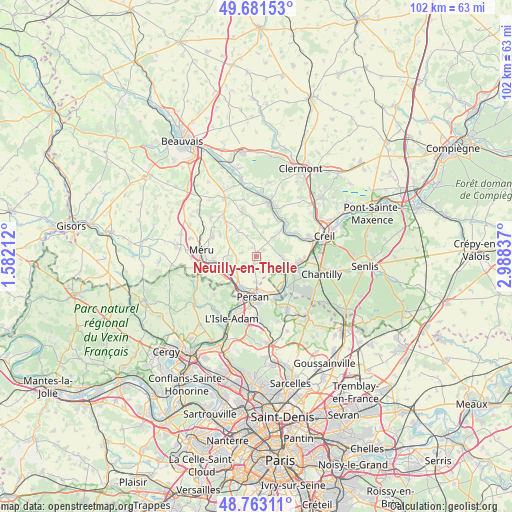
Neuilly-en-Thelle GPS coordinates[2]
49° 13' 28.02" North, 2° 17' 6.9" East
| Map corner | latitude | longitude |
|---|---|---|
| Upper-left | 49.68153°, | 1.58212° |
| Center: | 49.22445°, | 2.28525° |
| Lower-right: | 48.76311°, | 2.98837° |
| Map W x H: | 102.1×102.1 km | = 63.4×63.4mi |
| max Lat: | 51.07786° ⇑15.3% North |
| Neuilly-en-Thelle: | 49.22445° |
| min Lat: | ⇓84.7% South 41.3874° |
| min Long | Neuilly-en-Thel | max Long |
| -5.08615° | 2.28525° | 9.52242° |
| W 47%⇐ | ⇒53% E |
Elevation
Elevation of Neuilly-en-Thelle is 124 m = 407 ft, and this is 69.7 m = 229 ft below average elevation for this country.
| Max E: |
2333 m = 7654 ft | 52.3% |
| Avg. | 193.7 m = 635 ft | |
| Neuilly-en-Thelle | 124 m = 407 ft | |
Min E: |
-1 m = -3 ft | 47.7% |
See also: France elevation on elevation.city.
Geographical zone
Neuilly-en-Thelle is located in North temperate zone (between Tropic of Cancer and the Arctic Circle). Distance of this North polar circle is 1927.9 km =1197.9 mi to North.| Distance of | km | miles | from Neuilly-en-Thelle |
|---|---|---|---|
| North Pole | 4533.8 | 2817.2 | to North |
| Arctic Circle | 1927.9 | 1197.9 | to North |
| Tropic Cancer | 2867.3 | 1781.7 | to South |
| Equator | 5473.2 | 3400.9 | to South |


Nearby cities:
15 places around Neuilly-en-Thelle: (largest is in red/bold)
• Belle-Église
6 km =3.7 mi,  233°
233°
• Bernes-sur-Oise
7.1 km =4.4 mi,  171°
171°
• Blaincourt-lès-Précy
4.8 km =3 mi,  78°
78°
• Bornel
6.3 km =3.9 mi,  242°
242°
• Chambly
6.9 km =4.3 mi,  201°
201°
• Cires-lès-Mello
7.5 km =4.7 mi,  44°
44°
• Crouy-en-Thelle
2.8 km =1.7 mi,  112°
112°
• Ercuis
1.8 km =1.1 mi,  50°
50°
• Fosseuse
7.2 km =4.5 mi,  259°
259°
• Fresnoy-en-Thelle
2.9 km =1.8 mi, 203°
• Lachapelle-Saint-Pierre
6.2 km =3.9 mi,  324°
324°
• Le Mesnil-en-Thelle
5.1 km =3.2 mi,  179°
179°
• Précy-sur-Oise
6.6 km =4.1 mi, 106°
• Puiseux-le-Hauberger
3.6 km =2.2 mi, 256°
• Ully-Saint-Georges
6.1 km =3.8 mi,  357°
357°
Sources, notices
• [Note1] Compared only with cities in France existing in our database
• [Src1] Map data: © OpenStreetMap contributors (CC-BY-SA)
• [Src2] Other city data from geonames.org with taken over terms of usage.
• [Src3] Geographical zone / Annual Mean Temperature by Robert A. Rohde @ Wikipedia
