Mur-de-Sologne geodata
Mur-de-Sologne (Centre) is a populated place; located in France in Europe/Paris (GMT+2) time zone. With population of 1,241 people, there are 7323 cities with bigger population in this country. Compared to other cities in France, 50.1% of cities are located further ↓South; 61.6% of cities are located further →East and 54.8% of cities have higher elevation than Mur-de-Sologne. Note1
Administrative division(s):
- Level 1: Centre
- Level 2: Département du Loir-et-Cher
- Level 3: Arrondissement de Romorantin-Lanthenay
- Level 4: Mur-de-Sologne


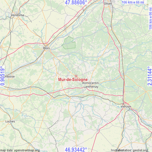
Mur-de-Sologne GPS coordinates[2]
47° 24' 44.604" North, 1° 36' 29.952" East
| Map corner | latitude | longitude |
|---|---|---|
| Upper-left | 47.88606°, | 0.90519° |
| Center: | 47.41239°, | 1.60832° |
| Lower-right: | 46.93442°, | 2.31144° |
| Map W x H: | 105.8×105.8 km | = 65.7×65.7mi |
| max Lat: | 51.07786° ⇑49.9% North |
| Mur-de-Sologne: | 47.41239° |
| min Lat: | ⇓50.1% South 41.3874° |
| min Long | Mur-de-Sologne | max Long |
| -5.08615° | 1.60832° | 9.52242° |
| W 38.4%⇐ | ⇒61.6% E |
Elevation
Elevation of Mur-de-Sologne is 117 m = 384 ft, and this is 76.7 m = 252 ft below average elevation for this country.
| Max E: |
2333 m = 7654 ft | 54.8% |
| Avg. | 193.7 m = 635 ft | |
| Mur-de-Sologne | 117 m = 384 ft | |
Min E: |
-1 m = -3 ft | 45.2% |
See also: France elevation on elevation.city.
Geographical zone
Mur-de-Sologne is located in North temperate zone (between Tropic of Cancer and the Arctic Circle). Distance of this North polar circle is 2129.4 km =1323.1 mi to North.| Distance of | km | miles | from Mur-de-Sologne |
|---|---|---|---|
| North Pole | 4735.3 | 2942.4 | to North |
| Arctic Circle | 2129.4 | 1323.1 | to North |
| Tropic Cancer | 2665.8 | 1656.5 | to South |
| Equator | 5271.8 | 3275.7 | to South |


Nearby cities:
15 places around Mur-de-Sologne: (largest is in red/bold)
• Billy
12.3 km =7.6 mi,  205°
205°
• Cheverny
14.9 km =9.3 mi,  311°
311°
• Chémery
12.2 km =7.6 mi,  233°
233°
• Contres
13.5 km =8.4 mi,  272°
272°
• Fontaines-en-Sologne
11.6 km =7.2 mi,  337°
337°
• Fresnes
15 km =9.3 mi,  279°
279°
• Gy-en-Sologne
7.8 km =4.8 mi,  194°
194°
• Millançay
12.9 km =8 mi,  72°
72°
• Pruniers-en-Sologne
11.5 km =7.1 mi,  157°
157°
• Romorantin-Lanthenay
11.8 km =7.3 mi,  115°
115°
• Sassay
12.7 km =7.9 mi,  260°
260°
• Selles-sur-Cher
15.4 km =9.6 mi,  195°
195°
• Soings-en-Sologne
6.3 km =3.9 mi, 270°
• Vernou-en-Sologne
11.2 km =7 mi,  28°
28°
• Villeherviers
15.3 km =9.5 mi,  109°
109°
Sources, notices
• [Note1] Compared only with cities in France existing in our database
• [Src1] Map data: © OpenStreetMap contributors (CC-BY-SA)
• [Src2] Other city data from geonames.org with taken over terms of usage.
• [Src3] Geographical zone / Annual Mean Temperature by Robert A. Rohde @ Wikipedia
