Fontaine-Guérin geodata
Fontaine-Guérin (Pays de la Loire) is a populated place; located in France in Europe/Paris (GMT+2) time zone. With population of 758 people, there are 11078 cities with bigger population in this country. Compared to other cities in France, 51% of cities are located further ↓South; 79.5% of cities are located further →East and 83.1% of cities have higher elevation than Fontaine-Guérin. Note1
Administrative division(s):
- Level 1: Pays de la Loire
- Level 2: Département de Maine-et-Loire
- Level 3: Arrondissement de Saumur
- Level 4: Les Bois d'Anjou


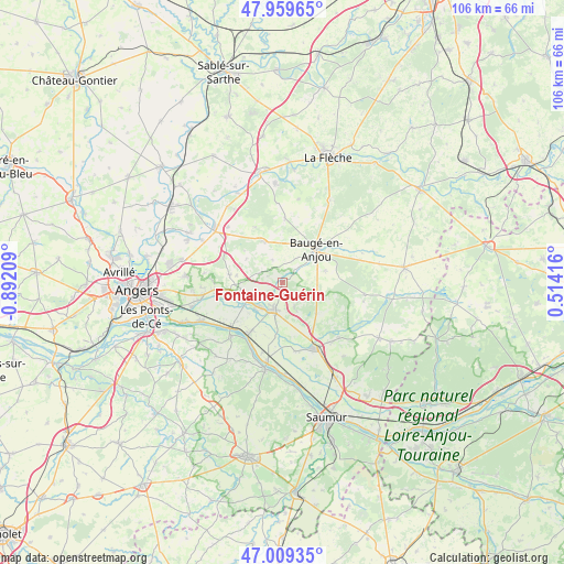
Fontaine-Guérin GPS coordinates[2]
47° 29' 11.94" North, 0° 11' 20.256" West
| Map corner | latitude | longitude |
|---|---|---|
| Upper-left | 47.95965°, | -0.89209° |
| Center: | 47.48665°, | -0.18896° |
| Lower-right: | 47.00935°, | 0.51416° |
| Map W x H: | 105.7×105.7 km | = 65.7×65.7mi |
| max Lat: | 51.07786° ⇑49% North |
| Fontaine-Guérin: | 47.48665° |
| min Lat: | ⇓51% South 41.3874° |
| min Long | Fontaine-Guéri | max Long |
| -5.08615° | -0.18896° | 9.52242° |
| W 20.5%⇐ | ⇒79.5% E |
Elevation
Elevation of Fontaine-Guérin is 47 m = 154 ft, and this is 146.7 m = 481 ft below average elevation for this country.
| Max E: |
2333 m = 7654 ft | 83.1% |
| Avg. | 193.7 m = 635 ft | |
| Fontaine-Guérin | 47 m = 154 ft | |
Min E: |
-1 m = -3 ft | 16.9% |
See also: France elevation on elevation.city.
Geographical zone
Fontaine-Guérin is located in North temperate zone (between Tropic of Cancer and the Arctic Circle). Distance of this North polar circle is 2121.2 km =1318.1 mi to North.| Distance of | km | miles | from Fontaine-Guérin |
|---|---|---|---|
| North Pole | 4727 | 2937.2 | to North |
| Arctic Circle | 2121.2 | 1318.1 | to North |
| Tropic Cancer | 2674.1 | 1661.6 | to South |
| Equator | 5280 | 3280.8 | to South |


Nearby cities:
15 places around Fontaine-Guérin: (largest is in red/bold)
• Baugé-en-Anjou
8.9 km =5.5 mi,  43°
43°
• Bauné
9.9 km =6.2 mi,  278°
278°
• Beaufort-en-Vallée
5.7 km =3.5 mi,  203°
203°
• Bocé
8.3 km =5.2 mi,  74°
74°
• Brion
5.6 km =3.5 mi,  153°
153°
• Cheviré-le-Rouge
12 km =7.5 mi,  2°
2°
• Corné
12.2 km =7.6 mi,  261°
261°
• Jarzé
8.3 km =5.2 mi,  337°
337°
• Jumelles
8.6 km =5.3 mi,  131°
131°
• La Ménitré
11.3 km =7 mi,  211°
211°
• Le Vieil-Baugé
7.3 km =4.5 mi,  46°
46°
• Mazé
7 km =4.3 mi,  241°
241°
• Saint-Mathurin-sur-Loire
12.4 km =7.7 mi,  230°
230°
• Saint-Rémy-la-Varenne
13.7 km =8.5 mi,  223°
223°
• Sarrigné
14.7 km =9.1 mi, 276°
Sources, notices
• [Note1] Compared only with cities in France existing in our database
• [Src1] Map data: © OpenStreetMap contributors (CC-BY-SA)
• [Src2] Other city data from geonames.org with taken over terms of usage.
• [Src3] Geographical zone / Annual Mean Temperature by Robert A. Rohde @ Wikipedia
