Beaufort-en-Vallée geodata
Beaufort-en-Vallée (Pays de la Loire) is a populated place; located in France in Europe/Paris (GMT+2) time zone. With population of 5,677 people, there are 1744 cities with bigger population in this country. Compared to other cities in France, 50.4% of cities are located further ↓South; 79.9% of cities are located further →East and 88.3% of cities have higher elevation than Beaufort-en-Vallée. Note1
Administrative division(s):
- Level 1: Pays de la Loire
- Level 2: Département de Maine-et-Loire
- Level 3: Arrondissement de Saumur
- Level 4: Beaufort-en-Anjou


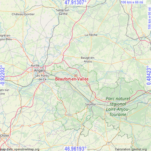
Beaufort-en-Vallée GPS coordinates[2]
47° 26' 22.74" North, 0° 13' 8.04" West
| Map corner | latitude | longitude |
|---|---|---|
| Upper-left | 47.91307°, | -0.92202° |
| Center: | 47.43965°, | -0.2189° |
| Lower-right: | 46.96193°, | 0.48423° |
| Map W x H: | 105.8×105.8 km | = 65.7×65.7mi |
| max Lat: | 51.07786° ⇑49.6% North |
| Beaufort-en-Vallée: | 47.43965° |
| min Lat: | ⇓50.4% South 41.3874° |
| min Long | Beaufort-en-Val | max Long |
| -5.08615° | -0.2189° | 9.52242° |
| W 20.1%⇐ | ⇒79.9% E |
Elevation
Elevation of Beaufort-en-Vallée is 34 m = 112 ft, and this is 159.7 m = 524 ft below average elevation for this country.
| Max E: |
2333 m = 7654 ft | 88.3% |
| Avg. | 193.7 m = 635 ft | |
| Beaufort-en-Vallée | 34 m = 112 ft | |
Min E: |
-1 m = -3 ft | 11.7% |
See also: France elevation on elevation.city.
Geographical zone
Beaufort-en-Vallée is located in North temperate zone (between Tropic of Cancer and the Arctic Circle). Distance of this North polar circle is 2126.4 km =1321.3 mi to North.| Distance of | km | miles | from Beaufort-en-Vallée |
|---|---|---|---|
| North Pole | 4732.3 | 2940.5 | to North |
| Arctic Circle | 2126.4 | 1321.3 | to North |
| Tropic Cancer | 2668.9 | 1658.4 | to South |
| Equator | 5274.8 | 3277.6 | to South |


Nearby cities:
15 places around Beaufort-en-Vallée: (largest is in red/bold)
• Bauné
10.1 km =6.3 mi,  311°
311°
• Bocé
12.7 km =7.9 mi,  54°
54°
• Brion
4.7 km =2.9 mi,  87°
87°
• Corné
10.4 km =6.5 mi,  289°
289°
• Fontaine-Guérin
5.7 km =3.5 mi,  23°
23°
• Gennes
11.1 km =6.9 mi,  184°
184°
• Jumelles
8.7 km =5.4 mi, 93°
• La Ménitré
5.7 km =3.5 mi,  219°
219°
• Le Vieil-Baugé
12.7 km =7.9 mi,  36°
36°
• Les Rosiers-sur-Loire
10 km =6.2 mi, 179°
• Mazé
4.3 km =2.7 mi,  295°
295°
• Saint-Clément-des-Levées
12.1 km =7.5 mi,  166°
166°
• Saint-Georges-des-Sept-Voies
11.1 km =6.9 mi,  205°
205°
• Saint-Mathurin-sur-Loire
7.8 km =4.8 mi,  250°
250°
• Saint-Rémy-la-Varenne
8.6 km =5.3 mi,  236°
236°
Sources, notices
• [Note1] Compared only with cities in France existing in our database
• [Src1] Map data: © OpenStreetMap contributors (CC-BY-SA)
• [Src2] Other city data from geonames.org with taken over terms of usage.
• [Src3] Geographical zone / Annual Mean Temperature by Robert A. Rohde @ Wikipedia
