Molliens-Dreuil geodata
Molliens-Dreuil (Hauts-de-France) is a populated place; located in France in Europe/Paris (GMT+2) time zone. With population of 869 people, there are 9902 cities with bigger population in this country. Compared to other cities in France, 92.9% of cities are located further ↓South; 57% of cities are located further →East and 81.5% of cities have higher elevation than Molliens-Dreuil. Note1
Administrative division(s):
- Level 1: Hauts-de-France
- Level 2: Somme
- Level 3: Amiens
- Level 4: Molliens-Dreuil


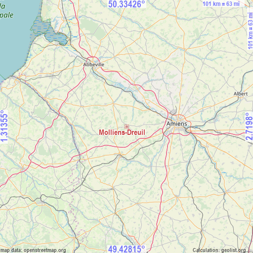
Molliens-Dreuil GPS coordinates[2]
49° 52' 59.988" North, 2° 1' 0.012" East
| Map corner | latitude | longitude |
|---|---|---|
| Upper-left | 50.33426°, | 1.31355° |
| Center: | 49.88333°, | 2.01667° |
| Lower-right: | 49.42815°, | 2.7198° |
| Map W x H: | 100.7×100.7 km | = 62.6×62.6mi |
| max Lat: | 51.07786° ⇑7.1% North |
| Molliens-Dreuil: | 49.88333° |
| min Lat: | ⇓92.9% South 41.3874° |
| min Long | Molliens-Dreuil | max Long |
| -5.08615° | 2.01667° | 9.52242° |
| W 43%⇐ | ⇒57% E |
Elevation
Elevation of Molliens-Dreuil is 51 m = 167 ft, and this is 142.7 m = 468 ft below average elevation for this country.
| Max E: |
2333 m = 7654 ft | 81.5% |
| Avg. | 193.7 m = 635 ft | |
| Molliens-Dreuil | 51 m = 167 ft | |
Min E: |
-1 m = -3 ft | 18.5% |
See also: France elevation on elevation.city.
Geographical zone
Molliens-Dreuil is located in North temperate zone (between Tropic of Cancer and the Arctic Circle). Distance of this North polar circle is 1854.7 km =1152.5 mi to North.| Distance of | km | miles | from Molliens-Dreuil |
|---|---|---|---|
| North Pole | 4460.6 | 2771.7 | to North |
| Arctic Circle | 1854.7 | 1152.5 | to North |
| Tropic Cancer | 2940.6 | 1827.2 | to South |
| Equator | 5546.5 | 3446.4 | to South |


Nearby cities:
15 places around Molliens-Dreuil: (largest is in red/bold)
• Ailly-sur-Somme
13.8 km =8.6 mi,  68°
68°
• Airaines
10.8 km =6.7 mi,  330°
330°
• Allery
12.3 km =7.6 mi,  316°
316°
• Condé-Folie
14 km =8.7 mi,  358°
358°
• Hangest-sur-Somme
11.4 km =7.1 mi,  17°
17°
• Hornoy-le-Bourg
9.1 km =5.7 mi,  246°
246°
• La Chaussée-Tirancourt
12.3 km =7.6 mi,  50°
50°
• Longpré-les-Corps-Saints
14.5 km =9 mi,  353°
353°
• Picquigny
11.3 km =7 mi, 53°
• Poix-de-Picardie
11.4 km =7.1 mi,  192°
192°
• Prouzel
15.1 km =9.4 mi,  118°
118°
• Quevauvillers
8.2 km =5.1 mi,  143°
143°
• Revelles
8.4 km =5.2 mi, 116°
• Saint-Sauveur
15.2 km =9.4 mi, 66°
• Saveuse
14.6 km =9.1 mi,  82°
82°
Sources, notices
• [Note1] Compared only with cities in France existing in our database
• [Src1] Map data: © OpenStreetMap contributors (CC-BY-SA)
• [Src2] Other city data from geonames.org with taken over terms of usage.
• [Src3] Geographical zone / Annual Mean Temperature by Robert A. Rohde @ Wikipedia
