Insming geodata
Insming (Grand Est) is a populated place; located in France in Europe/Paris (GMT+2) time zone. With population of 642 people, there are 12644 cities with bigger population in this country. Compared to other cities in France, 78.7% of cities are located further ↓South; 94.1% of cities are located further ←West and 74.3% of cities have lower elevation than Insming. Note1
Administrative division(s):
- Level 1: Grand Est
- Level 2: Moselle
- Level 3: Arrondissement de Sarrebourg-Château-Salins
- Level 4: Insming


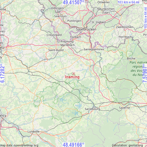
Insming GPS coordinates[2]
48° 57' 19.8" North, 6° 52' 33.384" East
| Map corner | latitude | longitude |
|---|---|---|
| Upper-left | 49.41507°, | 6.17282° |
| Center: | 48.9555°, | 6.87594° |
| Lower-right: | 48.49166°, | 7.57907° |
| Map W x H: | 102.7×102.7 km | = 63.8×63.8mi |
| max Lat: | 51.07786° ⇑21.3% North |
| Insming: | 48.9555° |
| min Lat: | ⇓78.7% South 41.3874° |
| min Long | Insming | max Long |
| -5.08615° | 6.87594° | 9.52242° |
| W 94.1%⇐ | ⇒5.9% E |
Elevation
Elevation of Insming is 244 m = 801 ft, and this is 50.3 m = 165 ft above average elevation for this country.
| Max E: |
2333 m = 7654 ft | 25.7% |
| Insming | 244 m 801 ft | |
| Avg. | 193.7 m = 635 ft | |
Min E: |
-1 m = -3 ft | 74.3% |
See also: France elevation on elevation.city.
Geographical zone
Insming is located in North temperate zone (between Tropic of Cancer and the Arctic Circle). Distance of this North polar circle is 1957.8 km =1216.5 mi to North.| Distance of | km | miles | from Insming |
|---|---|---|---|
| North Pole | 4563.7 | 2835.8 | to North |
| Arctic Circle | 1957.8 | 1216.5 | to North |
| Tropic Cancer | 2837.4 | 1763.1 | to South |
| Equator | 5443.3 | 3382.3 | to South |


Nearby cities:
15 places around Insming: (largest is in red/bold)
• Albestroff
2.9 km =1.8 mi,  210°
210°
• Bénestroff
10.3 km =6.4 mi,  236°
236°
• Francaltroff
5.7 km =3.5 mi,  277°
277°
• Grostenquin
10.3 km =6.4 mi,  285°
285°
• Grundviller
12.1 km =7.5 mi,  35°
35°
• Harskirchen
12 km =7.5 mi,  101°
101°
• Hellimer
5.7 km =3.5 mi,  323°
323°
• Hilsprich
7.1 km =4.4 mi,  23°
23°
• Holving
9 km =5.6 mi,  46°
46°
• Laning
11.6 km =7.2 mi, 320°
• Le Val-de-Guéblange
7 km =4.3 mi,  66°
66°
• Mittersheim
11.6 km =7.2 mi,  155°
155°
• Rémering-lès-Puttelange
10.1 km =6.3 mi,  26°
26°
• Saint-Jean-Rohrbach
7.9 km =4.9 mi,  4°
4°
• Sarralbe
12.3 km =7.6 mi, 67°
Sources, notices
• [Note1] Compared only with cities in France existing in our database
• [Src1] Map data: © OpenStreetMap contributors (CC-BY-SA)
• [Src2] Other city data from geonames.org with taken over terms of usage.
• [Src3] Geographical zone / Annual Mean Temperature by Robert A. Rohde @ Wikipedia
