Fougerolles geodata
Fougerolles (Bourgogne-Franche-Comté) is a populated place; located in France in Europe/Paris (GMT+2) time zone. With population of 4,242 people, there are 2320 cities with bigger population in this country. Compared to other cities in France, 57.3% of cities are located further ↓South; 91.1% of cities are located further ←West and 81.6% of cities have lower elevation than Fougerolles. Note1
Administrative division(s):
- Level 1: Bourgogne-Franche-Comté
- Level 2: Département de la Haute-Saône
- Level 3: Arrondissement de Lure
- Level 4: Fougerolles-Saint-Valbert


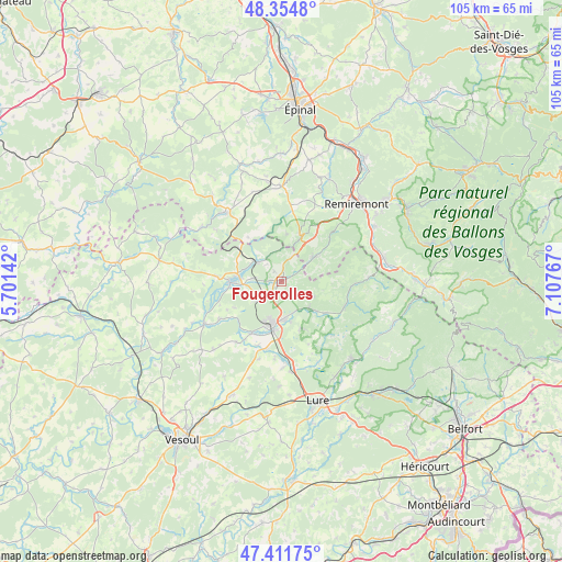
Fougerolles GPS coordinates[2]
47° 53' 7.512" North, 6° 24' 16.344" East
| Map corner | latitude | longitude |
|---|---|---|
| Upper-left | 48.3548°, | 5.70142° |
| Center: | 47.88542°, | 6.40454° |
| Lower-right: | 47.41175°, | 7.10767° |
| Map W x H: | 104.9×104.9 km | = 65.2×65.2mi |
| max Lat: | 51.07786° ⇑42.7% North |
| Fougerolles: | 47.88542° |
| min Lat: | ⇓57.3% South 41.3874° |
| min Long | Fougerolles | max Long |
| -5.08615° | 6.40454° | 9.52242° |
| W 91.1%⇐ | ⇒8.9% E |
Elevation
Elevation of Fougerolles is 306 m = 1004 ft, and this is 112.3 m = 368 ft above average elevation for this country.
| Max E: |
2333 m = 7654 ft | 18.4% |
| Fougerolles | 306 m 1004 ft | |
| Avg. | 193.7 m = 635 ft | |
Min E: |
-1 m = -3 ft | 81.6% |
See also: France elevation on elevation.city.
Geographical zone
Fougerolles is located in North temperate zone (between Tropic of Cancer and the Arctic Circle). Distance of this North polar circle is 2076.8 km =1290.5 mi to North.| Distance of | km | miles | from Fougerolles |
|---|---|---|---|
| North Pole | 4682.7 | 2909.7 | to North |
| Arctic Circle | 2076.8 | 1290.5 | to North |
| Tropic Cancer | 2718.4 | 1689.1 | to South |
| Equator | 5324.4 | 3308.4 | to South |


Nearby cities:
15 places around Fougerolles: (largest is in red/bold)
• Aillevillers-et-Lyaumont
6.3 km =3.9 mi,  307°
307°
• Baudoncourt
12.7 km =7.9 mi,  200°
200°
• Bellefontaine
14.5 km =9 mi,  11°
11°
• Breuches
11.1 km =6.9 mi,  210°
210°
• Citers
16 km =9.9 mi,  178°
178°
• Corbenay
5.6 km =3.5 mi,  278°
278°
• Faucogney-et-la-Mer
12.8 km =8 mi,  112°
112°
• Fontaine-lès-Luxeuil
6.1 km =3.8 mi,  237°
237°
• Froideconche
7.2 km =4.5 mi,  173°
173°
• Le Clerjus
10.4 km =6.5 mi,  324°
324°
• Luxeuil-les-Bains
8.1 km =5 mi, 201°
• Plombières-les-Bains
9.5 km =5.9 mi,  24°
24°
• Raddon-et-Chapendu
6.9 km =4.3 mi,  131°
131°
• Saint-Loup-sur-Semouse
9.6 km =6 mi,  268°
268°
• Saint-Sauveur
9 km =5.6 mi,  188°
188°
Sources, notices
• [Note1] Compared only with cities in France existing in our database
• [Src1] Map data: © OpenStreetMap contributors (CC-BY-SA)
• [Src2] Other city data from geonames.org with taken over terms of usage.
• [Src3] Geographical zone / Annual Mean Temperature by Robert A. Rohde @ Wikipedia
