Beauval geodata
Beauval (Hauts-de-France) is a populated place; located in France in Europe/Paris (GMT+2) time zone. With population of 2,277 people, there are 4230 cities with bigger population in this country. Compared to other cities in France, 94.3% of cities are located further ↓South; 52.1% of cities are located further →East and 58.7% of cities have higher elevation than Beauval. Note1
Administrative division(s):
- Level 1: Hauts-de-France
- Level 2: Somme
- Level 3: Amiens
- Level 4: Beauval


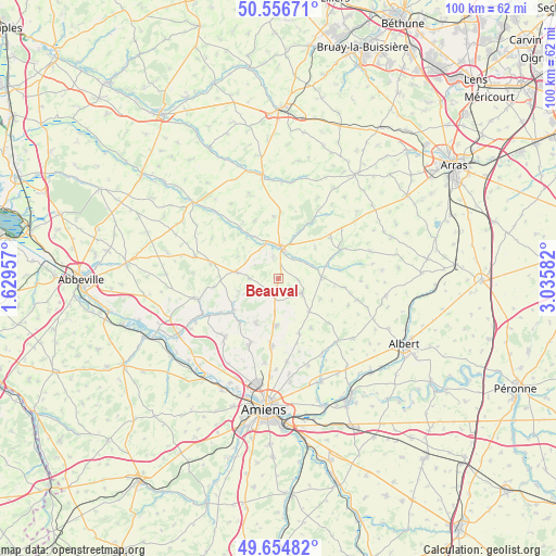
Beauval GPS coordinates[2]
50° 6' 28.404" North, 2° 19' 57.684" East
| Map corner | latitude | longitude |
|---|---|---|
| Upper-left | 50.55671°, | 1.62957° |
| Center: | 50.10789°, | 2.33269° |
| Lower-right: | 49.65482°, | 3.03582° |
| Map W x H: | 100.3×100.3 km | = 62.3×62.3mi |
| max Lat: | 51.07786° ⇑5.7% North |
| Beauval: | 50.10789° |
| min Lat: | ⇓94.3% South 41.3874° |
| min Long | Beauval | max Long |
| -5.08615° | 2.33269° | 9.52242° |
| W 47.9%⇐ | ⇒52.1% E |
Elevation
Elevation of Beauval is 106 m = 348 ft, and this is 87.7 m = 288 ft below average elevation for this country.
| Max E: |
2333 m = 7654 ft | 58.7% |
| Avg. | 193.7 m = 635 ft | |
| Beauval | 106 m = 348 ft | |
Min E: |
-1 m = -3 ft | 41.3% |
See also: France elevation on elevation.city.
Geographical zone
Beauval is located in North temperate zone (between Tropic of Cancer and the Arctic Circle). Distance of this North polar circle is 1829.7 km =1136.9 mi to North.| Distance of | km | miles | from Beauval |
|---|---|---|---|
| North Pole | 4435.6 | 2756.2 | to North |
| Arctic Circle | 1829.7 | 1136.9 | to North |
| Tropic Cancer | 2965.6 | 1842.7 | to South |
| Equator | 5571.5 | 3462 | to South |


Nearby cities:
15 places around Beauval: (largest is in red/bold)
• Beauquesne
5 km =3.1 mi,  120°
120°
• Bernaville
12.4 km =7.7 mi,  282°
282°
• Canaples
10 km =6.2 mi,  234°
234°
• Candas
5.2 km =3.2 mi,  269°
269°
• Doullens
5.5 km =3.4 mi,  5°
5°
• Fienvillers
7.5 km =4.7 mi, 278°
• Hérissart
10.8 km =6.7 mi,  146°
146°
• Lucheux
11.4 km =7.1 mi,  30°
30°
• Mondicourt
11.6 km =7.2 mi,  52°
52°
• Naours
8.8 km =5.5 mi,  206°
206°
• Pas-en-Artois
12.3 km =7.6 mi,  65°
65°
• Pernois
12.1 km =7.5 mi,  239°
239°
• Rubempré
10.6 km =6.6 mi,  159°
159°
• Talmas
8.6 km =5.3 mi,  183°
183°
• Villers-Bocage
12.3 km =7.6 mi,  185°
185°
Sources, notices
• [Note1] Compared only with cities in France existing in our database
• [Src1] Map data: © OpenStreetMap contributors (CC-BY-SA)
• [Src2] Other city data from geonames.org with taken over terms of usage.
• [Src3] Geographical zone / Annual Mean Temperature by Robert A. Rohde @ Wikipedia
