Le Cannet-des-Maures geodata
Le Cannet-des-Maures (Provence-Alpes-Côte d'Azur) is a populated place; located in France in Europe/Paris (GMT+2) time zone. With population of 3,980 people, there are 2474 cities with bigger population in this country. Compared to other cities in France, 94.3% of cities are located further ↑North; 90.6% of cities are located further ←West and 50.5% of cities have higher elevation than Le Cannet-des-Maures. Note1
Administrative division(s):
- Level 1: Provence-Alpes-Côte d'Azur
- Level 2: Var
- Level 3: Arrondissement de Brignoles
- Level 4: Le Cannet-des-Maures
Current local time in Le Cannet-des-Maures:
05:55 AM, WednesdayDifference from your time zone: hours


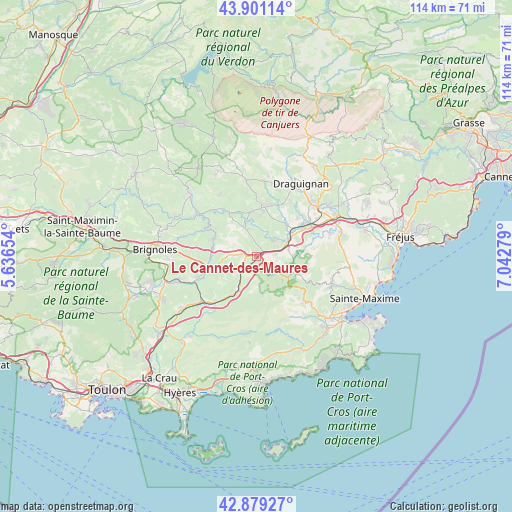
Le Cannet-des-Maures GPS coordinates[2]
43° 23' 32.496" North, 6° 20' 22.776" East
| Map corner | latitude | longitude |
|---|---|---|
| Upper-left | 43.90114°, | 5.63654° |
| Center: | 43.39236°, | 6.33966° |
| Lower-right: | 42.87927°, | 7.04279° |
| Map W x H: | 113.6×113.6 km | = 70.6×70.6mi |
| max Lat: | 51.07786° ⇑94.3% North |
| Le Cannet-des-Maures: | 43.39236° |
| min Lat: | ⇓5.7% South 41.3874° |
| min Long | Le Cannet-des-M | max Long |
| -5.08615° | 6.33966° | 9.52242° |
| W 90.6%⇐ | ⇒9.4% E |
Elevation
Elevation of Le Cannet-des-Maures is 130 m = 427 ft, and this is 63.7 m = 209 ft below average elevation for this country.
| Max E: |
2333 m = 7654 ft | 50.5% |
| Avg. | 193.7 m = 635 ft | |
| Le Cannet-des-Maures | 130 m = 427 ft | |
Min E: |
-1 m = -3 ft | 49.5% |
See also: France elevation on elevation.city.
Geographical zone
Le Cannet-des-Maures is located in North temperate zone (between Tropic of Cancer and the Arctic Circle). Distance of this Northern Tropic circle is 2218.9 km =1378.8 mi to South.| Distance of | km | miles | from Le Cannet-des-Maures |
|---|---|---|---|
| North Pole | 5182.3 | 3220.1 | to North |
| Arctic Circle | 2576.4 | 1600.9 | to North |
| Tropic Cancer | 2218.9 | 1378.8 | to South |
| Equator | 4824.8 | 2998 | to South |


Nearby cities:
15 places around Le Cannet-des-Maures: (largest is in red/bold)
• Besse-sur-Issole
14 km =8.7 mi,  249°
249°
• Cabasse
10.4 km =6.5 mi,  291°
291°
• Carcès
15.7 km =9.8 mi,  306°
306°
• Entrecasteaux
15.8 km =9.8 mi,  330°
330°
• Flassans-sur-Issole
9.9 km =6.2 mi, 254°
• Gonfaron
9 km =5.6 mi,  206°
206°
• La Garde-Freinet
13.4 km =8.3 mi,  128°
128°
• Le Luc
2.2 km =1.4 mi,  276°
276°
• Le Thoronet
7.2 km =4.5 mi,  336°
336°
• Les Arcs
13.7 km =8.5 mi,  54°
54°
• Les Mayons
9 km =5.6 mi,  170°
170°
• Lorgues
11.4 km =7.1 mi,  8°
8°
• Pignans
13.7 km =8.5 mi,  221°
221°
• Taradeau
9.9 km =6.2 mi, 45°
• Vidauban
8.4 km =5.2 mi,  62°
62°
Sources, notices
• [Note1] Compared only with cities in France existing in our database
• [Src1] Map data: © OpenStreetMap contributors (CC-BY-SA)
• [Src2] Other city data from geonames.org with taken over terms of usage.
• [Src3] Geographical zone / Annual Mean Temperature by Robert A. Rohde @ Wikipedia
