Lanslebourg-Mont-Cenis geodata
Lanslebourg-Mont-Cenis (Auvergne-Rhône-Alpes) is a populated place; located in France in Europe/Paris (GMT+2) time zone. With population of 598 people, there are 13354 cities with bigger population in this country. Compared to other cities in France, 76.5% of cities are located further ↑North; 94.1% of cities are located further ←West and 99.8% of cities have lower elevation than Lanslebourg-Mont-Cenis. Note1
Administrative division(s):
- Level 1: Auvergne-Rhône-Alpes
- Level 2: Savoie
- Level 3: Arrondissement de Saint-Jean-de-Maurienne
- Level 4: Val-Cenis
Current local time in Lanslebourg-Mont-Cenis:
05:54 AM, WednesdayDifference from your time zone: hours


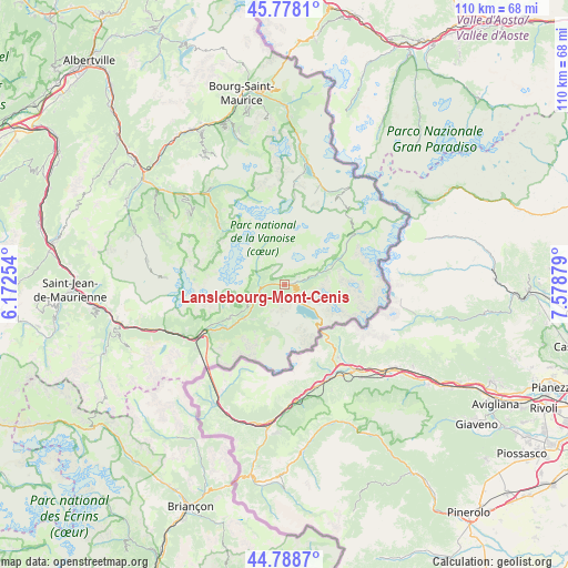
Lanslebourg-Mont-Cenis GPS coordinates[2]
45° 17' 8.016" North, 6° 52' 32.376" East
| Map corner | latitude | longitude |
|---|---|---|
| Upper-left | 45.7781°, | 6.17254° |
| Center: | 45.28556°, | 6.87566° |
| Lower-right: | 44.7887°, | 7.57879° |
| Map W x H: | 110×110 km | = 68.4×68.4mi |
| max Lat: | 51.07786° ⇑76.5% North |
| Lanslebourg-Mont-Cenis: | 45.28556° |
| min Lat: | ⇓23.5% South 41.3874° |
| min Long | Lanslebourg-Mon | max Long |
| -5.08615° | 6.87566° | 9.52242° |
| W 94.1%⇐ | ⇒5.9% E |
Elevation
Elevation of Lanslebourg-Mont-Cenis is 1401 m = 4596 ft, and this is 1207.3 m = 3961 ft above average elevation for this country.
| Max E: |
2333 m = 7654 ft | 0.2% |
| Lanslebourg-Mont-Cenis | 1401 m 4596 ft | |
| Avg. | 193.7 m = 635 ft | |
Min E: |
-1 m = -3 ft | 99.8% |
See also: France elevation on elevation.city.
Geographical zone
Lanslebourg-Mont-Cenis is located in North temperate zone (between Tropic of Cancer and the Arctic Circle). Distance of this North polar circle is 2365.9 km =1470.1 mi to North.| Distance of | km | miles | from Lanslebourg-Mont-Cenis |
|---|---|---|---|
| North Pole | 4971.8 | 3089.3 | to North |
| Arctic Circle | 2365.9 | 1470.1 | to North |
| Tropic Cancer | 2429.4 | 1509.6 | to South |
| Equator | 5035.3 | 3128.8 | to South |


Nearby cities:
15 places around Lanslebourg-Mont-Cenis: (largest is in red/bold)
• Aussois
12.2 km =7.6 mi,  238°
238°
• Belle-Plagne
28.2 km =17.5 mi,  332°
332°
• Bozel
24.9 km =15.5 mi,  314°
314°
• Champagny-en-Vanoise
23.6 km =14.7 mi,  322°
322°
• Courchevel
23.6 km =14.7 mi, 307°
• Fourneaux
20.7 km =12.9 mi, 239°
• Les Allues
29.9 km =18.6 mi,  303°
303°
• Modane
18.8 km =11.7 mi, 239°
• Méribel
28.2 km =17.5 mi, 300°
• Pralognan-la-Vanoise
16.5 km =10.3 mi, 311°
• Saint-Bon-Tarentaise
24.9 km =15.5 mi, 311°
• Tignes
23.7 km =14.7 mi,  9°
9°
• Val Thorens
22.9 km =14.2 mi,  273°
273°
• Val-d’Isère
20 km =12.4 mi,  22°
22°
• Villarodin
15.6 km =9.7 mi, 236°
Sources, notices
• [Note1] Compared only with cities in France existing in our database
• [Src1] Map data: © OpenStreetMap contributors (CC-BY-SA)
• [Src2] Other city data from geonames.org with taken over terms of usage.
• [Src3] Geographical zone / Annual Mean Temperature by Robert A. Rohde @ Wikipedia
