Boran-sur-Oise geodata
Boran-sur-Oise (Hauts-de-France) is a populated place; located in France in Europe/Paris (GMT+2) time zone. With population of 2,203 people, there are 4360 cities with bigger population in this country. Compared to other cities in France, 83.6% of cities are located further ↓South; 51.7% of cities are located further →East and 86.2% of cities have higher elevation than Boran-sur-Oise. Note1
Administrative division(s):
- Level 1: Hauts-de-France
- Level 2: Département de l'Oise
- Level 3: Arrondissement de Senlis
- Level 4: Boran-sur-Oise


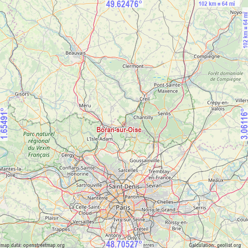
Boran-sur-Oise GPS coordinates[2]
49° 10' 1.74" North, 2° 21' 28.908" East
| Map corner | latitude | longitude |
|---|---|---|
| Upper-left | 49.62476°, | 1.65491° |
| Center: | 49.16715°, | 2.35803° |
| Lower-right: | 48.70527°, | 3.06116° |
| Map W x H: | 102.2×102.2 km | = 63.5×63.5mi |
| max Lat: | 51.07786° ⇑16.4% North |
| Boran-sur-Oise: | 49.16715° |
| min Lat: | ⇓83.6% South 41.3874° |
| min Long | Boran-sur-Oise | max Long |
| -5.08615° | 2.35803° | 9.52242° |
| W 48.3%⇐ | ⇒51.7% E |
Elevation
Elevation of Boran-sur-Oise is 39 m = 128 ft, and this is 154.7 m = 508 ft below average elevation for this country.
| Max E: |
2333 m = 7654 ft | 86.2% |
| Avg. | 193.7 m = 635 ft | |
| Boran-sur-Oise | 39 m = 128 ft | |
Min E: |
-1 m = -3 ft | 13.8% |
See also: France elevation on elevation.city.
Geographical zone
Boran-sur-Oise is located in North temperate zone (between Tropic of Cancer and the Arctic Circle). Distance of this North polar circle is 1934.3 km =1201.9 mi to North.| Distance of | km | miles | from Boran-sur-Oise |
|---|---|---|---|
| North Pole | 4540.2 | 2821.1 | to North |
| Arctic Circle | 1934.3 | 1201.9 | to North |
| Tropic Cancer | 2861 | 1777.7 | to South |
| Equator | 5466.9 | 3397 | to South |


Nearby cities:
15 places around Boran-sur-Oise: (largest is in red/bold)
• Asnières-sur-Oise
3.7 km =2.3 mi,  182°
182°
• Beaumont-sur-Oise
5.9 km =3.7 mi,  241°
241°
• Bernes-sur-Oise
4.3 km =2.7 mi,  261°
261°
• Bruyères-sur-Oise
2.6 km =1.6 mi,  245°
245°
• Crouy-en-Thelle
5.9 km =3.7 mi,  333°
333°
• Gouvieux
4.7 km =2.9 mi,  61°
61°
• Lamorlaye
6.5 km =4 mi,  94°
94°
• Le Mesnil-en-Thelle
5.4 km =3.4 mi,  283°
283°
• Nointel
6.5 km =4 mi,  228°
228°
• Noisy-sur-Oise
3.9 km =2.4 mi,  210°
210°
• Persan
6.4 km =4 mi, 256°
• Précy-sur-Oise
4.6 km =2.9 mi,  13°
13°
• Seugy
5.7 km =3.5 mi,  152°
152°
• Viarmes
4.1 km =2.5 mi,  167°
167°
• Villers-sous-Saint-Leu
5.7 km =3.5 mi,  28°
28°
Sources, notices
• [Note1] Compared only with cities in France existing in our database
• [Src1] Map data: © OpenStreetMap contributors (CC-BY-SA)
• [Src2] Other city data from geonames.org with taken over terms of usage.
• [Src3] Geographical zone / Annual Mean Temperature by Robert A. Rohde @ Wikipedia
