La Ménitré geodata
La Ménitré (Pays de la Loire) is a populated place; located in France in Europe/Paris (GMT+2) time zone. With population of 2,020 people, there are 4746 cities with bigger population in this country. Compared to other cities in France, 50.1% of cities are located further ↑North; 80.5% of cities are located further →East and 93.6% of cities have higher elevation than La Ménitré. Note1
Administrative division(s):
- Level 1: Pays de la Loire
- Level 2: Département de Maine-et-Loire
- Level 3: Arrondissement de Saumur
- Level 4: La Ménitré


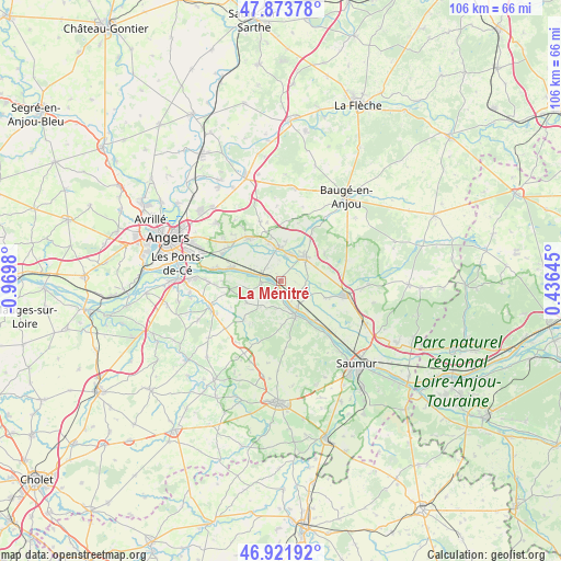
La Ménitré GPS coordinates[2]
47° 24' 0" North, 0° 16' 0.012" West
| Map corner | latitude | longitude |
|---|---|---|
| Upper-left | 47.87378°, | -0.9698° |
| Center: | 47.4°, | -0.26667° |
| Lower-right: | 46.92192°, | 0.43645° |
| Map W x H: | 105.8×105.8 km | = 65.7×65.7mi |
| max Lat: | 51.07786° ⇑50.1% North |
| La Ménitré: | 47.4° |
| min Lat: | ⇓49.9% South 41.3874° |
| min Long | La Ménitré | max Long |
| -5.08615° | -0.26667° | 9.52242° |
| W 19.5%⇐ | ⇒80.5% E |
Elevation
Elevation of La Ménitré is 21 m = 69 ft, and this is 172.7 m = 567 ft below average elevation for this country.
| Max E: |
2333 m = 7654 ft | 93.6% |
| Avg. | 193.7 m = 635 ft | |
| La Ménitré | 21 m = 69 ft | |
Min E: |
-1 m = -3 ft | 6.4% |
See also: France elevation on elevation.city.
Geographical zone
La Ménitré is located in North temperate zone (between Tropic of Cancer and the Arctic Circle). Distance of this North polar circle is 2130.8 km =1324 mi to North.| Distance of | km | miles | from La Ménitré |
|---|---|---|---|
| North Pole | 4736.7 | 2943.2 | to North |
| Arctic Circle | 2130.8 | 1324 | to North |
| Tropic Cancer | 2664.5 | 1655.6 | to South |
| Equator | 5270.4 | 3274.9 | to South |


Nearby cities:
15 places around La Ménitré: (largest is in red/bold)
• Beaufort-en-Vallée
5.7 km =3.5 mi,  39°
39°
• Blaison-Gohier
8.3 km =5.2 mi,  269°
269°
• Brion
9.5 km =5.9 mi,  61°
61°
• Chemellier
9.5 km =5.9 mi,  226°
226°
• Corné
10.1 km =6.3 mi,  321°
321°
• Coutures
7.9 km =4.9 mi,  238°
238°
• Fontaine-Guérin
11.3 km =7 mi,  31°
31°
• Gennes
7.2 km =4.5 mi,  158°
158°
• La Bohalle
10.1 km =6.3 mi,  283°
283°
• Les Rosiers-sur-Loire
6.7 km =4.2 mi,  145°
145°
• Mazé
6.3 km =3.9 mi,  356°
356°
• Saint-Clément-des-Levées
9.8 km =6.1 mi,  139°
139°
• Saint-Georges-des-Sept-Voies
5.7 km =3.5 mi,  192°
192°
• Saint-Mathurin-sur-Loire
4.2 km =2.6 mi,  296°
296°
• Saint-Rémy-la-Varenne
3.6 km =2.2 mi, 265°
Sources, notices
• [Note1] Compared only with cities in France existing in our database
• [Src1] Map data: © OpenStreetMap contributors (CC-BY-SA)
• [Src2] Other city data from geonames.org with taken over terms of usage.
• [Src3] Geographical zone / Annual Mean Temperature by Robert A. Rohde @ Wikipedia
