Kœnigsmacker geodata
Kœnigsmacker (Grand Est) is a populated place; located in France in Europe/Paris (GMT+2) time zone. With population of 1,952 people, there are 4907 cities with bigger population in this country. Compared to other cities in France, 87.9% of cities are located further ↓South; 90% of cities are located further ←West and 54.2% of cities have lower elevation than Kœnigsmacker. Note1
Administrative division(s):
- Level 1: Grand Est
- Level 2: Moselle
- Level 3: Arrondissement de Thionville
- Level 4: Kœnigsmacker


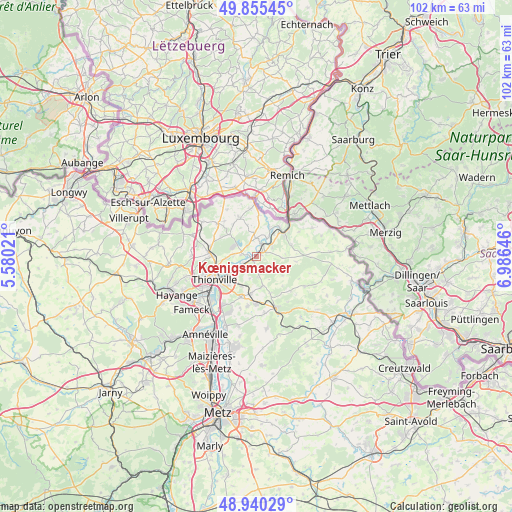
Kœnigsmacker GPS coordinates[2]
49° 24' 0" North, 6° 16' 59.988" East
| Map corner | latitude | longitude |
|---|---|---|
| Upper-left | 49.85545°, | 5.58021° |
| Center: | 49.4°, | 6.28333° |
| Lower-right: | 48.94029°, | 6.98646° |
| Map W x H: | 101.8×101.8 km | = 63.3×63.3mi |
| max Lat: | 51.07786° ⇑12.1% North |
| Kœnigsmacker: | 49.4° |
| min Lat: | ⇓87.9% South 41.3874° |
| min Long | Kœnigsmacker | max Long |
| -5.08615° | 6.28333° | 9.52242° |
| W 90%⇐ | ⇒10% E |
Elevation
Elevation of Kœnigsmacker is 147 m = 482 ft, and this is 46.7 m = 153 ft below average elevation for this country.
| Max E: |
2333 m = 7654 ft | 45.8% |
| Avg. | 193.7 m = 635 ft | |
| Kœnigsmacker | 147 m = 482 ft | |
Min E: |
-1 m = -3 ft | 54.2% |
See also: France elevation on elevation.city.
Geographical zone
Kœnigsmacker is located in North temperate zone (between Tropic of Cancer and the Arctic Circle). Distance of this North polar circle is 1908.4 km =1185.8 mi to North.| Distance of | km | miles | from Kœnigsmacker |
|---|---|---|---|
| North Pole | 4514.3 | 2805.1 | to North |
| Arctic Circle | 1908.4 | 1185.8 | to North |
| Tropic Cancer | 2886.8 | 1793.8 | to South |
| Equator | 5492.8 | 3413.1 | to South |


Nearby cities:
15 places around Kœnigsmacker: (largest is in red/bold)
• Basse-Ham
3.4 km =2.1 mi,  243°
243°
• Boust
7.7 km =4.8 mi,  300°
300°
• Cattenom
3 km =1.9 mi,  283°
283°
• Distroff
7.6 km =4.7 mi,  189°
189°
• Elzange
4.2 km =2.6 mi,  177°
177°
• Gavisse
3.6 km =2.2 mi,  3°
3°
• Hunting
3.5 km =2.2 mi,  61°
61°
• Kuntzig
6.7 km =4.2 mi,  209°
209°
• Malling
2.8 km =1.7 mi,  20°
20°
• Manom
7.9 km =4.9 mi,  245°
245°
• Oudrenne
3.9 km =2.4 mi,  125°
125°
• Rettel
5.8 km =3.6 mi,  36°
36°
• Rustroff
8 km =5 mi,  53°
53°
• Sierck-les-Bains
7 km =4.3 mi, 50°
• Yutz
8.2 km =5.1 mi,  233°
233°
Sources, notices
• [Note1] Compared only with cities in France existing in our database
• [Src1] Map data: © OpenStreetMap contributors (CC-BY-SA)
• [Src2] Other city data from geonames.org with taken over terms of usage.
• [Src3] Geographical zone / Annual Mean Temperature by Robert A. Rohde @ Wikipedia
