Jouy-en-Josas geodata
Jouy-en-Josas (Île-de-France) is a populated place; located in France in Europe/Paris (GMT+2) time zone. With population of 8,383 people, there are 1156 cities with bigger population in this country. Compared to other cities in France, 74.6% of cities are located further ↓South; 54.9% of cities are located further →East and 54.2% of cities have lower elevation than Jouy-en-Josas. Note1
Administrative division(s):
- Level 1: Île-de-France
- Level 2: Yvelines
- Level 3: Arrondissement de Versailles
- Level 4: Jouy-en-Josas


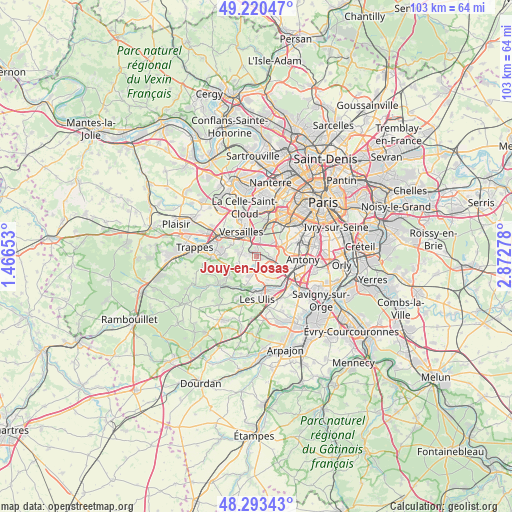
Jouy-en-Josas GPS coordinates[2]
48° 45' 32.724" North, 2° 10' 10.776" East
| Map corner | latitude | longitude |
|---|---|---|
| Upper-left | 49.22047°, | 1.46653° |
| Center: | 48.75909°, | 2.16966° |
| Lower-right: | 48.29343°, | 2.87278° |
| Map W x H: | 103.1×103.1 km | = 64.1×64.1mi |
| max Lat: | 51.07786° ⇑25.4% North |
| Jouy-en-Josas: | 48.75909° |
| min Lat: | ⇓74.6% South 41.3874° |
| min Long | Jouy-en-Josas | max Long |
| -5.08615° | 2.16966° | 9.52242° |
| W 45.1%⇐ | ⇒54.9% E |
Elevation
Elevation of Jouy-en-Josas is 147 m = 482 ft, and this is 46.7 m = 153 ft below average elevation for this country.
| Max E: |
2333 m = 7654 ft | 45.8% |
| Avg. | 193.7 m = 635 ft | |
| Jouy-en-Josas | 147 m = 482 ft | |
Min E: |
-1 m = -3 ft | 54.2% |
See also: France elevation on elevation.city.
Geographical zone
Jouy-en-Josas is located in North temperate zone (between Tropic of Cancer and the Arctic Circle). Distance of this North polar circle is 1979.7 km =1230.1 mi to North.| Distance of | km | miles | from Jouy-en-Josas |
|---|---|---|---|
| North Pole | 4585.6 | 2849.4 | to North |
| Arctic Circle | 1979.7 | 1230.1 | to North |
| Tropic Cancer | 2815.6 | 1749.5 | to South |
| Equator | 5421.5 | 3368.8 | to South |


Nearby cities:
15 places around Jouy-en-Josas: (largest is in red/bold)
• Bièvres
3.6 km =2.2 mi,  92°
92°
• Buc
3.7 km =2.3 mi,  300°
300°
• Bures-sur-Yvette
6.6 km =4.1 mi,  179°
179°
• Chaville
5.4 km =3.4 mi,  15°
15°
• Châteaufort
6.4 km =4 mi,  245°
245°
• Igny
4.3 km =2.7 mi,  112°
112°
• Les Loges-en-Josas
2.2 km =1.4 mi,  283°
283°
• Saclay
2.9 km =1.8 mi, 180°
• Saint-Aubin
5.5 km =3.4 mi,  202°
202°
• Toussus-le-Noble
4.3 km =2.7 mi,  255°
255°
• Vauhallan
3.7 km =2.3 mi,  139°
139°
• Versailles
5.6 km =3.5 mi,  332°
332°
• Villiers-le-Bâcle
5 km =3.1 mi,  227°
227°
• Viroflay
4.7 km =2.9 mi,  352°
352°
• Vélizy-Villacoublay
3.1 km =1.9 mi,  34°
34°
Sources, notices
• [Note1] Compared only with cities in France existing in our database
• [Src1] Map data: © OpenStreetMap contributors (CC-BY-SA)
• [Src2] Other city data from geonames.org with taken over terms of usage.
• [Src3] Geographical zone / Annual Mean Temperature by Robert A. Rohde @ Wikipedia
