Pierric geodata
Pierric (Pays de la Loire) is a populated place; located in France in Europe/Paris (GMT+2) time zone. With population of 845 people, there are 10134 cities with bigger population in this country. Compared to other cities in France, 54% of cities are located further ↓South; 93.7% of cities are located further →East and 93.1% of cities have higher elevation than Pierric. Note1
Administrative division(s):
- Level 1: Pays de la Loire
- Level 2: Loire-Atlantique
- Level 3: Arrondissement of Châteaubriant-Ancenis
- Level 4: Pierric


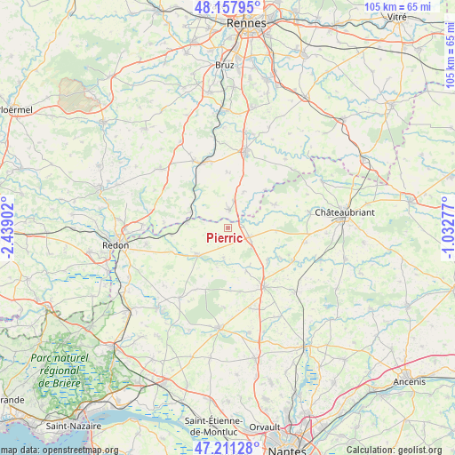
Pierric GPS coordinates[2]
47° 41' 12.336" North, 1° 44' 9.24" West
| Map corner | latitude | longitude |
|---|---|---|
| Upper-left | 48.15795°, | -2.43902° |
| Center: | 47.68676°, | -1.7359° |
| Lower-right: | 47.21128°, | -1.03277° |
| Map W x H: | 105.3×105.3 km | = 65.4×65.4mi |
| max Lat: | 51.07786° ⇑46% North |
| Pierric: | 47.68676° |
| min Lat: | ⇓54% South 41.3874° |
| min Long | Pierric | max Long |
| -5.08615° | -1.7359° | 9.52242° |
| W 6.3%⇐ | ⇒93.7% E |
Elevation
Elevation of Pierric is 22 m = 72 ft, and this is 171.7 m = 563 ft below average elevation for this country.
| Max E: |
2333 m = 7654 ft | 93.1% |
| Avg. | 193.7 m = 635 ft | |
| Pierric | 22 m = 72 ft | |
Min E: |
-1 m = -3 ft | 6.9% |
See also: France elevation on elevation.city.
Geographical zone
Pierric is located in North temperate zone (between Tropic of Cancer and the Arctic Circle). Distance of this North polar circle is 2098.9 km =1304.2 mi to North.| Distance of | km | miles | from Pierric |
|---|---|---|---|
| North Pole | 4704.8 | 2923.4 | to North |
| Arctic Circle | 2098.9 | 1304.2 | to North |
| Tropic Cancer | 2696.4 | 1675.5 | to South |
| Equator | 5302.3 | 3294.7 | to South |


Nearby cities:
15 places around Pierric: (largest is in red/bold)
• Conquereuil
6.9 km =4.3 mi,  189°
189°
• Derval
5.4 km =3.4 mi,  113°
113°
• Grand-Fougeray
4.1 km =2.5 mi,  3°
3°
• Guémené-Penfao
9.4 km =5.8 mi,  230°
230°
• Jans
11.7 km =7.3 mi,  129°
129°
• La Dominelais
9.1 km =5.7 mi,  23°
23°
• La Noë-Blanche
13.1 km =8.1 mi,  358°
358°
• Langon
9.3 km =5.8 mi,  293°
293°
• Lusanger
11 km =6.8 mi,  93°
93°
• Marsac-sur-Don
10.9 km =6.8 mi,  157°
157°
• Messac
16.3 km =10.1 mi,  339°
339°
• Nozay
15.8 km =9.8 mi,  148°
148°
• Sainte-Anne-sur-Vilaine
8.3 km =5.2 mi,  305°
305°
• Sion-les-Mines
12 km =7.5 mi,  63°
63°
• Vay
14.9 km =9.3 mi,  169°
169°
Sources, notices
• [Note1] Compared only with cities in France existing in our database
• [Src1] Map data: © OpenStreetMap contributors (CC-BY-SA)
• [Src2] Other city data from geonames.org with taken over terms of usage.
• [Src3] Geographical zone / Annual Mean Temperature by Robert A. Rohde @ Wikipedia
