Helfaut geodata
Helfaut (Hauts-de-France) is a populated place; located in France in Europe/Paris (GMT+2) time zone. With population of 1,748 people, there are 5419 cities with bigger population in this country. Compared to other cities in France, 98.8% of cities are located further ↓South; 53.7% of cities are located further →East and 63.6% of cities have higher elevation than Helfaut. Note1
Administrative division(s):
- Level 1: Hauts-de-France
- Level 2: Pas-de-Calais
- Level 3: Arrondissement de Saint-Omer
- Level 4: Helfaut


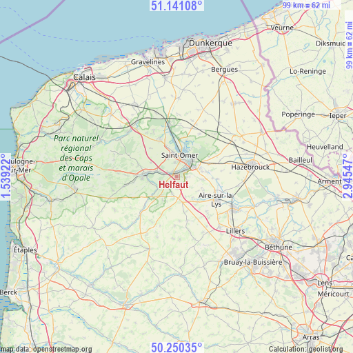
Helfaut GPS coordinates[2]
50° 41' 52.188" North, 2° 14' 32.424" East
| Map corner | latitude | longitude |
|---|---|---|
| Upper-left | 51.14108°, | 1.53922° |
| Center: | 50.69783°, | 2.24234° |
| Lower-right: | 50.25035°, | 2.94547° |
| Map W x H: | 99×99 km | = 61.5×61.5mi |
| max Lat: | 51.07786° ⇑1.2% North |
| Helfaut: | 50.69783° |
| min Lat: | ⇓98.8% South 41.3874° |
| min Long | Helfaut | max Long |
| -5.08615° | 2.24234° | 9.52242° |
| W 46.3%⇐ | ⇒53.7% E |
Elevation
Elevation of Helfaut is 93 m = 305 ft, and this is 100.7 m = 330 ft below average elevation for this country.
| Max E: |
2333 m = 7654 ft | 63.6% |
| Avg. | 193.7 m = 635 ft | |
| Helfaut | 93 m = 305 ft | |
Min E: |
-1 m = -3 ft | 36.4% |
See also: France elevation on elevation.city.
Geographical zone
Helfaut is located in North temperate zone (between Tropic of Cancer and the Arctic Circle). Distance of this North polar circle is 1764.1 km =1096.2 mi to North.| Distance of | km | miles | from Helfaut |
|---|---|---|---|
| North Pole | 4370 | 2715.4 | to North |
| Arctic Circle | 1764.1 | 1096.2 | to North |
| Tropic Cancer | 3031.2 | 1883.5 | to South |
| Equator | 5637.1 | 3502.7 | to South |


Nearby cities:
15 places around Helfaut: (largest is in red/bold)
• Arques
5.8 km =3.6 mi,  46°
46°
• Blendecques
3.8 km =2.4 mi, 53°
• Cléty
6.4 km =4 mi,  218°
218°
• Ecques
4.4 km =2.7 mi,  134°
134°
• Esquerdes
3.9 km =2.4 mi,  280°
280°
• Hallines
1.8 km =1.1 mi,  322°
322°
• Heuringhem
2.9 km =1.8 mi,  93°
93°
• Longuenesse
4 km =2.5 mi,  352°
352°
• Pihem
2.6 km =1.6 mi,  230°
230°
• Quiestède
6.7 km =4.2 mi,  106°
106°
• Saint-Martin-au-Laërt
6 km =3.7 mi,  358°
358°
• Saint-Omer
5.8 km =3.6 mi,  13°
13°
• Setques
6.1 km =3.8 mi, 284°
• Tatinghem
5.6 km =3.5 mi,  333°
333°
• Wizernes
1.5 km =0.9 mi,  2°
2°
Sources, notices
• [Note1] Compared only with cities in France existing in our database
• [Src1] Map data: © OpenStreetMap contributors (CC-BY-SA)
• [Src2] Other city data from geonames.org with taken over terms of usage.
• [Src3] Geographical zone / Annual Mean Temperature by Robert A. Rohde @ Wikipedia
