Hallennes-lez-Haubourdin geodata
Hallennes-lez-Haubourdin (Hauts-de-France) is a populated place; located in France in Europe/Paris (GMT+2) time zone. With population of 3,872 people, there are 2537 cities with bigger population in this country. Compared to other cities in France, 98.2% of cities are located further ↓South; 57.4% of cities are located further ←West and 92% of cities have higher elevation than Hallennes-lez-Haubourdin. Note1
Administrative division(s):
- Level 1: Hauts-de-France
- Level 2: Nord
- Level 3: Arrondissement de Lille
- Level 4: Hallennes-lez-Haubourdin
Current local time in Hallennes-lez-Haubourdin:
05:58 AM, WednesdayDifference from your time zone: hours


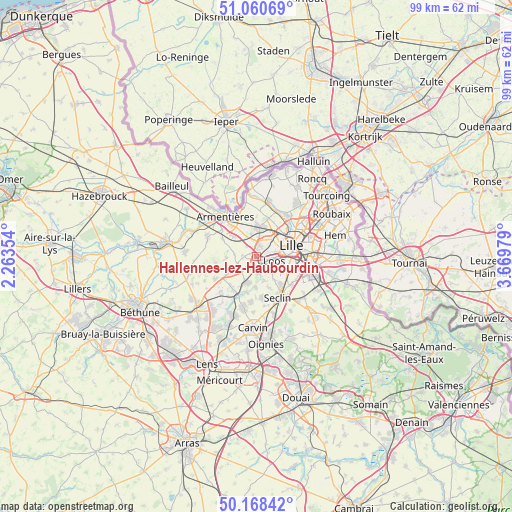
Hallennes-lez-Haubourdin GPS coordinates[2]
50° 37' 0.012" North, 2° 58' 0.012" East
| Map corner | latitude | longitude |
|---|---|---|
| Upper-left | 51.06069°, | 2.26354° |
| Center: | 50.61667°, | 2.96667° |
| Lower-right: | 50.16842°, | 3.66979° |
| Map W x H: | 99.2×99.2 km | = 61.6×61.6mi |
| max Lat: | 51.07786° ⇑1.8% North |
| Hallennes-lez-Haubourdin: | 50.61667° |
| min Lat: | ⇓98.2% South 41.3874° |
| min Long | Hallennes-lez-H | max Long |
| -5.08615° | 2.96667° | 9.52242° |
| W 57.4%⇐ | ⇒42.6% E |
Elevation
Elevation of Hallennes-lez-Haubourdin is 25 m = 82 ft, and this is 168.7 m = 553 ft below average elevation for this country.
| Max E: |
2333 m = 7654 ft | 92% |
| Avg. | 193.7 m = 635 ft | |
| Hallennes-lez-Haubourdin | 25 m = 82 ft | |
Min E: |
-1 m = -3 ft | 8% |
See also: France elevation on elevation.city.
Geographical zone
Hallennes-lez-Haubourdin is located in North temperate zone (between Tropic of Cancer and the Arctic Circle). Distance of this North polar circle is 1773.1 km =1101.8 mi to North.| Distance of | km | miles | from Hallennes-lez-Haubourdin |
|---|---|---|---|
| North Pole | 4379 | 2721 | to North |
| Arctic Circle | 1773.1 | 1101.8 | to North |
| Tropic Cancer | 3022.1 | 1877.8 | to South |
| Equator | 5628 | 3497.1 | to South |


Nearby cities:
15 places around Hallennes-lez-Haubourdin: (largest is in red/bold)
• Beaucamps-Ligny
3.8 km =2.4 mi,  251°
251°
• Capinghem
3.2 km =2 mi,  354°
354°
• Emmerin
3.4 km =2.1 mi,  134°
134°
• Englos
1.3 km =0.8 mi,  328°
328°
• Ennetières-en-Weppes
2.8 km =1.7 mi,  317°
317°
• Haubourdin
2 km =1.2 mi,  118°
118°
• Le Maisnil
5.7 km =3.5 mi,  268°
268°
• Lomme
3.3 km =2.1 mi,  25°
25°
• Loos
3.8 km =2.4 mi,  101°
101°
• Noyelles-lès-Seclin
5.7 km =3.5 mi,  141°
141°
• Prémesques
4.5 km =2.8 mi, 346°
• Radinghem-en-Weppes
4.1 km =2.5 mi, 273°
• Santes
2.6 km =1.6 mi,  185°
185°
• Sequedin
1.5 km =0.9 mi,  48°
48°
• Wavrin
5.2 km =3.2 mi,  204°
204°
Sources, notices
• [Note1] Compared only with cities in France existing in our database
• [Src1] Map data: © OpenStreetMap contributors (CC-BY-SA)
• [Src2] Other city data from geonames.org with taken over terms of usage.
• [Src3] Geographical zone / Annual Mean Temperature by Robert A. Rohde @ Wikipedia
