Le Grand-Quevilly geodata
Le Grand-Quevilly (Normandy) is a populated place; located in France in Europe/Paris (GMT+2) time zone. With population of 26,522 people, there are 326 cities with bigger population in this country. Compared to other cities in France, 87.9% of cities are located further ↓South; 68.3% of cities are located further →East and 83.1% of cities have higher elevation than Le Grand-Quevilly. Note1
Administrative division(s):
- Level 1: Normandy
- Level 2: Seine-Maritime
- Level 3: Arrondissement de Rouen
- Level 4: Le Grand-Quevilly


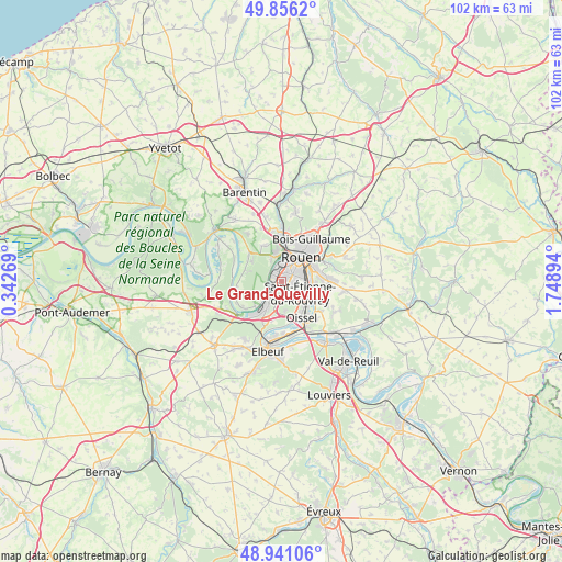
Le Grand-Quevilly GPS coordinates[2]
49° 24' 2.736" North, 1° 2' 44.952" East
| Map corner | latitude | longitude |
|---|---|---|
| Upper-left | 49.8562°, | 0.34269° |
| Center: | 49.40076°, | 1.04582° |
| Lower-right: | 48.94106°, | 1.74894° |
| Map W x H: | 101.8×101.8 km | = 63.3×63.3mi |
| max Lat: | 51.07786° ⇑12.1% North |
| Le Grand-Quevilly: | 49.40076° |
| min Lat: | ⇓87.9% South 41.3874° |
| min Long | Le Grand-Quevil | max Long |
| -5.08615° | 1.04582° | 9.52242° |
| W 31.7%⇐ | ⇒68.3% E |
Elevation
Elevation of Le Grand-Quevilly is 47 m = 154 ft, and this is 146.7 m = 481 ft below average elevation for this country.
| Max E: |
2333 m = 7654 ft | 83.1% |
| Avg. | 193.7 m = 635 ft | |
| Le Grand-Quevilly | 47 m = 154 ft | |
Min E: |
-1 m = -3 ft | 16.9% |
See also: France elevation on elevation.city.
Geographical zone
Le Grand-Quevilly is located in North temperate zone (between Tropic of Cancer and the Arctic Circle). Distance of this North polar circle is 1908.3 km =1185.8 mi to North.| Distance of | km | miles | from Le Grand-Quevilly |
|---|---|---|---|
| North Pole | 4514.2 | 2805 | to North |
| Arctic Circle | 1908.3 | 1185.8 | to North |
| Tropic Cancer | 2886.9 | 1793.8 | to South |
| Equator | 5492.8 | 3413.1 | to South |


Nearby cities:
15 places around Le Grand-Quevilly: (largest is in red/bold)
• Amfreville-la-Mi-Voie
6.8 km =4.2 mi,  83°
83°
• Belbeuf
7.1 km =4.4 mi,  101°
101°
• Canteleu
4.7 km =2.9 mi,  340°
340°
• Déville-lès-Rouen
7.6 km =4.7 mi,  3°
3°
• Grand-Couronne
5.8 km =3.6 mi,  209°
209°
• Le Mesnil-Esnard
7.3 km =4.5 mi, 79°
• Le Petit-Quevilly
1.8 km =1.1 mi,  39°
39°
• Mont-Saint-Aignan
7.7 km =4.8 mi,  26°
26°
• Montigny
7.3 km =4.5 mi,  333°
333°
• Petit-Couronne
2.9 km =1.8 mi,  227°
227°
• Quevillon
7 km =4.3 mi,  287°
287°
• Rouen
6.1 km =3.8 mi, 39°
• Saint-Étienne-du-Rouvray
5 km =3.1 mi,  120°
120°
• Sotteville-lès-Rouen
3.4 km =2.1 mi,  72°
72°
• Val-de-la-Haye
4 km =2.5 mi, 232°
Sources, notices
• [Note1] Compared only with cities in France existing in our database
• [Src1] Map data: © OpenStreetMap contributors (CC-BY-SA)
• [Src2] Other city data from geonames.org with taken over terms of usage.
• [Src3] Geographical zone / Annual Mean Temperature by Robert A. Rohde @ Wikipedia
