Saint-Étienne-du-Rouvray geodata
Saint-Étienne-du-Rouvray (Normandy) is a populated place; located in France in Europe/Paris (GMT+2) time zone. With population of 28,953 people, there are 289 cities with bigger population in this country. Compared to other cities in France, 87.5% of cities are located further ↓South; 67.8% of cities are located further →East and 96% of cities have higher elevation than Saint-Étienne-du-Rouvray. Note1
Administrative division(s):
- Level 1: Normandy
- Level 2: Seine-Maritime
- Level 3: Arrondissement de Rouen
- Level 4: Saint-Étienne-du-Rouvray
Current local time in Saint-Étienne-du-Rouvray:
03:04 AM, WednesdayDifference from your time zone: hours


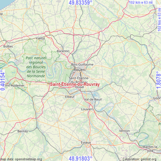
Saint-Étienne-du-Rouvray GPS coordinates[2]
49° 22' 40.584" North, 1° 6' 16.812" East
| Map corner | latitude | longitude |
|---|---|---|
| Upper-left | 49.83359°, | 0.40154° |
| Center: | 49.37794°, | 1.10467° |
| Lower-right: | 48.91803°, | 1.8078° |
| Map W x H: | 101.8×101.8 km | = 63.3×63.3mi |
| max Lat: | 51.07786° ⇑12.5% North |
| Saint-Étienne-du-Rouvray: | 49.37794° |
| min Lat: | ⇓87.5% South 41.3874° |
| min Long | Saint-Étienne- | max Long |
| -5.08615° | 1.10467° | 9.52242° |
| W 32.2%⇐ | ⇒67.8% E |
Elevation
Elevation of Saint-Étienne-du-Rouvray is 14 m = 46 ft, and this is 179.7 m = 590 ft below average elevation for this country.
| Max E: |
2333 m = 7654 ft | 96% |
| Avg. | 193.7 m = 635 ft | |
| Saint-Étienne-du-Rouvray | 14 m = 46 ft | |
Min E: |
-1 m = -3 ft | 4% |
See also: France elevation on elevation.city.
Geographical zone
Saint-Étienne-du-Rouvray is located in North temperate zone (between Tropic of Cancer and the Arctic Circle). Distance of this North polar circle is 1910.9 km =1187.4 mi to North.| Distance of | km | miles | from Saint-Étienne-du-Rouvray |
|---|---|---|---|
| North Pole | 4516.7 | 2806.5 | to North |
| Arctic Circle | 1910.9 | 1187.4 | to North |
| Tropic Cancer | 2884.4 | 1792.3 | to South |
| Equator | 5490.3 | 3411.5 | to South |


Nearby cities:
15 places around Saint-Étienne-du-Rouvray: (largest is in red/bold)
• Amfreville-la-Mi-Voie
4.1 km =2.5 mi,  36°
36°
• Belbeuf
2.9 km =1.8 mi,  68°
68°
• Gouy
4.2 km =2.6 mi,  129°
129°
• Le Grand-Quevilly
5 km =3.1 mi,  300°
300°
• Le Mesnil-Esnard
4.9 km =3 mi, 36°
• Le Petit-Quevilly
5 km =3.1 mi,  321°
321°
• Les Authieux-sur-le-Port-Saint-Ouen
4.6 km =2.9 mi,  152°
152°
• Oissel
5 km =3.1 mi,  188°
188°
• Petit-Couronne
6.4 km =4 mi,  275°
275°
• Quévreville-la-Poterie
6.7 km =4.2 mi,  112°
112°
• Saint-Aubin-Celloville
4.3 km =2.7 mi, 111°
• Saint-Aubin-Épinay
6.2 km =3.9 mi,  46°
46°
• Sotteville-lès-Rouen
3.7 km =2.3 mi,  343°
343°
• Tourville-la-Rivière
5.6 km =3.5 mi,  179°
179°
• Ymare
6.2 km =3.9 mi,  119°
119°
Sources, notices
• [Note1] Compared only with cities in France existing in our database
• [Src1] Map data: © OpenStreetMap contributors (CC-BY-SA)
• [Src2] Other city data from geonames.org with taken over terms of usage.
• [Src3] Geographical zone / Annual Mean Temperature by Robert A. Rohde @ Wikipedia
