Boisville-la-Saint-Père geodata
Boisville-la-Saint-Père (Centre) is a populated place; located in France in Europe/Paris (GMT+2) time zone. With population of 726 people, there are 11454 cities with bigger population in this country. Compared to other cities in France, 65.1% of cities are located further ↓South; 60.5% of cities are located further →East and 55% of cities have lower elevation than Boisville-la-Saint-Père. Note1
Administrative division(s):
- Level 1: Centre
- Level 2: Département d'Eure-et-Loir
- Level 3: Arrondissement de Chartres
- Level 4: Boisville-la-Saint-Père
Current local time in Boisville-la-Saint-Père:
09:14 AM, SaturdayDifference from your time zone: hours


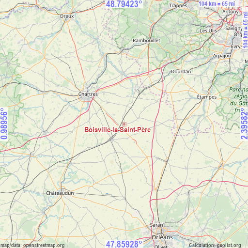
Boisville-la-Saint-Père GPS coordinates[2]
48° 19' 44.04" North, 1° 41' 33.684" East
| Map corner | latitude | longitude |
|---|---|---|
| Upper-left | 48.79423°, | 0.98956° |
| Center: | 48.3289°, | 1.69269° |
| Lower-right: | 47.85928°, | 2.39582° |
| Map W x H: | 104×104 km | = 64.6×64.6mi |
| max Lat: | 51.07786° ⇑34.9% North |
| Boisville-la-Saint-Père: | 48.3289° |
| min Lat: | ⇓65.1% South 41.3874° |
| min Long | Boisville-la-Sa | max Long |
| -5.08615° | 1.69269° | 9.52242° |
| W 39.5%⇐ | ⇒60.5% E |
Elevation
Elevation of Boisville-la-Saint-Père is 150 m = 492 ft, and this is 43.7 m = 143 ft below average elevation for this country.
| Max E: |
2333 m = 7654 ft | 45% |
| Avg. | 193.7 m = 635 ft | |
| Boisville-la-Saint-Père | 150 m = 492 ft | |
Min E: |
-1 m = -3 ft | 55% |
See also: France elevation on elevation.city.
Geographical zone
Boisville-la-Saint-Père is located in North temperate zone (between Tropic of Cancer and the Arctic Circle). Distance of this North polar circle is 2027.5 km =1259.8 mi to North.| Distance of | km | miles | from Boisville-la-Saint-Père |
|---|---|---|---|
| North Pole | 4633.4 | 2879.1 | to North |
| Arctic Circle | 2027.5 | 1259.8 | to North |
| Tropic Cancer | 2767.8 | 1719.8 | to South |
| Equator | 5373.7 | 3339.1 | to South |


Nearby cities:
15 places around Boisville-la-Saint-Père: (largest is in red/bold)
• Aunay-sous-Auneau
15.3 km =9.5 mi,  34°
34°
• Auneau
16.1 km =10 mi,  21°
21°
• Berchères-les-Pierres
12 km =7.5 mi,  301°
301°
• Béville-le-Comte
12 km =7.5 mi,  7°
7°
• Dammarie
14.7 km =9.1 mi,  276°
276°
• Denonville
11.2 km =7 mi,  51°
51°
• Francourville
8.9 km =5.5 mi,  344°
344°
• Morancez
16.7 km =10.4 mi, 298°
• Nogent-le-Phaye
15.5 km =9.6 mi,  326°
326°
• Ouarville
6.7 km =4.2 mi,  64°
64°
• Prunay-le-Gillon
5.8 km =3.6 mi,  312°
312°
• Sainville
16.8 km =10.4 mi, 55°
• Sancheville
17.4 km =10.8 mi,  209°
209°
• Sours
11.4 km =7.1 mi,  322°
322°
• Voves
8.1 km =5 mi,  217°
217°
Sources, notices
• [Note1] Compared only with cities in France existing in our database
• [Src1] Map data: © OpenStreetMap contributors (CC-BY-SA)
• [Src2] Other city data from geonames.org with taken over terms of usage.
• [Src3] Geographical zone / Annual Mean Temperature by Robert A. Rohde @ Wikipedia
