Fos-sur-Mer geodata
Fos-sur-Mer (Provence-Alpes-Côte d'Azur) is a populated place; located in France in Europe/Paris (GMT+2) time zone. With population of 17,317 people, there are 551 cities with bigger population in this country. Compared to other cities in France, 93.8% of cities are located further ↑North; 77% of cities are located further ←West and 97.8% of cities have higher elevation than Fos-sur-Mer. Note1
Administrative division(s):
- Level 1: Provence-Alpes-Côte d'Azur
- Level 2: Département des Bouches-du-Rhône
- Level 3: Arrondissement d'Istres
- Level 4: Fos-sur-Mer


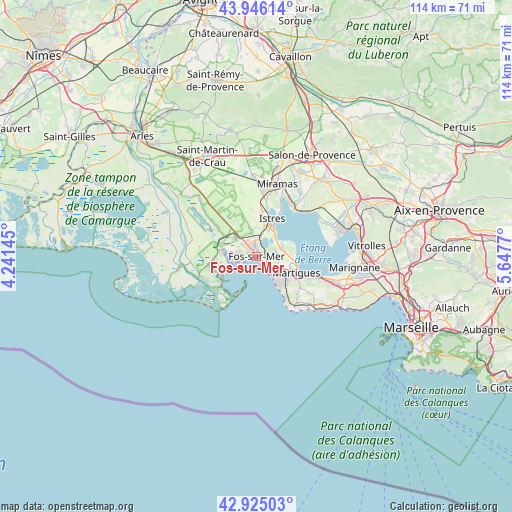
Fos-sur-Mer GPS coordinates[2]
43° 26' 15.864" North, 4° 56' 40.452" East
| Map corner | latitude | longitude |
|---|---|---|
| Upper-left | 43.94614°, | 4.24145° |
| Center: | 43.43774°, | 4.94457° |
| Lower-right: | 42.92503°, | 5.6477° |
| Map W x H: | 113.5×113.5 km | = 70.5×70.5mi |
| max Lat: | 51.07786° ⇑93.8% North |
| Fos-sur-Mer: | 43.43774° |
| min Lat: | ⇓6.2% South 41.3874° |
| min Long | Fos-sur-Mer | max Long |
| -5.08615° | 4.94457° | 9.52242° |
| W 77%⇐ | ⇒23% E |
Elevation
Elevation of Fos-sur-Mer is 9 m = 30 ft, and this is 184.7 m = 606 ft below average elevation for this country.
| Max E: |
2333 m = 7654 ft | 97.8% |
| Avg. | 193.7 m = 635 ft | |
| Fos-sur-Mer | 9 m = 30 ft | |
Min E: |
-1 m = -3 ft | 2.2% |
See also: France elevation on elevation.city.
Geographical zone
Fos-sur-Mer is located in North temperate zone (between Tropic of Cancer and the Arctic Circle). Distance of this Northern Tropic circle is 2223.9 km =1381.9 mi to South.| Distance of | km | miles | from Fos-sur-Mer |
|---|---|---|---|
| North Pole | 5177.2 | 3217 | to North |
| Arctic Circle | 2571.4 | 1597.8 | to North |
| Tropic Cancer | 2223.9 | 1381.9 | to South |
| Equator | 4829.8 | 3001.1 | to South |


Nearby cities:
15 places around Fos-sur-Mer: (largest is in red/bold)
• Berre-l'Étang
18.8 km =11.7 mi,  76°
76°
• Carry-le-Rouet
20.5 km =12.7 mi,  125°
125°
• Châteauneuf-les-Martigues
18.7 km =11.6 mi,  108°
108°
• Cornillon-Confoux
17.3 km =10.7 mi,  36°
36°
• Grans
21.3 km =13.2 mi,  26°
26°
• Istres
9.1 km =5.7 mi,  22°
22°
• Lançon-Provence
22.7 km =14.1 mi, 40°
• Marignane
21.9 km =13.6 mi,  95°
95°
• Martigues
9.6 km =6 mi, 110°
• Miramas
17 km =10.6 mi, 15°
• Port-Saint-Louis-du-Rhône
11.1 km =6.9 mi,  239°
239°
• Port-de-Bouc
4.5 km =2.8 mi,  139°
139°
• Saint-Chamas
14.5 km =9 mi, 30°
• Saint-Mitre-les-Remparts
5.9 km =3.7 mi,  71°
71°
• Sausset-les-Pins
17.5 km =10.9 mi, 132°
Sources, notices
• [Note1] Compared only with cities in France existing in our database
• [Src1] Map data: © OpenStreetMap contributors (CC-BY-SA)
• [Src2] Other city data from geonames.org with taken over terms of usage.
• [Src3] Geographical zone / Annual Mean Temperature by Robert A. Rohde @ Wikipedia
