Port-de-Bouc geodata
Port-de-Bouc (Provence-Alpes-Côte d'Azur) is a populated place; located in France in Europe/Paris (GMT+2) time zone. With population of 15,934 people, there are 601 cities with bigger population in this country. Compared to other cities in France, 94.1% of cities are located further ↑North; 77.5% of cities are located further ←West and 94.4% of cities have higher elevation than Port-de-Bouc. Note1
Administrative division(s):
- Level 1: Provence-Alpes-Côte d'Azur
- Level 2: Département des Bouches-du-Rhône
- Level 3: Arrondissement d'Istres
- Level 4: Port-de-Bouc


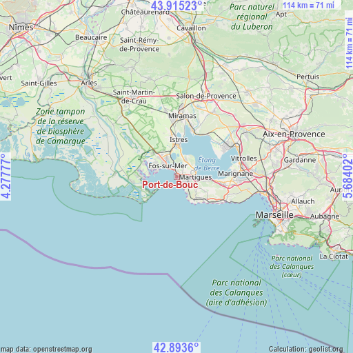
Port-de-Bouc GPS coordinates[2]
43° 24' 23.652" North, 4° 58' 51.24" East
| Map corner | latitude | longitude |
|---|---|---|
| Upper-left | 43.91523°, | 4.27777° |
| Center: | 43.40657°, | 4.9809° |
| Lower-right: | 42.8936°, | 5.68402° |
| Map W x H: | 113.6×113.6 km | = 70.6×70.6mi |
| max Lat: | 51.07786° ⇑94.1% North |
| Port-de-Bouc: | 43.40657° |
| min Lat: | ⇓5.9% South 41.3874° |
| min Long | Port-de-Bouc | max Long |
| -5.08615° | 4.9809° | 9.52242° |
| W 77.5%⇐ | ⇒22.5% E |
Elevation
Elevation of Port-de-Bouc is 19 m = 62 ft, and this is 174.7 m = 573 ft below average elevation for this country.
| Max E: |
2333 m = 7654 ft | 94.4% |
| Avg. | 193.7 m = 635 ft | |
| Port-de-Bouc | 19 m = 62 ft | |
Min E: |
-1 m = -3 ft | 5.6% |
See also: France elevation on elevation.city.
Geographical zone
Port-de-Bouc is located in North temperate zone (between Tropic of Cancer and the Arctic Circle). Distance of this Northern Tropic circle is 2220.4 km =1379.7 mi to South.| Distance of | km | miles | from Port-de-Bouc |
|---|---|---|---|
| North Pole | 5180.7 | 3219.1 | to North |
| Arctic Circle | 2574.8 | 1599.9 | to North |
| Tropic Cancer | 2220.4 | 1379.7 | to South |
| Equator | 4826.4 | 2999 | to South |


Nearby cities:
15 places around Port-de-Bouc: (largest is in red/bold)
• Berre-l'Étang
17.2 km =10.7 mi,  62°
62°
• Carry-le-Rouet
16.2 km =10.1 mi,  121°
121°
• Châteauneuf-les-Martigues
15 km =9.3 mi,  99°
99°
• Cornillon-Confoux
18.8 km =11.7 mi,  22°
22°
• Ensuès-la-Redonne
18.9 km =11.7 mi,  107°
107°
• Fos-sur-Mer
4.5 km =2.8 mi,  319°
319°
• Istres
11.9 km =7.4 mi,  2°
2°
• Marignane
18.9 km =11.7 mi,  86°
86°
• Martigues
6 km =3.7 mi, 89°
• Miramas
19.9 km =12.4 mi,  5°
5°
• Port-Saint-Louis-du-Rhône
12.7 km =7.9 mi,  260°
260°
• Saint-Chamas
16.6 km =10.3 mi, 15°
• Saint-Mitre-les-Remparts
6 km =3.7 mi,  26°
26°
• Saint-Victoret
20.5 km =12.7 mi, 85°
• Sausset-les-Pins
13 km =8.1 mi,  129°
129°
Sources, notices
• [Note1] Compared only with cities in France existing in our database
• [Src1] Map data: © OpenStreetMap contributors (CC-BY-SA)
• [Src2] Other city data from geonames.org with taken over terms of usage.
• [Src3] Geographical zone / Annual Mean Temperature by Robert A. Rohde @ Wikipedia
