Dambach geodata
Dambach (Grand Est) is a populated place; located in France in Europe/Paris (GMT+2) time zone. With population of 771 people, there are 10923 cities with bigger population in this country. Compared to other cities in France, 79.8% of cities are located further ↓South; 98.7% of cities are located further ←West and 73.3% of cities have lower elevation than Dambach. Note1
Administrative division(s):
- Level 1: Grand Est
- Level 2: Bas-Rhin
- Level 3: Arrondissement de Haguenau-Wissembourg
- Level 4: Dambach


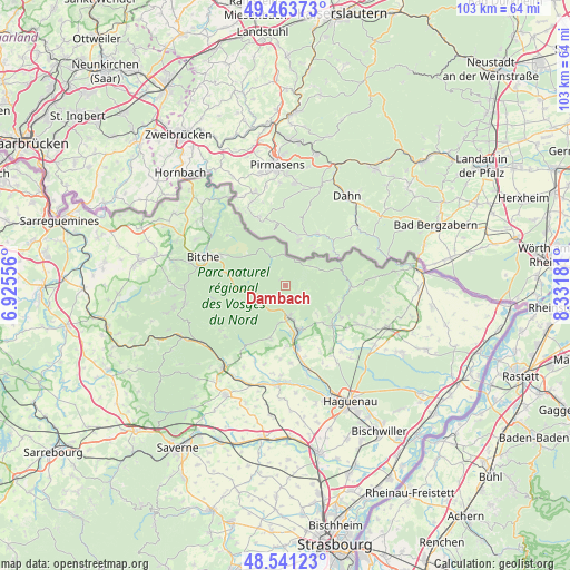
Dambach GPS coordinates[2]
49° 0' 16.632" North, 7° 37' 43.248" East
| Map corner | latitude | longitude |
|---|---|---|
| Upper-left | 49.46373°, | 6.92556° |
| Center: | 49.00462°, | 7.62868° |
| Lower-right: | 48.54123°, | 8.33181° |
| Map W x H: | 102.6×102.6 km | = 63.8×63.8mi |
| max Lat: | 51.07786° ⇑20.2% North |
| Dambach: | 49.00462° |
| min Lat: | ⇓79.8% South 41.3874° |
| min Long | Dambach | max Long |
| -5.08615° | 7.62868° | 9.52242° |
| W 98.7%⇐ | ⇒1.3% E |
Elevation
Elevation of Dambach is 238 m = 781 ft, and this is 44.3 m = 145 ft above average elevation for this country.
| Max E: |
2333 m = 7654 ft | 26.7% |
| Dambach | 238 m 781 ft | |
| Avg. | 193.7 m = 635 ft | |
Min E: |
-1 m = -3 ft | 73.3% |
See also: France elevation on elevation.city.
Geographical zone
Dambach is located in North temperate zone (between Tropic of Cancer and the Arctic Circle). Distance of this North polar circle is 1952.4 km =1213.2 mi to North.| Distance of | km | miles | from Dambach |
|---|---|---|---|
| North Pole | 4558.3 | 2832.4 | to North |
| Arctic Circle | 1952.4 | 1213.2 | to North |
| Tropic Cancer | 2842.9 | 1766.5 | to South |
| Equator | 5448.8 | 3385.7 | to South |


Nearby cities:
15 places around Dambach: (largest is in red/bold)
• Baerenthal
8.6 km =5.3 mi,  247°
247°
• Forstheim
13.7 km =8.5 mi,  152°
152°
• Frœschwiller
8.8 km =5.5 mi,  133°
133°
• Gumbrechtshoffen
11 km =6.8 mi,  179°
179°
• Gundershoffen
11.2 km =7 mi,  167°
167°
• Gœrsdorf
11.8 km =7.3 mi,  121°
121°
• Langensoultzbach
8.8 km =5.5 mi, 118°
• Lembach
11.8 km =7.3 mi,  90°
90°
• Niederbronn-les-Bains
6 km =3.7 mi, 170°
• Oberbronn
7.3 km =4.5 mi,  192°
192°
• Offwiller
12.1 km =7.5 mi,  210°
210°
• Reichshoffen
8.4 km =5.2 mi,  161°
161°
• Rothbach
13 km =8.1 mi, 213°
• Woerth
11 km =6.8 mi, 130°
• Zinswiller
9.8 km =6.1 mi,  196°
196°
Sources, notices
• [Note1] Compared only with cities in France existing in our database
• [Src1] Map data: © OpenStreetMap contributors (CC-BY-SA)
• [Src2] Other city data from geonames.org with taken over terms of usage.
• [Src3] Geographical zone / Annual Mean Temperature by Robert A. Rohde @ Wikipedia
