Choisy-le-Roi geodata
Choisy-le-Roi (Île-de-France) is a populated place; located in France in Europe/Paris (GMT+2) time zone. With population of 35,590 people, there are 218 cities with bigger population in this country. Compared to other cities in France, 74.8% of cities are located further ↓South; 50.8% of cities are located further →East and 88.3% of cities have higher elevation than Choisy-le-Roi. Note1
Administrative division(s):
- Level 1: Île-de-France
- Level 2: Val-de-Marne
- Level 3: Arrondissement de L'Haÿ-les-Roses
- Level 4: Choisy-le-Roi


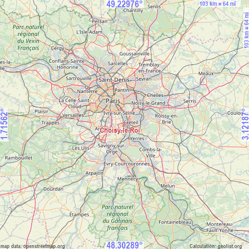
Choisy-le-Roi GPS coordinates[2]
48° 46' 6.456" North, 2° 25' 7.464" East
| Map corner | latitude | longitude |
|---|---|---|
| Upper-left | 49.22976°, | 1.71562° |
| Center: | 48.76846°, | 2.41874° |
| Lower-right: | 48.30289°, | 3.12187° |
| Map W x H: | 103.1×103.1 km | = 64.1×64.1mi |
| max Lat: | 51.07786° ⇑25.2% North |
| Choisy-le-Roi: | 48.76846° |
| min Lat: | ⇓74.8% South 41.3874° |
| min Long | Choisy-le-Roi | max Long |
| -5.08615° | 2.41874° | 9.52242° |
| W 49.2%⇐ | ⇒50.8% E |
Elevation
Elevation of Choisy-le-Roi is 34 m = 112 ft, and this is 159.7 m = 524 ft below average elevation for this country.
| Max E: |
2333 m = 7654 ft | 88.3% |
| Avg. | 193.7 m = 635 ft | |
| Choisy-le-Roi | 34 m = 112 ft | |
Min E: |
-1 m = -3 ft | 11.7% |
See also: France elevation on elevation.city.
Geographical zone
Choisy-le-Roi is located in North temperate zone (between Tropic of Cancer and the Arctic Circle). Distance of this North polar circle is 1978.6 km =1229.4 mi to North.| Distance of | km | miles | from Choisy-le-Roi |
|---|---|---|---|
| North Pole | 4584.5 | 2848.7 | to North |
| Arctic Circle | 1978.6 | 1229.4 | to North |
| Tropic Cancer | 2816.6 | 1750.2 | to South |
| Equator | 5422.5 | 3369.4 | to South |


Nearby cities:
15 places around Choisy-le-Roi: (largest is in red/bold)
• Ablon-sur-Seine
4.6 km =2.9 mi,  172°
172°
• Alfortville
4.1 km =2.5 mi,  1°
1°
• Bonneuil-sur-Marne
4.4 km =2.7 mi,  88°
88°
• Chevilly-Larue
5 km =3.1 mi,  265°
265°
• Créteil
4.4 km =2.7 mi,  51°
51°
• Limeil-Brévannes
5.7 km =3.5 mi,  117°
117°
• Maisons-Alfort
5 km =3.1 mi,  17°
17°
• Orly
3 km =1.9 mi,  220°
220°
• Rungis
5.4 km =3.4 mi,  242°
242°
• Thiais
1.7 km =1.1 mi,  256°
256°
• Valenton
4.2 km =2.6 mi,  127°
127°
• Villejuif
5.2 km =3.2 mi,  303°
303°
• Villeneuve-Saint-Georges
4.6 km =2.9 mi,  150°
150°
• Villeneuve-le-Roi
3.8 km =2.4 mi,  200°
200°
• Vitry-sur-Seine
2.4 km =1.5 mi,  331°
331°
Sources, notices
• [Note1] Compared only with cities in France existing in our database
• [Src1] Map data: © OpenStreetMap contributors (CC-BY-SA)
• [Src2] Other city data from geonames.org with taken over terms of usage.
• [Src3] Geographical zone / Annual Mean Temperature by Robert A. Rohde @ Wikipedia
