Lachapelle-sous-Chaux geodata
Lachapelle-sous-Chaux (Bourgogne-Franche-Comté) is a populated place; located in France in Europe/Paris (GMT+2) time zone. With population of 652 people, there are 12498 cities with bigger population in this country. Compared to other cities in France, 54.3% of cities are located further ↓South; 93.7% of cities are located further ←West and 89.4% of cities have lower elevation than Lachapelle-sous-Chaux. Note1
Administrative division(s):
- Level 1: Bourgogne-Franche-Comté
- Level 2: Territoire de Belfort
- Level 3: Arrondissement de Belfort
- Level 4: Lachapelle-sous-Chaux
Current local time in Lachapelle-sous-Chaux:
01:43 PM, WednesdayDifference from your time zone: hours


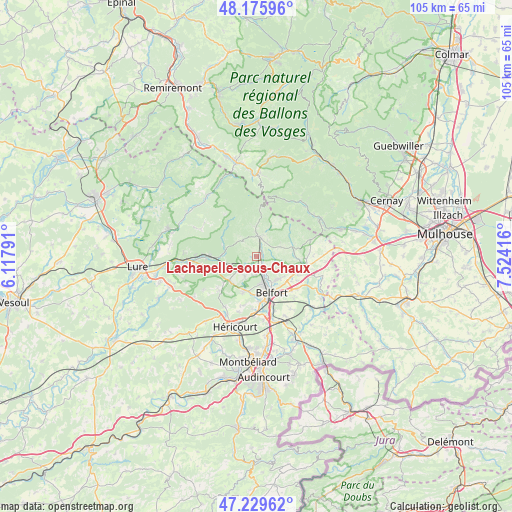
Lachapelle-sous-Chaux GPS coordinates[2]
47° 42' 17.784" North, 6° 49' 15.708" East
| Map corner | latitude | longitude |
|---|---|---|
| Upper-left | 48.17596°, | 6.11791° |
| Center: | 47.70494°, | 6.82103° |
| Lower-right: | 47.22962°, | 7.52416° |
| Map W x H: | 105.2×105.2 km | = 65.4×65.4mi |
| max Lat: | 51.07786° ⇑45.7% North |
| Lachapelle-sous-Chaux: | 47.70494° |
| min Lat: | ⇓54.3% South 41.3874° |
| min Long | Lachapelle-sous | max Long |
| -5.08615° | 6.82103° | 9.52242° |
| W 93.7%⇐ | ⇒6.3% E |
Elevation
Elevation of Lachapelle-sous-Chaux is 414 m = 1358 ft, and this is 220.3 m = 723 ft above average elevation for this country.
| Max E: |
2333 m = 7654 ft | 10.6% |
| Lachapelle-sous-Chaux | 414 m 1358 ft | |
| Avg. | 193.7 m = 635 ft | |
Min E: |
-1 m = -3 ft | 89.4% |
See also: France elevation on elevation.city.
Geographical zone
Lachapelle-sous-Chaux is located in North temperate zone (between Tropic of Cancer and the Arctic Circle). Distance of this North polar circle is 2096.9 km =1303 mi to North.| Distance of | km | miles | from Lachapelle-sous-Chaux |
|---|---|---|---|
| North Pole | 4702.8 | 2922.2 | to North |
| Arctic Circle | 2096.9 | 1303 | to North |
| Tropic Cancer | 2698.4 | 1676.7 | to South |
| Equator | 5304.3 | 3295.9 | to South |


Nearby cities:
15 places around Lachapelle-sous-Chaux: (largest is in red/bold)
• Belfort
7.4 km =4.6 mi,  160°
160°
• Chaux
1.6 km =1 mi,  42°
42°
• Cravanche
5.8 km =3.6 mi,  171°
171°
• Frahier-et-Chatebier
6.8 km =4.2 mi,  231°
231°
• Giromagny
4.2 km =2.6 mi,  6°
6°
• Grosmagny
5.3 km =3.3 mi,  67°
67°
• Lepuix
6.2 km =3.9 mi,  355°
355°
• Offemont
6.3 km =3.9 mi,  137°
137°
• Plancher-Bas
7 km =4.3 mi,  283°
283°
• Rougegoutte
3.8 km =2.4 mi,  34°
34°
• Salbert
4 km =2.5 mi,  189°
189°
• Sermamagny
1.9 km =1.2 mi, 142°
• Valdoie
4.1 km =2.5 mi, 157°
• Vescemont
4.7 km =2.9 mi,  21°
21°
• Éloie
4.3 km =2.7 mi,  112°
112°
Sources, notices
• [Note1] Compared only with cities in France existing in our database
• [Src1] Map data: © OpenStreetMap contributors (CC-BY-SA)
• [Src2] Other city data from geonames.org with taken over terms of usage.
• [Src3] Geographical zone / Annual Mean Temperature by Robert A. Rohde @ Wikipedia
