Courcelles-Chaussy geodata
Courcelles-Chaussy (Grand Est) is a populated place; located in France in Europe/Paris (GMT+2) time zone. With population of 2,855 people, there are 3414 cities with bigger population in this country. Compared to other cities in France, 82.4% of cities are located further ↓South; 91.1% of cities are located further ←West and 72.8% of cities have lower elevation than Courcelles-Chaussy. Note1
Administrative division(s):
- Level 1: Grand Est
- Level 2: Moselle
- Level 3: Arrondissement de Metz
- Level 4: Courcelles-Chaussy


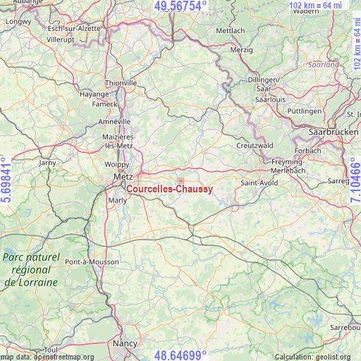
Courcelles-Chaussy GPS coordinates[2]
49° 6' 33.84" North, 6° 24' 5.508" East
| Map corner | latitude | longitude |
|---|---|---|
| Upper-left | 49.56754°, | 5.69841° |
| Center: | 49.1094°, | 6.40153° |
| Lower-right: | 48.64699°, | 7.10466° |
| Map W x H: | 102.4×102.4 km | = 63.6×63.6mi |
| max Lat: | 51.07786° ⇑17.6% North |
| Courcelles-Chaussy: | 49.1094° |
| min Lat: | ⇓82.4% South 41.3874° |
| min Long | Courcelles-Chau | max Long |
| -5.08615° | 6.40153° | 9.52242° |
| W 91.1%⇐ | ⇒8.9% E |
Elevation
Elevation of Courcelles-Chaussy is 235 m = 771 ft, and this is 41.3 m = 135 ft above average elevation for this country.
| Max E: |
2333 m = 7654 ft | 27.2% |
| Courcelles-Chaussy | 235 m 771 ft | |
| Avg. | 193.7 m = 635 ft | |
Min E: |
-1 m = -3 ft | 72.8% |
See also: France elevation on elevation.city.
Geographical zone
Courcelles-Chaussy is located in North temperate zone (between Tropic of Cancer and the Arctic Circle). Distance of this North polar circle is 1940.7 km =1205.9 mi to North.| Distance of | km | miles | from Courcelles-Chaussy |
|---|---|---|---|
| North Pole | 4546.6 | 2825.1 | to North |
| Arctic Circle | 1940.7 | 1205.9 | to North |
| Tropic Cancer | 2854.5 | 1773.7 | to South |
| Equator | 5460.5 | 3393 | to South |


Nearby cities:
15 places around Courcelles-Chaussy: (largest is in red/bold)
• Ars-Laquenexy
9.7 km =6 mi,  259°
259°
• Boulay-Moselle
10.9 km =6.8 mi,  41°
41°
• Condé
5.4 km =3.4 mi,  23°
23°
• Courcelles-sur-Nied
8.3 km =5.2 mi,  234°
234°
• Failly
11.5 km =7.1 mi,  297°
297°
• Jury
11.7 km =7.3 mi,  247°
247°
• Laquenexy
7.2 km =4.5 mi,  241°
241°
• Mécleuves
12 km =7.5 mi, 232°
• Noisseville
9.6 km =6 mi,  286°
286°
• Pange
4.4 km =2.7 mi, 232°
• Retonfey
7.6 km =4.7 mi, 293°
• Rémilly
10.7 km =6.6 mi,  183°
183°
• Sainte-Barbe
9.2 km =5.7 mi,  306°
306°
• Sanry-lès-Vigy
12 km =7.5 mi, 312°
• Silly-sur-Nied
3.3 km =2.1 mi, 291°
Sources, notices
• [Note1] Compared only with cities in France existing in our database
• [Src1] Map data: © OpenStreetMap contributors (CC-BY-SA)
• [Src2] Other city data from geonames.org with taken over terms of usage.
• [Src3] Geographical zone / Annual Mean Temperature by Robert A. Rohde @ Wikipedia
