Condé geodata
Condé (Grand Est) is a populated place; located in France in Europe/Paris (GMT+2) time zone. With population of 544 people, there are 14318 cities with bigger population in this country. Compared to other cities in France, 83.4% of cities are located further ↓South; 91.3% of cities are located further ←West and 68.6% of cities have lower elevation than Condé. Note1
Administrative division(s):
- Level 1: Grand Est
- Level 2: Moselle
- Level 3: Arrondissement de Forbach-Boulay-Moselle
- Level 4: Condé-Northen


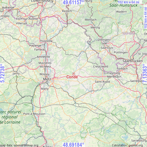
Condé GPS coordinates[2]
49° 9' 13.824" North, 6° 25' 49.8" East
| Map corner | latitude | longitude |
|---|---|---|
| Upper-left | 49.61157°, | 5.72738° |
| Center: | 49.15384°, | 6.4305° |
| Lower-right: | 48.69184°, | 7.13363° |
| Map W x H: | 102.3×102.3 km | = 63.6×63.6mi |
| max Lat: | 51.07786° ⇑16.6% North |
| Condé: | 49.15384° |
| min Lat: | ⇓83.4% South 41.3874° |
| min Long | Condé | max Long |
| -5.08615° | 6.4305° | 9.52242° |
| W 91.3%⇐ | ⇒8.7% E |
Elevation
Elevation of Condé is 212 m = 696 ft, and this is 18.3 m = 60 ft above average elevation for this country.
| Max E: |
2333 m = 7654 ft | 31.4% |
| Condé | 212 m 696 ft | |
| Avg. | 193.7 m = 635 ft | |
Min E: |
-1 m = -3 ft | 68.6% |
See also: France elevation on elevation.city.
Geographical zone
Condé is located in North temperate zone (between Tropic of Cancer and the Arctic Circle). Distance of this North polar circle is 1935.8 km =1202.8 mi to North.| Distance of | km | miles | from Condé |
|---|---|---|---|
| North Pole | 4541.7 | 2822.1 | to North |
| Arctic Circle | 1935.8 | 1202.8 | to North |
| Tropic Cancer | 2859.5 | 1776.8 | to South |
| Equator | 5465.4 | 3396 | to South |


Nearby cities:
15 places around Condé: (largest is in red/bold)
• Boulay-Moselle
6 km =3.7 mi,  57°
57°
• Coume
11.5 km =7.1 mi, 64°
• Courcelles-Chaussy
5.4 km =3.4 mi,  203°
203°
• Failly
12.3 km =7.6 mi,  271°
271°
• Laquenexy
11.9 km =7.4 mi,  225°
225°
• Noisseville
11.5 km =7.1 mi,  259°
259°
• Pange
9.4 km =5.8 mi,  216°
216°
• Piblange
10.9 km =6.8 mi,  354°
354°
• Retonfey
9.2 km =5.7 mi, 257°
• Sainte-Barbe
9.5 km =5.9 mi, 273°
• Sanry-lès-Vigy
11.4 km =7.1 mi,  286°
286°
• Silly-sur-Nied
6.4 km =4 mi, 234°
• Téterchen
12.8 km =8 mi,  48°
48°
• Vigy
11.1 km =6.9 mi,  300°
300°
• Zimming
12 km =7.5 mi,  106°
106°
Sources, notices
• [Note1] Compared only with cities in France existing in our database
• [Src1] Map data: © OpenStreetMap contributors (CC-BY-SA)
• [Src2] Other city data from geonames.org with taken over terms of usage.
• [Src3] Geographical zone / Annual Mean Temperature by Robert A. Rohde @ Wikipedia
