Communay geodata
Communay (Auvergne-Rhône-Alpes) is a populated place; located in France in Europe/Paris (GMT+2) time zone. With population of 4,110 people, there are 2389 cities with bigger population in this country. Compared to other cities in France, 72.5% of cities are located further ↑North; 75.6% of cities are located further ←West and 71.7% of cities have lower elevation than Communay. Note1
Administrative division(s):
- Level 1: Auvergne-Rhône-Alpes
- Level 2: Département du Rhône
- Level 3: Arrondissement de Lyon
- Level 4: Communay


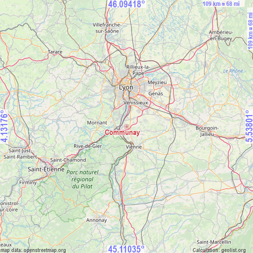
Communay GPS coordinates[2]
45° 36' 15.912" North, 4° 50' 5.568" East
| Map corner | latitude | longitude |
|---|---|---|
| Upper-left | 46.09418°, | 4.13176° |
| Center: | 45.60442°, | 4.83488° |
| Lower-right: | 45.11035°, | 5.53801° |
| Map W x H: | 109.4×109.4 km | = 68×68mi |
| max Lat: | 51.07786° ⇑72.5% North |
| Communay: | 45.60442° |
| min Lat: | ⇓27.5% South 41.3874° |
| min Long | Communay | max Long |
| -5.08615° | 4.83488° | 9.52242° |
| W 75.6%⇐ | ⇒24.4% E |
Elevation
Elevation of Communay is 228 m = 748 ft, and this is 34.3 m = 113 ft above average elevation for this country.
| Max E: |
2333 m = 7654 ft | 28.3% |
| Communay | 228 m 748 ft | |
| Avg. | 193.7 m = 635 ft | |
Min E: |
-1 m = -3 ft | 71.7% |
See also: France elevation on elevation.city.
Geographical zone
Communay is located in North temperate zone (between Tropic of Cancer and the Arctic Circle). Distance of this North polar circle is 2330.4 km =1448 mi to North.| Distance of | km | miles | from Communay |
|---|---|---|---|
| North Pole | 4936.3 | 3067.3 | to North |
| Arctic Circle | 2330.4 | 1448 | to North |
| Tropic Cancer | 2464.8 | 1531.6 | to South |
| Equator | 5070.7 | 3150.8 | to South |


Nearby cities:
15 places around Communay: (largest is in red/bold)
• Charly
5.9 km =3.7 mi,  327°
327°
• Chasse-sur-Rhône
3.5 km =2.2 mi,  214°
214°
• Chuzelles
3.9 km =2.4 mi,  123°
123°
• Givors
5.4 km =3.4 mi,  253°
253°
• Grigny
3.5 km =2.2 mi,  277°
277°
• Loire-sur-Rhône
6.6 km =4.1 mi,  204°
204°
• Marennes
6.3 km =3.9 mi,  73°
73°
• Millery
5.1 km =3.2 mi,  307°
307°
• Seyssuel
5.2 km =3.2 mi,  172°
172°
• Simandres
3.4 km =2.1 mi,  60°
60°
• Solaize
3.9 km =2.4 mi,  6°
6°
• Sérézin-du-Rhône
2.8 km =1.7 mi,  342°
342°
• Ternay
1.9 km =1.2 mi,  263°
263°
• Vernaison
5.2 km =3.2 mi, 339°
• Villette-de-Vienne
6.4 km =4 mi,  103°
103°
Sources, notices
• [Note1] Compared only with cities in France existing in our database
• [Src1] Map data: © OpenStreetMap contributors (CC-BY-SA)
• [Src2] Other city data from geonames.org with taken over terms of usage.
• [Src3] Geographical zone / Annual Mean Temperature by Robert A. Rohde @ Wikipedia
