Chemazé geodata
Chemazé (Pays de la Loire) is a populated place; located in France in Europe/Paris (GMT+1) time zone. With population of 1,072 people, there are 8316 cities with bigger population in this country. Compared to other cities in France, 55.5% of cities are located further ↓South; 86.2% of cities are located further →East and 65.6% of cities have higher elevation than Chemazé. Note1
Administrative division(s):
- Level 1: Pays de la Loire
- Level 2: Mayenne
- Level 3: Arrondissement de Château-Gontier
- Level 4: Chemazé


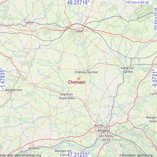
Chemazé GPS coordinates[2]
47° 47' 12.84" North, 0° 46' 30.828" West
| Map corner | latitude | longitude |
|---|---|---|
| Upper-left | 48.25718°, | -1.47835° |
| Center: | 47.7869°, | -0.77523° |
| Lower-right: | 47.31233°, | -0.0721° |
| Map W x H: | 105.1×105.1 km | = 65.3×65.3mi |
| max Lat: | 51.07786° ⇑44.5% North |
| Chemazé: | 47.7869° |
| min Lat: | ⇓55.5% South 41.3874° |
| min Long | Chemazé | max Long |
| -5.08615° | -0.77523° | 9.52242° |
| W 13.8%⇐ | ⇒86.2% E |
Elevation
Elevation of Chemazé is 88 m = 289 ft, and this is 105.7 m = 347 ft below average elevation for this country.
| Max E: |
2333 m = 7654 ft | 65.6% |
| Avg. | 193.7 m = 635 ft | |
| Chemazé | 88 m = 289 ft | |
Min E: |
-1 m = -3 ft | 34.4% |
See also: France elevation on elevation.city.
Geographical zone
Chemazé is located in North temperate zone (between Tropic of Cancer and the Arctic Circle). Distance of this North polar circle is 2087.8 km =1297.3 mi to North.| Distance of | km | miles | from Chemazé |
|---|---|---|---|
| North Pole | 4693.7 | 2916.5 | to North |
| Arctic Circle | 2087.8 | 1297.3 | to North |
| Tropic Cancer | 2707.5 | 1682.4 | to South |
| Equator | 5313.4 | 3301.6 | to South |


Nearby cities:
15 places around Chemazé: (largest is in red/bold)
• Azé
7.9 km =4.9 mi,  60°
60°
• Château-Gontier
7.1 km =4.4 mi,  49°
49°
• Châtelais
11.8 km =7.3 mi,  254°
254°
• Coudray
9.8 km =6.1 mi,  87°
87°
• Fromentières
11.8 km =7.3 mi,  43°
43°
• La Chapelle-sur-Oudon
12.8 km =8 mi,  197°
197°
• Laigné
6.9 km =4.3 mi,  332°
332°
• Loigné-sur-Mayenne
9.7 km =6 mi,  11°
11°
• Marigné-Peuton
9.6 km =6 mi,  343°
343°
• Ménil
7.4 km =4.6 mi,  98°
98°
• Nyoiseau
13.1 km =8.1 mi,  233°
233°
• Pommerieux
10.1 km =6.3 mi,  293°
293°
• Saint-Fort
4.3 km =2.7 mi,  71°
71°
• Saint-Martin-du-Bois
9.3 km =5.8 mi,  164°
164°
• Segré
13.3 km =8.3 mi,  213°
213°
Sources, notices
• [Note1] Compared only with cities in France existing in our database
• [Src1] Map data: © OpenStreetMap contributors (CC-BY-SA)
• [Src2] Other city data from geonames.org with taken over terms of usage.
• [Src3] Geographical zone / Annual Mean Temperature by Robert A. Rohde @ Wikipedia
