Château-Gontier geodata
Château-Gontier (Pays de la Loire) is a seat of a third-order administrative division; located in France in Europe/Paris (GMT+2) time zone. With population of 12,292 people, there are 781 cities with bigger population in this country. Compared to other cities in France, 56.3% of cities are located further ↓South; 85.6% of cities are located further →East and 86.2% of cities have higher elevation than Château-Gontier. Note1
Administrative division(s):
- Level 1: Pays de la Loire
- Level 2: Mayenne
- Level 3: Arrondissement de Château-Gontier
- Level 4: Château-Gontier-sur-Mayenne


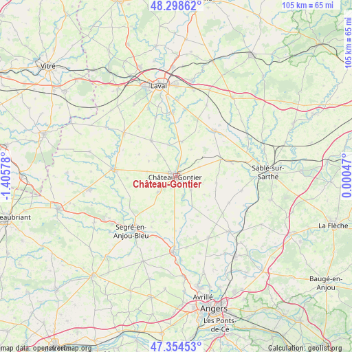
Château-Gontier GPS coordinates[2]
47° 49' 43.392" North, 0° 42' 9.54" West
| Map corner | latitude | longitude |
|---|---|---|
| Upper-left | 48.29862°, | -1.40578° |
| Center: | 47.82872°, | -0.70265° |
| Lower-right: | 47.35453°, | 0.00047° |
| Map W x H: | 105×105 km | = 65.2×65.2mi |
| max Lat: | 51.07786° ⇑43.7% North |
| Château-Gontier: | 47.82872° |
| min Lat: | ⇓56.3% South 41.3874° |
| min Long | Château-Gontie | max Long |
| -5.08615° | -0.70265° | 9.52242° |
| W 14.4%⇐ | ⇒85.6% E |
Elevation
Elevation of Château-Gontier is 39 m = 128 ft, and this is 154.7 m = 508 ft below average elevation for this country.
| Max E: |
2333 m = 7654 ft | 86.2% |
| Avg. | 193.7 m = 635 ft | |
| Château-Gontier | 39 m = 128 ft | |
Min E: |
-1 m = -3 ft | 13.8% |
See also: France elevation on elevation.city.
Geographical zone
Château-Gontier is located in North temperate zone (between Tropic of Cancer and the Arctic Circle). Distance of this North polar circle is 2083.1 km =1294.4 mi to North.| Distance of | km | miles | from Château-Gontier |
|---|---|---|---|
| North Pole | 4689 | 2913.6 | to North |
| Arctic Circle | 2083.1 | 1294.4 | to North |
| Tropic Cancer | 2712.1 | 1685.2 | to South |
| Equator | 5318.1 | 3304.5 | to South |


Nearby cities:
15 places around Château-Gontier: (largest is in red/bold)
• Azé
1.6 km =1 mi,  116°
116°
• Bierné
12 km =7.5 mi,  99°
99°
• Chemazé
7.1 km =4.4 mi,  229°
229°
• Coudray
6.1 km =3.8 mi,  133°
133°
• Fromentières
4.8 km =3 mi,  33°
33°
• Gennes-sur-Glaize
7.6 km =4.7 mi,  68°
68°
• Laigné
8.8 km =5.5 mi,  279°
279°
• Loigné-sur-Mayenne
6 km =3.7 mi,  324°
324°
• Marigné
13.4 km =8.3 mi,  151°
151°
• Marigné-Peuton
9.4 km =5.8 mi,  298°
298°
• Ménil
6.1 km =3.8 mi,  161°
161°
• Quelaines-Saint-Gault
13.7 km =8.5 mi,  328°
328°
• Saint-Fort
3.5 km =2.2 mi,  202°
202°
• Saint-Martin-du-Bois
13.9 km =8.6 mi,  192°
192°
• Villiers-Charlemagne
10.5 km =6.5 mi,  10°
10°
Sources, notices
• [Note1] Compared only with cities in France existing in our database
• [Src1] Map data: © OpenStreetMap contributors (CC-BY-SA)
• [Src2] Other city data from geonames.org with taken over terms of usage.
• [Src3] Geographical zone / Annual Mean Temperature by Robert A. Rohde @ Wikipedia
