Chaux geodata
Chaux (Bourgogne-Franche-Comté) is a populated place; located in France in Europe/Paris (GMT+2) time zone. With population of 991 people, there are 8899 cities with bigger population in this country. Compared to other cities in France, 54.5% of cities are located further ↓South; 93.8% of cities are located further ←West and 90.2% of cities have lower elevation than Chaux. Note1
Administrative division(s):
- Level 1: Bourgogne-Franche-Comté
- Level 2: Territoire de Belfort
- Level 3: Arrondissement de Belfort
- Level 4: Chaux


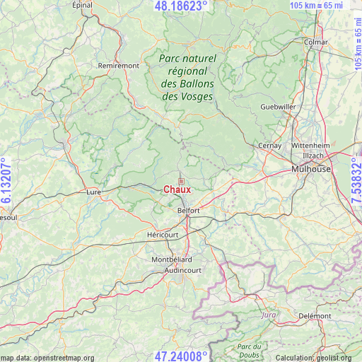
Chaux GPS coordinates[2]
47° 42' 55.08" North, 6° 50' 6.684" East
| Map corner | latitude | longitude |
|---|---|---|
| Upper-left | 48.18623°, | 6.13207° |
| Center: | 47.7153°, | 6.83519° |
| Lower-right: | 47.24008°, | 7.53832° |
| Map W x H: | 105.2×105.2 km | = 65.4×65.4mi |
| max Lat: | 51.07786° ⇑45.5% North |
| Chaux: | 47.7153° |
| min Lat: | ⇓54.5% South 41.3874° |
| min Long | Chaux | max Long |
| -5.08615° | 6.83519° | 9.52242° |
| W 93.8%⇐ | ⇒6.2% E |
Elevation
Elevation of Chaux is 430 m = 1411 ft, and this is 236.3 m = 775 ft above average elevation for this country.
| Max E: |
2333 m = 7654 ft | 9.8% |
| Chaux | 430 m 1411 ft | |
| Avg. | 193.7 m = 635 ft | |
Min E: |
-1 m = -3 ft | 90.2% |
See also: France elevation on elevation.city.
Geographical zone
Chaux is located in North temperate zone (between Tropic of Cancer and the Arctic Circle). Distance of this North polar circle is 2095.7 km =1302.2 mi to North.| Distance of | km | miles | from Chaux |
|---|---|---|---|
| North Pole | 4701.6 | 2921.4 | to North |
| Arctic Circle | 2095.7 | 1302.2 | to North |
| Tropic Cancer | 2699.5 | 1677.4 | to South |
| Equator | 5305.4 | 3296.6 | to South |


Nearby cities:
15 places around Chaux: (largest is in red/bold)
• Anjoutey
7.5 km =4.7 mi,  102°
102°
• Cravanche
6.9 km =4.3 mi,  182°
182°
• Giromagny
3.1 km =1.9 mi,  349°
349°
• Grosmagny
3.9 km =2.4 mi,  76°
76°
• Lachapelle-sous-Chaux
1.6 km =1 mi,  222°
222°
• Lepuix
5.3 km =3.3 mi,  342°
342°
• Offemont
6.6 km =4.1 mi,  151°
151°
• Plancher-Bas
7.9 km =4.9 mi,  273°
273°
• Roppe
8.1 km =5 mi,  128°
128°
• Rougegoutte
2.3 km =1.4 mi,  29°
29°
• Salbert
5.4 km =3.4 mi,  198°
198°
• Sermamagny
2.7 km =1.7 mi, 177°
• Valdoie
5 km =3.1 mi,  174°
174°
• Vescemont
3.3 km =2.1 mi,  11°
11°
• Éloie
4 km =2.5 mi, 134°
Sources, notices
• [Note1] Compared only with cities in France existing in our database
• [Src1] Map data: © OpenStreetMap contributors (CC-BY-SA)
• [Src2] Other city data from geonames.org with taken over terms of usage.
• [Src3] Geographical zone / Annual Mean Temperature by Robert A. Rohde @ Wikipedia
