Chamoux-sur-Gelon geodata
Chamoux-sur-Gelon (Auvergne-Rhône-Alpes) is a populated place; located in France in Europe/Paris (GMT+2) time zone. With population of 736 people, there are 11334 cities with bigger population in this country. Compared to other cities in France, 73.7% of cities are located further ↑North; 89.4% of cities are located further ←West and 81.9% of cities have lower elevation than Chamoux-sur-Gelon. Note1
Administrative division(s):
- Level 1: Auvergne-Rhône-Alpes
- Level 2: Savoie
- Level 3: Arrondissement de Chambéry
- Level 4: Chamoux-sur-Gelon


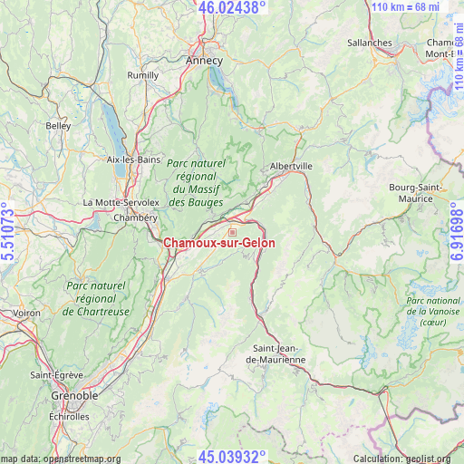
Chamoux-sur-Gelon GPS coordinates[2]
45° 32' 2.436" North, 6° 12' 49.86" East
| Map corner | latitude | longitude |
|---|---|---|
| Upper-left | 46.02438°, | 5.51073° |
| Center: | 45.53401°, | 6.21385° |
| Lower-right: | 45.03932°, | 6.91698° |
| Map W x H: | 109.5×109.5 km | = 68×68mi |
| max Lat: | 51.07786° ⇑73.7% North |
| Chamoux-sur-Gelon: | 45.53401° |
| min Lat: | ⇓26.3% South 41.3874° |
| min Long | Chamoux-sur-Gel | max Long |
| -5.08615° | 6.21385° | 9.52242° |
| W 89.4%⇐ | ⇒10.6% E |
Elevation
Elevation of Chamoux-sur-Gelon is 310 m = 1017 ft, and this is 116.3 m = 382 ft above average elevation for this country.
| Max E: |
2333 m = 7654 ft | 18.1% |
| Chamoux-sur-Gelon | 310 m 1017 ft | |
| Avg. | 193.7 m = 635 ft | |
Min E: |
-1 m = -3 ft | 81.9% |
See also: France elevation on elevation.city.
Geographical zone
Chamoux-sur-Gelon is located in North temperate zone (between Tropic of Cancer and the Arctic Circle). Distance of this North polar circle is 2338.3 km =1453 mi to North.| Distance of | km | miles | from Chamoux-sur-Gelon |
|---|---|---|---|
| North Pole | 4944.2 | 3072.2 | to North |
| Arctic Circle | 2338.3 | 1453 | to North |
| Tropic Cancer | 2457 | 1526.7 | to South |
| Equator | 5062.9 | 3145.9 | to South |


Nearby cities:
15 places around Chamoux-sur-Gelon: (largest is in red/bold)
• Aiguebelle
7.1 km =4.4 mi,  81°
81°
• Aiton
4.7 km =2.9 mi,  49°
49°
• Arbin
11.4 km =7.1 mi,  257°
257°
• Argentine
8.9 km =5.5 mi,  119°
119°
• Châteauneuf
3.6 km =2.2 mi,  296°
296°
• Coise
5.5 km =3.4 mi, 263°
• Cruet
9.5 km =5.9 mi,  266°
266°
• Grésy-sur-Isère
7.9 km =4.9 mi,  23°
23°
• La Rochette
11.5 km =7.1 mi,  222°
222°
• Montailleur
10.5 km =6.5 mi,  28°
28°
• Randens
7.6 km =4.7 mi, 79°
• Saint-Jean-de-la-Porte
7 km =4.3 mi,  290°
290°
• Saint-Vital
12.4 km =7.7 mi, 32°
• Sainte-Hélène-sur-Isère
12.2 km =7.6 mi,  42°
42°
• Épierre
11 km =6.8 mi,  144°
144°
Sources, notices
• [Note1] Compared only with cities in France existing in our database
• [Src1] Map data: © OpenStreetMap contributors (CC-BY-SA)
• [Src2] Other city data from geonames.org with taken over terms of usage.
• [Src3] Geographical zone / Annual Mean Temperature by Robert A. Rohde @ Wikipedia
