Argentine geodata
Argentine (Auvergne-Rhône-Alpes) is a populated place; located in France in Europe/Paris (GMT+2) time zone. With population of 831 people, there are 10280 cities with bigger population in this country. Compared to other cities in France, 74.2% of cities are located further ↑North; 90.3% of cities are located further ←West and 92.4% of cities have lower elevation than Argentine. Note1
Administrative division(s):
- Level 1: Auvergne-Rhône-Alpes
- Level 2: Savoie
- Level 3: Arrondissement de Saint-Jean-de-Maurienne
- Level 4: Argentine


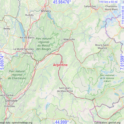
Argentine GPS coordinates[2]
45° 29' 38.544" North, 6° 18' 46.296" East
| Map corner | latitude | longitude |
|---|---|---|
| Upper-left | 45.98476°, | 5.60974° |
| Center: | 45.49404°, | 6.31286° |
| Lower-right: | 44.999°, | 7.01599° |
| Map W x H: | 109.6×109.6 km | = 68.1×68.1mi |
| max Lat: | 51.07786° ⇑74.2% North |
| Argentine: | 45.49404° |
| min Lat: | ⇓25.8% South 41.3874° |
| min Long | Argentine | max Long |
| -5.08615° | 6.31286° | 9.52242° |
| W 90.3%⇐ | ⇒9.7% E |
Elevation
Elevation of Argentine is 486 m = 1594 ft, and this is 292.3 m = 959 ft above average elevation for this country.
| Max E: |
2333 m = 7654 ft | 7.6% |
| Argentine | 486 m 1594 ft | |
| Avg. | 193.7 m = 635 ft | |
Min E: |
-1 m = -3 ft | 92.4% |
See also: France elevation on elevation.city.
Geographical zone
Argentine is located in North temperate zone (between Tropic of Cancer and the Arctic Circle). Distance of this North polar circle is 2342.7 km =1455.7 mi to North.| Distance of | km | miles | from Argentine |
|---|---|---|---|
| North Pole | 4948.6 | 3074.9 | to North |
| Arctic Circle | 2342.7 | 1455.7 | to North |
| Tropic Cancer | 2452.5 | 1523.9 | to South |
| Equator | 5058.5 | 3143.2 | to South |


Nearby cities:
15 places around Argentine: (largest is in red/bold)
• Aiguebelle
5.6 km =3.5 mi,  352°
352°
• Aigueblanche
14.8 km =9.2 mi,  85°
85°
• Aiton
8.5 km =5.3 mi,  330°
330°
• Chamoux-sur-Gelon
8.9 km =5.5 mi,  299°
299°
• Châteauneuf
12.5 km =7.8 mi, 299°
• Coise
13.7 km =8.5 mi,  286°
286°
• Feissons-sur-Isère
14.3 km =8.9 mi,  59°
59°
• Grésy-sur-Isère
12.5 km =7.8 mi,  338°
338°
• Montailleur
14 km =8.7 mi, 348°
• Notre-Dame-des-Millières
14.4 km =8.9 mi,  7°
7°
• Randens
5.8 km =3.6 mi,  357°
357°
• Saint-Rémy-de-Maurienne
11.1 km =6.9 mi,  199°
199°
• Saint-Vital
14.9 km =9.3 mi, 355°
• Sainte-Hélène-sur-Isère
13.4 km =8.3 mi,  2°
2°
• Épierre
4.8 km =3 mi, 196°
Sources, notices
• [Note1] Compared only with cities in France existing in our database
• [Src1] Map data: © OpenStreetMap contributors (CC-BY-SA)
• [Src2] Other city data from geonames.org with taken over terms of usage.
• [Src3] Geographical zone / Annual Mean Temperature by Robert A. Rohde @ Wikipedia
