Beaumont-en-Véron geodata
Beaumont-en-Véron (Centre) is a populated place; located in France in Europe/Paris (GMT+2) time zone. With population of 2,933 people, there are 3322 cities with bigger population in this country. Compared to other cities in France, 53.1% of cities are located further ↑North; 76.4% of cities are located further →East and 85.3% of cities have higher elevation than Beaumont-en-Véron. Note1
Administrative division(s):
- Level 1: Centre
- Level 2: Département d'Indre-et-Loire
- Level 3: Arrondissement de Chinon
- Level 4: Beaumont-en-Véron


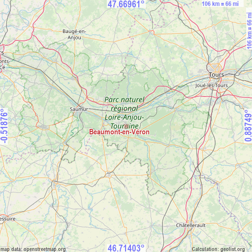
Beaumont-en-Véron GPS coordinates[2]
47° 11' 38.292" North, 0° 11' 3.696" East
| Map corner | latitude | longitude |
|---|---|---|
| Upper-left | 47.66961°, | -0.51876° |
| Center: | 47.19397°, | 0.18436° |
| Lower-right: | 46.71403°, | 0.88749° |
| Map W x H: | 106.3×106.2 km | = 66.1×66mi |
| max Lat: | 51.07786° ⇑53.1% North |
| Beaumont-en-Véron: | 47.19397° |
| min Lat: | ⇓46.9% South 41.3874° |
| min Long | Beaumont-en-Vé | max Long |
| -5.08615° | 0.18436° | 9.52242° |
| W 23.6%⇐ | ⇒76.4% E |
Elevation
Elevation of Beaumont-en-Véron is 41 m = 135 ft, and this is 152.7 m = 501 ft below average elevation for this country.
| Max E: |
2333 m = 7654 ft | 85.3% |
| Avg. | 193.7 m = 635 ft | |
| Beaumont-en-Véron | 41 m = 135 ft | |
Min E: |
-1 m = -3 ft | 14.7% |
See also: France elevation on elevation.city.
Geographical zone
Beaumont-en-Véron is located in North temperate zone (between Tropic of Cancer and the Arctic Circle). Distance of this North polar circle is 2153.7 km =1338.2 mi to North.| Distance of | km | miles | from Beaumont-en-Véron |
|---|---|---|---|
| North Pole | 4759.6 | 2957.5 | to North |
| Arctic Circle | 2153.7 | 1338.2 | to North |
| Tropic Cancer | 2641.6 | 1641.4 | to South |
| Equator | 5247.5 | 3260.6 | to South |


Nearby cities:
15 places around Beaumont-en-Véron: (largest is in red/bold)
• Avoine
1.3 km =0.8 mi,  353°
353°
• Bourgueil
10 km =6.2 mi, 352°
• Chinon
5.3 km =3.3 mi,  124°
124°
• Chouzé-sur-Loire
6.6 km =4.1 mi,  316°
316°
• Fontevraud-l'Abbaye
10.2 km =6.3 mi,  263°
263°
• Huismes
6.7 km =4.2 mi,  49°
49°
• La Chapelle-sur-Loire
6.8 km =4.2 mi,  22°
22°
• La Roche-Clermault
6.5 km =4 mi,  165°
165°
• Montsoreau
9.6 km =6 mi,  284°
284°
• Restigné
10.3 km =6.4 mi, 18°
• Rigny-Ussé
10.9 km =6.8 mi, 53°
• Rivière
8.9 km =5.5 mi,  127°
127°
• Saint-Benoît-la-Forêt
10.9 km =6.8 mi,  72°
72°
• Savigny-en-Véron
3.1 km =1.9 mi, 283°
• Varennes-sur-Loire
11 km =6.8 mi,  296°
296°
Sources, notices
• [Note1] Compared only with cities in France existing in our database
• [Src1] Map data: © OpenStreetMap contributors (CC-BY-SA)
• [Src2] Other city data from geonames.org with taken over terms of usage.
• [Src3] Geographical zone / Annual Mean Temperature by Robert A. Rohde @ Wikipedia
