Balbigny geodata
Balbigny (Auvergne-Rhône-Alpes) is a populated place; located in France in Europe/Paris (GMT+2) time zone. With population of 2,583 people, there are 3778 cities with bigger population in this country. Compared to other cities in France, 69% of cities are located further ↑North; 69.6% of cities are located further ←West and 84.9% of cities have lower elevation than Balbigny. Note1
Administrative division(s):
- Level 1: Auvergne-Rhône-Alpes
- Level 2: Département de la Loire
- Level 3: Arrondissement de Roanne
- Level 4: Balbigny


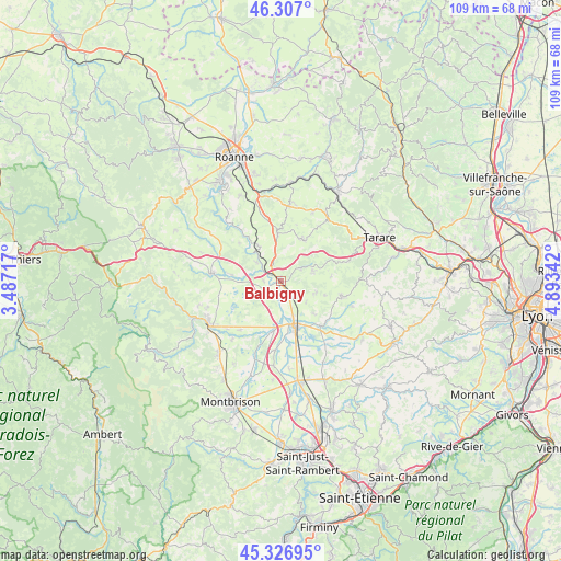
Balbigny GPS coordinates[2]
45° 49' 8.868" North, 4° 11' 25.08" East
| Map corner | latitude | longitude |
|---|---|---|
| Upper-left | 46.307°, | 3.48717° |
| Center: | 45.81913°, | 4.1903° |
| Lower-right: | 45.32695°, | 4.89342° |
| Map W x H: | 109×109 km | = 67.7×67.7mi |
| max Lat: | 51.07786° ⇑69% North |
| Balbigny: | 45.81913° |
| min Lat: | ⇓31% South 41.3874° |
| min Long | Balbigny | max Long |
| -5.08615° | 4.1903° | 9.52242° |
| W 69.6%⇐ | ⇒30.4% E |
Elevation
Elevation of Balbigny is 345 m = 1132 ft, and this is 151.3 m = 496 ft above average elevation for this country.
| Max E: |
2333 m = 7654 ft | 15.1% |
| Balbigny | 345 m 1132 ft | |
| Avg. | 193.7 m = 635 ft | |
Min E: |
-1 m = -3 ft | 84.9% |
See also: France elevation on elevation.city.
Geographical zone
Balbigny is located in North temperate zone (between Tropic of Cancer and the Arctic Circle). Distance of this North polar circle is 2306.6 km =1433.3 mi to North.| Distance of | km | miles | from Balbigny |
|---|---|---|---|
| North Pole | 4912.5 | 3052.5 | to North |
| Arctic Circle | 2306.6 | 1433.3 | to North |
| Tropic Cancer | 2488.7 | 1546.4 | to South |
| Equator | 5094.6 | 3165.6 | to South |


Nearby cities:
15 places around Balbigny: (largest is in red/bold)
• Bussières
6.5 km =4 mi,  73°
73°
• Civens
6.5 km =4 mi,  132°
132°
• Cottance
9 km =5.6 mi,  108°
108°
• Feurs
10 km =6.2 mi,  163°
163°
• Nervieux
3.5 km =2.2 mi,  240°
240°
• Neulise
8.8 km =5.5 mi,  355°
355°
• Néronde
4 km =2.5 mi,  61°
61°
• Panissières
12.1 km =7.5 mi,  104°
104°
• Poncins
10.6 km =6.6 mi,  188°
188°
• Pouilly-lès-Feurs
4.1 km =2.5 mi, 125°
• Rozier-en-Donzy
7.1 km =4.4 mi, 106°
• Saint-Jodard
8.2 km =5.1 mi,  325°
325°
• Saint-Just-la-Pendue
9.2 km =5.7 mi,  25°
25°
• Saint-Marcel-de-Félines
5.4 km =3.4 mi,  0°
0°
• Épercieux-Saint-Paul
3.6 km =2.2 mi, 155°
Sources, notices
• [Note1] Compared only with cities in France existing in our database
• [Src1] Map data: © OpenStreetMap contributors (CC-BY-SA)
• [Src2] Other city data from geonames.org with taken over terms of usage.
• [Src3] Geographical zone / Annual Mean Temperature by Robert A. Rohde @ Wikipedia
